Lansingerland
| |||||
 | |||||
| Państwo | |||||
| Prowincja | Holandia Południowa | ||||
| Burmistrz | Coos Rijsdijk (2014)[1] | ||||
| Powierzchnia | 56,37 km² | ||||
| Populacja • liczba ludności | 57 188[2] | ||||
| Kod pocztowy | 2650–2665 | ||||
| Strona internetowa | |||||
Lansingerland – gmina w Holandii, w prowincji Holandia Południowa.
Miejscowości
Bergschenhoek (siedziba gminy), Berkel en Rodenrijs, Bleiswijk, Rotte, Kruisweg.
Przypisy
- ↑ lansingerland.nl: Samenstelling B&W (niderl.). [dostęp 2014-07-19]. [zarchiwizowane z tego adresu (2014-07-25)].
- ↑ Alle 408 gemeenten in 2013 (niderl.). kpn.nl. [dostęp 2013-11-09].
Media użyte na tej stronie
Coat of arms of the Dutch municipality of Lansingerland, South Holland.
Autor: Erik Frohne, Licencja: CC BY-SA 3.0
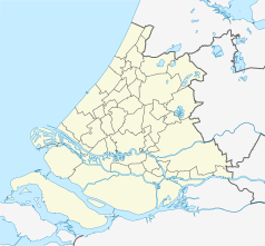
Location map of province South Holland in the Netherlands
Equirectangular projection, N/S stretching 162 %. Geographic limits of the map:
- N: 52.40° N
- S: 51.60° N
- W: 3.80° E
- E: 5.20° E
Autor: nl:User:Debot, Licencja: CC-BY-SA-3.0
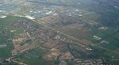
Aerial view of Berkel-en-Roderijs and Bergschenhoek, Bleiswijk visible in the distance, the Netherlands.


