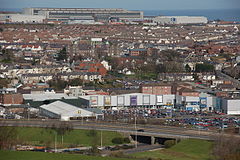
Larne
(c) Aubrey Dale, CC BY-SA 2.0 Widok na Larne | |
| Państwo | |
|---|---|
| Prowincja | |
| Hrabstwo | Antrim |
| Populacja (2001) • liczba ludności |
|
| Nr kierunkowy | 028 |
| Kod pocztowy | BT40 |
Położenie na mapie Wielkiej Brytanii (c) Karte: NordNordWest, Lizenz: Creative Commons by-sa-3.0 de | |
| Strona internetowa | |
| Portal | |
Larne (irl. Latharna) – miasto przemysłowe i portowe we wschodniej części hrabstwa Antrim, w Irlandii Północnej, liczące 18 228 mieszkańcami. Miasto pełni funkcję portu od ponad 1000 lat. Miastem partnerskim Larne jest Clover w Karolinie Południowej.
W XVIII wieku wielu Irlandczyków emigrowało z Irlandii do Ameryki, wypływając z portu w Larne. Pomnik w parku Smiley Park upamiętnia pierwszy statek z emigrantami, którzy wypłynęli do Bostonu w maju 1717 roku.
Sport
- Larne F.C.
- Latharna Óg G.A.A Club
Miasta partnerskie
Linki zewnętrzne
- Oficjalna strona miasta
- Historia portu w Larne
- Strona internetowa przewoźnika promowego w Larne
- Pierwszy kościół prezbiteriański w Larne
- Chaine FM, Lokalne radio w Larne. chainefm.com. [zarchiwizowane z tego adresu (2018-10-04)].
Media użyte na tej stronie
Autor: NordNordWest, Licencja: CC BY-SA 3.0
Location map of Northern Ireland
(c) Karte: NordNordWest, Lizenz: Creative Commons by-sa-3.0 de
Location map of the United Kingdom
Ulster Banner is a heraldic banner taken from the former coat of arms of Northern Ireland. It was used by the Northern Ireland government in 1953-1973 with Edwardian crown since coronation of Queen Elizabeth II, based earlier design with Tudor Crown from 1924. Otherwise known as the Ulster Flag, Red Hand of Ulster Flag, Red Hand Flag.
Ulster Banner is a heraldic banner taken from the former coat of arms of Northern Ireland. It was used by the Northern Ireland government in 1953-1973 with Edwardian crown since coronation of Queen Elizabeth II, based earlier design with Tudor Crown from 1924. Otherwise known as the Ulster Flag, Red Hand of Ulster Flag, Red Hand Flag.
The flag of Navassa Island is simply the United States flag. It does not have a "local" flag or "unofficial" flag; it is an uninhabited island. The version with a profile view was based on Flags of the World and as a fictional design has no status warranting a place on any Wiki. It was made up by a random person with no connection to the island, it has never flown on the island, and it has never received any sort of recognition or validation by any authority. The person quoted on that page has no authority to bestow a flag, "unofficial" or otherwise, on the island.
(c) Aubrey Dale, CC BY-SA 2.0
Site of former paper mill, Larne Larne had been associated with the making of paper for 100 (and more) years when the paper mill closed a few years ago. The site has now been redeveloped with shops. The Harbour Highway crosses near the bottom of the photo and the FG Wilson factory can be seen at the top.


