Lasne
 Kościół św. Gertrudy | |||||
| |||||
| Państwo | |||||
|---|---|---|---|---|---|
| Region | |||||
| Prowincja | Brabancja Walońska | ||||
| Burmistrz | Laurence Rothier | ||||
| Powierzchnia | 47,22 km² | ||||
| Populacja (2017[1]) • liczba ludności • gęstość |
| ||||
| Nr kierunkowy | 02 | ||||
| Kod pocztowy | 1380 | ||||
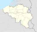
Położenie na mapie Belgii (c) Karte: NordNordWest, Lizenz: Creative Commons by-sa-3.0 de | |||||
| Strona internetowa | |||||
Lasne – miejscowość i gmina w środkowej Belgii, w prowincji Brabancja Walońska, w Regionie Walońskim.
Miasta partnerskie
Przypisy
- ↑ Stan na 1 stycznia 2017 roku, Direction générale Institutions et Population: Chiffres de la population par province et par commune, à la date du premier janvier 2017. [dostęp 2017-01-01]. (fr.).
Media użyte na tej stronie
(c) Karte: NordNordWest, Lizenz: Creative Commons by-sa-3.0 de
Location map of Belgium
The flag of Navassa Island is simply the United States flag. It does not have a "local" flag or "unofficial" flag; it is an uninhabited island. The version with a profile view was based on Flags of the World and as a fictional design has no status warranting a place on any Wiki. It was made up by a random person with no connection to the island, it has never flown on the island, and it has never received any sort of recognition or validation by any authority. The person quoted on that page has no authority to bestow a flag, "unofficial" or otherwise, on the island.
Banniel Lasne, Belgia.
Autor: Milenioscuro, Licencja: CC BY-SA 3.0
Location map of Walloon Brabant province, Belgium
Municipal flag of Lasne, Belgium.
The municipal flag of Lasne is diagonally divided blue-green by a white ascending wavy line.


