Latarnia morska Buchan Ness
| ||
(c) Richard Slessor, CC BY-SA 2.0 | ||
| Państwo | ||
| Kraj | ||
| Miejscowość | Boddam | |
| Wysokość wieży | 35 m | |
| Wysokość światła | 40 m n.p.m. | |
| Zasięg światła | 18 Mm | |
| Charakterystyka światła | biały błysk co 5 s.[1] | |
| Data budowy | 1824–1927 | |
| Data uruchomienia | 1827 | |
| Administrator | Northern Lighthouse Board | |
Położenie na mapie Aberdeenshire Contains Ordnance Survey data © Crown copyright and database right, CC BY-SA 3.0 | ||
Położenie na mapie Wielkiej Brytanii (c) Karte: NordNordWest, Lizenz: Creative Commons by-sa-3.0 de | ||
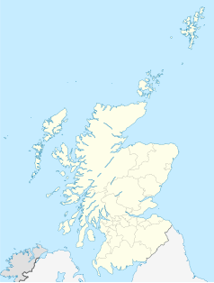
Położenie na mapie Szkocji | ||
| Strona internetowa | ||
Latarnia morska Buchan Ness – zbudowana w latach 1824–1827 przez szkockiego inżynier Robert Stevenson, dziadka Roberta Louisa Stevensona dla Northern Lighthouse Board. Położona jest na cyplu koło wioski Boddam w Aberdeenshire. Latarnia została wpisana w 1971 roku na listę zabytków kategorii A Historic Scotland pod numerem 16367[2]. Obiekt znajduje się także na liście Royal Commission on the Ancient and Historical Monuments of Scotland pod numerem NK14SW 73[3].
Latarnia została zelektryfikowana w 1978 roku, wtedy też zwiększono światłość z 786000 do 2 milionów kandeli. W 1988 roku latarnia została zautomatyzowana i jest sterowana z centrum w Edynburgu[1]. Dwie wille latarników zostały sprzedane i istnieje możliwość ich wynajęcia.
Przypisy
- ↑ a b Buchan-Ness (ang.). Northern Lighthouse Board, Lighthouse Liibrary. [dostęp 2014-05-03].
- ↑ BUCHANNESS LIGHTHOUSE (Ref:16367) (ang.). Historic Scotland Data Services. [dostęp 2014-05-12].
- ↑ Boddam; Buchanness Lighthouse (ang.). Royal Commission on the Ancient and Historical Monuments of Scotland. [dostęp 2014-05-12].
Media użyte na tej stronie
(c) Karte: NordNordWest, Lizenz: Creative Commons by-sa-3.0 de
Location map of the United Kingdom
(c) Eric Gaba, NordNordWest, CC BY-SA 3.0
Location map of Scotland, United Kingdom
Symbol latarnii do legendy mapy
Contains Ordnance Survey data © Crown copyright and database right, CC BY-SA 3.0
Blank map of Aberdeenshire, UK with the following information shown:
- Administrative borders
- Coastline, lakes and rivers
- Roads and railways
- Urban areas
Equirectangular map projection on WGS 84 datum, with N/S stretched 180%
Geographic limits:
- West: 3.85W
- East: 1.70W
- North: 57.75N
- South: 56.70N
(c) Richard Slessor, CC BY-SA 2.0
Buchan Ness Lighthouse, Boddam This lighthouse was built by Robert Stevenson in 1827. The area is prone to fog and mist so the lighthouse acquired the red stripes in 1907 to help improve its visibility. It has been electrified since 1978 and fully automated since 1988.


