Latarnia morska Covesea Skerries
| ||
 | ||
| Państwo | ||
| Kraj | ||
| Miejscowość | Lossiemouth | |
| Wysokość wieży | 36 m | |
| Wysokość światła | 49 m n.p.m. | |
| Zasięg światła | 24 Mm | |
| Charakterystyka światła | 5 białych błysków co 30 s.[1] | |
| Data budowy | 1845-1846 | |
| Data uruchomienia | 1846 | |
| Administrator | Northern Lighthouse Board | |
Położenie na mapie Moray Contains Ordnance Survey data © Crown copyright and database right, CC BY-SA 3.0 | ||
Położenie na mapie Wielkiej Brytanii (c) Karte: NordNordWest, Lizenz: Creative Commons by-sa-3.0 de | ||
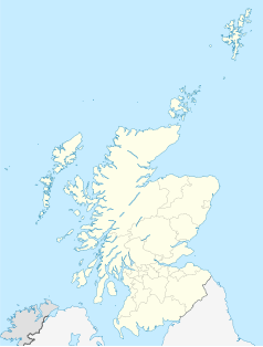
Położenie na mapie Szkocji | ||
Latarnia morska Covesea Skerries – latarnia morska w Szkocji, zlokalizowana nad zatoką Moray Firth, około 2 kilometrów na zachód od Lossiemouth w hrabstwie Moray. Została wzniesiona w latach 1845–1846 przez szkockiego inżyniera Alana Stevensona na zlecenie Northern Lighthouse Board. W 1971 roku została wpisana na listę zabytków kategorii A Historic Scotland pod numerem 37605[2]. Obiekt znajduje się także na liście Royal Commission on the Ancient and Historical Monuments of Scotland pod numerem NJ27SW 20[3].
W 1984 roku latarnia została zautomatyzowana i jest sterowana z centrum w Edynburgu[1]. W 2013 roku Northern Lighthouse Board sprzedało zabudowania towarzyszące latarni spółce The Covesea Lighthouse Community Company[1].
Przypisy
- ↑ a b c Covesea Skerries (ang.). Northern Lighthouse Board, Lighthouse Library. [dostęp 2014-05-16]. [zarchiwizowane z tego adresu (2016-03-07)].
- ↑ COVESEA SKERRIES LIGHTHOUSE, KEEPERS’ COTTAGES AND STEADING (Ref:37605) (ang.). Historic Scotland Data Services. [dostęp 2014-05-16].
- ↑ Covesea Skerries Lighthouse (ang.). Royal Commission on the Ancient and Historical Monuments of Scotland. [dostęp 2014-05-16].
Media użyte na tej stronie
(c) Karte: NordNordWest, Lizenz: Creative Commons by-sa-3.0 de
Location map of the United Kingdom
(c) Eric Gaba, NordNordWest, CC BY-SA 3.0
Location map of Scotland, United Kingdom
Symbol latarnii do legendy mapy
Covesea Lighthouse; Leuchtturmvon Lossiemouth
Das Covesea Lighthouse von Lossiemouth ist 36 Meter hoch, der Leuchtturm wurde im Jahre 1844 von Alan Stevenson errichtet. Es handelt sich um einen von vier Leuchttürmen mit insgesamt neun Wohnungen in Schottland, der über den National Trust for Scotland (ntsholidays.com) vermietet werden. Man wohnt natürlich nicht in dem runden Turm, sondern in sehr geräumigen Wohnungen ebenerdig am Fuße. Wir hatten die linke Wohnung, die für sechs Personen ausgelegt war. Es gab
- drei Schlafzimmer (ein Zimmer davon mit Etagenbett),
- ein schönes Wohnzimmer mit TV & DVD-Player,
- ein Esszimmer mit großem stabilen Esstisch, sowie Radio/CD-Standgerät,
- Küche mit Geschirrspüler, Waschmaschine, großer Kühlgefrierkombination,
- Badzimmer mit Dusche (Durchlauferhitzer) und Badewanne,
- Speisekammer, Besenkammer und Kofferversteck.
Contains Ordnance Survey data © Crown copyright and database right, CC BY-SA 3.0
Blank map of Moray, UK with the following information shown:
- Administrative borders
- Coastline, lakes and rivers
- Roads and railways
- Urban areas
Equirectangular map projection on WGS 84 datum, with N/S stretched 180%
Geographic limits:
- West: 3.80W
- East: 2.55W
- North: 57.75N
- South: 57.05N


