Launaguet
| miejscowość i gmina | |||
 Château de Launaguet - Obecny ratusz. | |||
| |||
| Państwo | |||
|---|---|---|---|
| Region | |||
| Departament | |||
| Okręg | |||
| Kod INSEE | 31282 | ||
| Powierzchnia | 7,02 km² | ||
| Populacja (1990) • liczba ludności |
| ||
| • gęstość | 537 os./km² | ||
| Kod pocztowy | 31140 | ||
Położenie na mapie Górnej Garonny  | |||
Położenie na mapie Francji  | |||
Położenie na mapie Oksytanii  | |||
| Portal | |||
Launaguet – miejscowość i gmina we Francji, w regionie Oksytania, w departamencie Górna Garonna.
Według danych na rok 1990 gminę zamieszkiwało 3 768 osób, a gęstość zaludnienia wynosiła 537 osób/km² (wśród 3020 gmin regionu Midi-Pyrénées Launaguet plasuje się na 85. miejscu pod względem liczby ludności, natomiast pod względem powierzchni na miejscu 1325.).
Zabytki

Zamek-Fasada.

Kościół "Saint-Barthélemy" - absydzie.
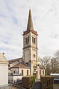
Dzwonnica.
Bibliografia
- Francuski urząd statystyczny. (fr.).
Media użyte na tej stronie
France location map-Regions and departements-2016.svg
Autor: Superbenjamin, Licencja: CC BY-SA 4.0
Blank administrative map of France for geo-location purpose, with regions and departements distinguished. Approximate scale : 1:3,000,000
Autor: Superbenjamin, Licencja: CC BY-SA 4.0
Blank administrative map of France for geo-location purpose, with regions and departements distinguished. Approximate scale : 1:3,000,000
Languedoc-Roussillon-Midi-Pyrénées region location map.svg
Autor: Flappiefh, Licencja: CC BY-SA 4.0
Carte administrative vierge de la région Languedoc-Roussillon-Midi-Pyrénées, France, destinée à la géolocalisation.
Autor: Flappiefh, Licencja: CC BY-SA 4.0
Carte administrative vierge de la région Languedoc-Roussillon-Midi-Pyrénées, France, destinée à la géolocalisation.
.svg)

Launaguet - Église Saint-Barthélemy - Clocher.jpg
Autor: Didier Descouens, Licencja: CC BY-SA 4.0
Bell tower of the church Saint-Barthélemy from Launaguet.
Autor: Didier Descouens, Licencja: CC BY-SA 4.0
Bell tower of the church Saint-Barthélemy from Launaguet.

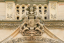
Château de Launaguet - Armes à l'entrée.jpg
Autor: Didier Descouens, Licencja: CC BY-SA 4.0
This building is classé au titre des monuments historiques de la France. It is indexed in the base Mérimée, a database of architectural heritage maintained by the French Ministry of Culture, under the reference PA00094690 .
.
Autor: Didier Descouens, Licencja: CC BY-SA 4.0
This building is classé au titre des monuments historiques de la France. It is indexed in the base Mérimée, a database of architectural heritage maintained by the French Ministry of Culture, under the reference PA00094690

Launaguet - Église Saint-Barthélemy - Abside.jpg
Autor: Didier Descouens, Licencja: CC BY-SA 4.0
Apse of the church Saint-Barthélemy from Launaguet.
Autor: Didier Descouens, Licencja: CC BY-SA 4.0
Apse of the church Saint-Barthélemy from Launaguet.

Château de Launaguet - Façade Nord-Ouest.jpg
Autor: Didier Descouens, Licencja: CC BY-SA 3.0
This building is classé au titre des monuments historiques de la France. It is indexed in the base Mérimée, a database of architectural heritage maintained by the French Ministry of Culture, under the reference PA00094690.
Autor: Didier Descouens, Licencja: CC BY-SA 3.0
This building is classé au titre des monuments historiques de la France. It is indexed in the base Mérimée, a database of architectural heritage maintained by the French Ministry of Culture, under the reference PA00094690
Château de Launaguet - Façade Sud-Est.jpg
Autor: Didier Descouens, Licencja: CC BY-SA 3.0
This building is classé au titre des monuments historiques de la France. It is indexed in the base Mérimée, a database of architectural heritage maintained by the French Ministry of Culture, under the reference PA00094690.
Autor: Didier Descouens, Licencja: CC BY-SA 3.0
This building is classé au titre des monuments historiques de la France. It is indexed in the base Mérimée, a database of architectural heritage maintained by the French Ministry of Culture, under the reference PA00094690
Haute-Garonne department location map.svg
Autor: Flappiefh, Licencja: CC BY-SA 4.0
Blank administrative map of the department of Haute-Garonne, France, for geo-location purpose.
Autor: Flappiefh, Licencja: CC BY-SA 4.0
Blank administrative map of the department of Haute-Garonne, France, for geo-location purpose.
.svg)