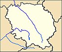
Le Grand-Bourg
| miejscowość i gmina | |||
 Le Grand-Bourg (2009) | |||
| |||
| Państwo | |||
|---|---|---|---|
| Region | |||
| Departament | |||
| Okręg | |||
| Kod INSEE | 23095 | ||
| Powierzchnia | 77,82 km² | ||
| Populacja (1990) • liczba ludności |
| ||
| • gęstość | 17 os./km² | ||
| Kod pocztowy | 23240 | ||
| Strona internetowa | |||
| Portal | |||
Le Grand-Bourg – miejscowość i gmina we Francji, w regionie Nowa Akwitania, w departamencie Creuse.
Według danych na rok 1990 gminę zamieszkiwały 1323 osoby, a gęstość zaludnienia wynosiła 17 osób/km² (wśród 747 gmin Limousin Le Grand-Bourg plasuje się na 88. miejscu pod względem liczby ludności, natomiast pod względem powierzchni na miejscu 3.).
Populacja
Bibliografia
- Francuski urząd statystyczny. (fr.).
Linki zewnętrzne
Media użyte na tej stronie
Autor: Superbenjamin, Licencja: CC BY-SA 4.0
Blank administrative map of France for geo-location purpose, with regions and departements distinguished. Approximate scale : 1:3,000,000
Autor: Flappiefh, Licencja: CC BY-SA 4.0
Carte administrative vierge de la région Aquitaine-Limousin-Poitou-Charentes, France, destinée à la géolocalisation.
Autor: Michiel1972, Licencja: CC BY-SA 3.0
Population - Municipality code 23095.svg
Population Census 1962-2008Autor: FB23, Licencja: CC BY-SA 3.0
Le bourg du Grand-Bourg vu depuis le village d'Ardannes. On distingue au premier plan la rivière Gartempe. Au second plan apparaît la zone artisanale, et plus loin le bourg regroupé autour de la collégiale Notre-Dame.
Autor: Wikisoft* @@@-fr 09:35, 20 December 2012 (UTC), Licencja: GFDL
Carte 23 Creuse département fr administrative


