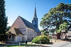
Le Mesnil-Durand
| miejscowość | |||
 | |||
| |||
| Państwo | |||
|---|---|---|---|
| Region | |||
| Departament | |||
| Okręg | |||
| Kod INSEE | 14418 | ||
| Powierzchnia | 9,74 km² | ||
| Populacja (2013) • liczba ludności |
| ||
| Kod pocztowy | 14140 | ||
| Portal | |||
Le Mesnil-Durand – miejscowość i dawna gmina we Francji, w regionie Normandia, w departamencie Calvados. W dniu 1 stycznia 2016 roku z połączenia 22 ówczesnych gmin – Auquainville, Les Autels-Saint-Bazile, Bellou, Cerqueux, Cheffreville-Tonnencourt, La Croupte, Familly, Fervaques, Heurtevent, Livarot, Le Mesnil-Bacley, Le Mesnil-Durand, Le Mesnil-Germain, Meulles, Les Moutiers-Hubert, Notre-Dame-de-Courson, Préaux-Saint-Sébastien, Sainte-Marguerite-des-Loges, Saint-Martin-du-Mesnil-Oury, Saint-Michel-de-Livet, Saint-Ouen-le-Houx oraz Tortisambert – powstała nowa gmina Livarot-Pays-d'Auge[1]. W 2013 roku populacja Le Mesnil-Durand wynosiła 313 mieszkańców[2].
Przypisy
- ↑ Recueil des Actes Administratif (fr.). calvados.gouv.fr. [dostęp 2016-11-17].
- ↑ Populations légales 2013 (fr.). INSEE. [dostęp 2016-11-17].
Media użyte na tej stronie
Autor: Eric Gaba (Sting - fr:Sting), Licencja: CC BY-SA 3.0
Blank administrative map of the department of Calvados, France, for geo-location purpose.
Autor: Superbenjamin, Licencja: CC BY-SA 4.0
Blank administrative map of France for geo-location purpose, with regions and departements distinguished. Approximate scale : 1:3,000,000
Autor: Flappiefh, Licencja: CC BY-SA 4.0
Carte administrative vierge de la région Normandie, France, destinée à la géolocalisation.
Autor: Chatsam, Licencja: CC BY-SA 3.0
blason de la commune de le Mesnil-Durand : D'azur au chevron d'argent accompagné, en chef, de deux lions affrontés d'or et en pointe de trois épis de blé liés du même.
Autor: P Florentin, Licencja: CC BY-SA 3.0
This building is indexed in the base Mérimée, a database of architectural heritage maintained by the French Ministry of Culture, under the reference PA00111536


