Le Perrier (Wandea)
| miejscowość i gmina | |||
 | |||
| |||
| Państwo | |||
|---|---|---|---|
| Region | |||
| Departament | |||
| Okręg | |||
| Kod INSEE | 85172 | ||
| Powierzchnia | 33,22 km² | ||
| Populacja (2012) • liczba ludności |
| ||
| • gęstość | 56 os./km² | ||
| Kod pocztowy | 85300 | ||
Położenie na mapie Wandei (c) Eric Gaba, Wikimedia Commons user Sting, CC BY-SA 3.0 | |||
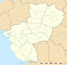
Położenie na mapie Kraju Loary (c) Eric Gaba, Wikimedia Commons user Sting, CC BY-SA 3.0 | |||
| Strona internetowa | |||
| Portal | |||
Le Perrier – miejscowość i gmina we Francji, w regionie Kraj Loary, w departamencie Wandea.
Bibliografia
- Francuski urząd statystyczny. (fr.).
Media użyte na tej stronie
Vendée department location map.svg
(c) Eric Gaba, Wikimedia Commons user Sting, CC BY-SA 3.0
Blank administrative map of the department of Vendée, France, as in February 2011, for geo-location purpose, with distinct boundaries for regions, departments and arrondissements.
(c) Eric Gaba, Wikimedia Commons user Sting, CC BY-SA 3.0
Blank administrative map of the department of Vendée, France, as in February 2011, for geo-location purpose, with distinct boundaries for regions, departments and arrondissements.
France location map-Regions and departements-2016.svg
Autor: Superbenjamin, Licencja: CC BY-SA 4.0
Blank administrative map of France for geo-location purpose, with regions and departements distinguished. Approximate scale : 1:3,000,000
Autor: Superbenjamin, Licencja: CC BY-SA 4.0
Blank administrative map of France for geo-location purpose, with regions and departements distinguished. Approximate scale : 1:3,000,000
Pays de la Loire region location map.svg
(c) Eric Gaba, Wikimedia Commons user Sting, CC BY-SA 3.0
Blank administrative map of the region of Pays de la Loire, France, as in February 2011, for geo-location purpose, with distinct boundaries for regions, departments and arrondissements.
(c) Eric Gaba, Wikimedia Commons user Sting, CC BY-SA 3.0
Blank administrative map of the region of Pays de la Loire, France, as in February 2011, for geo-location purpose, with distinct boundaries for regions, departments and arrondissements.
Blason ville fr Le Perrier (Vendée).svg
Autor: Autor nie został podany w rozpoznawalny automatycznie sposób. Założono, że to Ssire (w oparciu o szablon praw autorskich)., Licencja: CC BY-SA 3.0
Autor: Autor nie został podany w rozpoznawalny automatycznie sposób. Założono, że to Ssire (w oparciu o szablon praw autorskich)., Licencja: CC BY-SA 3.0
= Blasonnement
- De sinople à la fasce ondée d'argent sur laquelle est posée une yole et ses deux passagers, maraîchine assise et maraîchin (habitants du marais) ninglant (guidant d'une perche), le tout d'argent, accompagnée en pointe d'une croix fleurdelysée d'or.
Le Perrier-85300-Eglise de la Transfiguration de Notre Seigneur Vendée).JPG
Autor: Bococo, Licencja: CC BY-SA 3.0
partie sud-est
Autor: Bococo, Licencja: CC BY-SA 3.0
partie sud-est


