Le Plan
| miejscowość i gmina | |||
 | |||
| |||
| Państwo | |||
|---|---|---|---|
| Region | |||
| Departament | |||
| Okręg | |||
| Kod INSEE | 31425 | ||
| Powierzchnia | 8,11 km² | ||
| Populacja (1990) • liczba ludności |
| ||
| • gęstość | 37 os./km² | ||
| Kod pocztowy | 31220 | ||
| Portal | |||
Plan - miejscowość i gmina we Francji, w regionie Oksytania, w departamencie Górna Garonna.
Według danych z 1990 r. gminę zamieszkiwało 300 osób, a gęstość zaludnienia wynosiła 37 osób/km² (wśród 3020 gmin regionu Midi-Pireneje Plan plasuje się na 767. miejscu pod względem liczby ludności, natomiast pod względem powierzchni na miejscu 1238.).
Bibliografia
- Francuski urząd statystyczny (fr.).
Media użyte na tej stronie
Autor: Flappiefh, Licencja: CC BY-SA 4.0
Blank administrative map of the department of Haute-Garonne, France, for geo-location purpose.
Autor: Superbenjamin, Licencja: CC BY-SA 4.0
Blank administrative map of France for geo-location purpose, with regions and departements distinguished. Approximate scale : 1:3,000,000
Autor: Flappiefh, Licencja: CC BY-SA 4.0
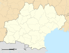
Carte administrative vierge de la région Languedoc-Roussillon-Midi-Pyrénées, France, destinée à la géolocalisation.
Autor: Celbusro, Licencja: CC BY-SA 3.0
Blasonnement : d'or à deux renards affrontés de sable gravissant les versants d'une colline d'argent posée sur une rivière courante en fasce de sinople et chargée d'une roue de moulin de sable brochant en partie sur la rivière; au chef d'or chargé d'une muraille crénelée de six pièces de sable, maçonnée du champ ; le tout enfermé dans un orle de gueules et de sable.
Autor: Paternel 1, Licencja: CC BY-SA 4.0
Église Saint-Pierre du Plan (Haute-Garonne)


