Le Thillay
| miejscowość i gmina | |||
 | |||
| |||
| Państwo | |||
|---|---|---|---|
| Region | |||
| Departament | |||
| Okręg | |||
| Kod INSEE | 95612 | ||
| Powierzchnia | 3,94 km² | ||
| Populacja (2010) • liczba ludności |
| ||
| • gęstość | 1045 os./km² | ||
| Kod pocztowy | 95500 | ||
Położenie na mapie Doliny Oise (c) Eric Gaba, Wikimedia Commons user Sting, CC BY-SA 3.0 | |||
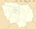
Położenie na mapie Île-de-France (c) Eric Gaba, Wikimedia Commons user Sting, CC BY-SA 3.0 | |||
| Portal | |||
Le Thillay – miejscowość i gmina we Francji, w regionie Île-de-France, w departamencie Dolina Oise.
Według danych na rok 2010 gminę zamieszkiwało 4118 osób, a gęstość zaludnienia wynosiła 1045 osób/km².
Bibliografia
- Francuski urząd statystyczny (fr.).
Media użyte na tej stronie
Autor: Superbenjamin, Licencja: CC BY-SA 4.0
Blank administrative map of France for geo-location purpose, with regions and departements distinguished. Approximate scale : 1:3,000,000
(c) Eric Gaba, Wikimedia Commons user Sting, CC BY-SA 3.0
Blank administrative map of the region of Île-de-France, France, as in January 2015, for geo-location purpose, with distinct boundaries for regions, departments and arrondissements.
(c) Eric Gaba, Wikimedia Commons user Sting, CC BY-SA 3.0
Blank administrative map of the department of Val-d'Oise, France, as in January 2015, for geo-location purpose, with distinct boundaries for regions, departments and arrondissements.
Autor: Chatsam, Licencja: CC BY-SA 3.0
blason de la commune de Le Thillay : Taillé au 1) d’azur au tilleul au naturel sur une terrasse de sinople herbée de sable adextré du château du lieu d’or, au 2) d’azur au pont d’une arche d’or maçonnée de sable, l’ouverture de l’arche remplie de même et adextrée de feuillage aussi de sinople, ledit pont mouvant de la partition et posé sur une rivière du champ d’ou émergent à senestre, deux bouquets de roseaux aussi de sable brochant en partie sur le pont.


