Le Vésinet
| miejscowość i gmina | |||
 Merostwo | |||
| |||
| Państwo | |||
|---|---|---|---|
| Region | |||
| Departament | |||
| Okręg | |||
| Kod INSEE | 78650 | ||
| Powierzchnia | 5 km² | ||
| Populacja (1990) • liczba ludności |
| ||
| • gęstość | 3189 os./km² | ||
| Kod pocztowy | 78110 | ||
Położenie na mapie Yvelines (c) Eric Gaba, Wikimedia Commons user Sting, CC BY-SA 3.0 | |||
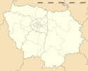
Położenie na mapie Île-de-France (c) Eric Gaba, Wikimedia Commons user Sting, CC BY-SA 3.0 | |||
| Portal | |||
Le Vésinet – miejscowość i gmina we Francji, w regionie Île-de-France, w departamencie Yvelines.
Według danych na rok 1990 gminę zamieszkiwało 15 945 osób, a gęstość zaludnienia wynosiła 3189 osób/km² (wśród 1287 gmin regionu Île-de-France Le Vésinet plasuje się na 184. miejscu pod względem liczby ludności, natomiast pod względem powierzchni na miejscu 678.).
Współpraca
 Oakwood, Stany Zjednoczone
 Unterhaching, Niemcy
 Worcester, Wielka Brytania
 Hunters Hill, Australia
 Villanueva de la Cañada, Hiszpania
Bibliografia
- Francuski urząd statystyczny (fr.).
Media użyte na tej stronie
Autor: Superbenjamin, Licencja: CC BY-SA 4.0
Blank administrative map of France for geo-location purpose, with regions and departements distinguished. Approximate scale : 1:3,000,000
(c) Eric Gaba, Wikimedia Commons user Sting, CC BY-SA 3.0
Blank administrative map of the region of Île-de-France, France, as in January 2015, for geo-location purpose, with distinct boundaries for regions, departments and arrondissements.
The flag of Navassa Island is simply the United States flag. It does not have a "local" flag or "unofficial" flag; it is an uninhabited island. The version with a profile view was based on Flags of the World and as a fictional design has no status warranting a place on any Wiki. It was made up by a random person with no connection to the island, it has never flown on the island, and it has never received any sort of recognition or validation by any authority. The person quoted on that page has no authority to bestow a flag, "unofficial" or otherwise, on the island.
Autor: Pedro A. Gracia Fajardo, escudo de Manual de Imagen Institucional de la Administración General del Estado, Licencja: CC0
Flaga Hiszpanii
(c) Eric Gaba, Wikimedia Commons user Sting, CC BY-SA 3.0
Blank administrative map of the department of the Yvelines, France, as in January 2015, for geo-location purpose, with distinct boundaries for regions, departments and arrondissements.
Autor: Henry SALOMÉ, Licencja: CC BY-SA 4.0
Mairie du Vésinet, Yvelines, France


