Lees (Wielki Manchester)
(c) Martin Clark, CC BY-SA 2.0 Centrum Lees | |
| Państwo | |
|---|---|
| Kraj | |
| Hrabstwo | |
| Populacja • liczba ludności |
|
| Nr kierunkowy | 0161 |
| Kod pocztowy | OL4 |
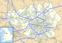
Położenie na mapie Wielkiego Manchesteru Contains Ordnance Survey data © Crown copyright and database right, CC BY-SA 3.0 | |
Położenie na mapie Wielkiej Brytanii (c) Karte: NordNordWest, Lizenz: Creative Commons by-sa-3.0 de | |
| Portal | |
Lees - miasteczko (formalnie wieś) w aglomeracji Manchesteru, administracyjnie należące do dystryktu Oldham. Niegdyś ośrodek przetwórstwa bawełny, obecnie większość mieszkańców dojeżdża do pracy do pracy do Oldham lub pobliskiego hrabstwa West Yorkshire. Około 10 tysięcy mieszkańców.
Media użyte na tej stronie
Contains Ordnance Survey data © Crown copyright and database right, CC BY-SA 3.0
Map of Greater Manchester, UK with the following information shown:
- Administrative borders
- Coastline, lakes and rivers
- Roads and railways
- Urban areas
The data includes both primary routes and railway lines.
Equirectangular map projection on WGS 84 datum, with N/S stretched 165%
Geographic limits:
- West: 2.80W
- East: 1.90W
- North: 53.70N
- South: 53.32N
(c) Karte: NordNordWest, Lizenz: Creative Commons by-sa-3.0 de
Location map of the United Kingdom
Flag of England. Saint George's cross (a red cross on a white background), used as the Flag of England, the Italian city of Genoa and various other places.
(c) Martin Clark, CC BY-SA 2.0
Lees village centre, in Greater Manchester, England. Looking eastwards along the A669 at Lees, near Oldham, towards County End, with the Red Lion pub on the corner.


