Leigham
| ||
(c) Derek Harper, CC BY-SA 2.0 | ||
| Państwo | ||
| Kraj | ||
| Region | South West England | |
| Hrabstwo ceremonialne | Devon | |
| Unitary authority | Plymouth | |
| Nr kierunkowy | 01752 | |
| Kod pocztowy | PL6 8xx | |
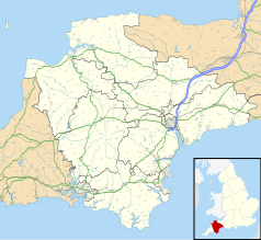
Położenie na mapie Devonu Contains Ordnance Survey data © Crown copyright and database right, CC BY-SA 3.0 | ||
| Portal | ||
Leigham – część miasta Plymouth w Anglii, w hrabstwie ceremonialnym Devon, w dystrykcie (unitary authority) Plymouth. Leży 53 km na południowy zachód od miasta Exeter i 304 km na południowy zachód od Londynu[1].
Przypisy
- ↑ Leigham na mapie (ang.). getamap.ordnancesurvey.co.uk. [dostęp 2010-10-06].
|
Media użyte na tej stronie
Flag of England. Saint George's cross (a red cross on a white background), used as the Flag of England, the Italian city of Genoa and various other places.
(c) Derek Harper, CC BY-SA 2.0
Bradfield Close, Leigham A view from Bampoton Road, which might suggest that there is simply a wooded valley between this close and the housing at Mainstone on the left. In fact, there is an entire estate of houses on Beechwood Rise and Parkfield Drive hidden there.
Contains Ordnance Survey data © Crown copyright and database right, CC BY-SA 3.0
Map of Devon, UK with the following information shown:
- Administrative borders
- Coastline, lakes and rivers
- Motorways and primary routes
- Urban areas
Equirectangular map projection on WGS 84 datum, with N/S stretched 150%
Geographic limits:
- West: 4.72W
- East: 2.86W
- North: 51.3N
- South: 50.16N
Autor: NordNordWest, Licencja: CC BY-SA 3.0
Location map of the United Kingdom


