Lekartów (stacja kolejowa)
 Lekartów – stacja | |
| Państwo | |
|---|---|
| Województwo | |
| Miejscowość | |
| Poprzednie nazwy | Mettich |
| Dane techniczne | |
| Kasy | nieczynna |
| Linie kolejowe | |
| |
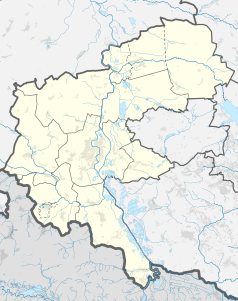
Położenie na mapie Polski (c) Karte: NordNordWest, Lizenz: Creative Commons by-sa-3.0 de | |
| Portal | |
Lekartów – stacja kolejowa położona w Lekartowie.
Linki zewnętrzne
- Lekartów w Ogólnopolskiej Bazie Kolejowej – bazakolejowa.pl
| Lekartów | ||
| Linia 177. Racibórz – Głubczyce (8,045 km) | ||
odległość: 4,297 km | odległość: 4,688 km | |
Media użyte na tej stronie
Poland adm location map.svg
(c) Karte: NordNordWest, Lizenz: Creative Commons by-sa-3.0 de
Location map of Poland
(c) Karte: NordNordWest, Lizenz: Creative Commons by-sa-3.0 de
Location map of Poland
Racibórz County location map02.svg
Autor: SANtosito, Licencja: CC BY-SA 4.0
Location map of Racibórz County with urbanized area highlighted. Geographic limits of the map:
Autor: SANtosito, Licencja: CC BY-SA 4.0
Location map of Racibórz County with urbanized area highlighted. Geographic limits of the map:
- N: 50.28 N
- S: 49.90 N
- W: 18.03 E
- E: 18.51 E
BSicon STRq.svg
Straight line aqross (according to naming convention, name + modifier)
Straight line aqross (according to naming convention, name + modifier)
BSicon exKBHFr.svg
ex terminal station, track to the right
ex terminal station, track to the right
BSicon exKBHFl.svg
ex terminal station, track to the left
ex terminal station, track to the left
BSicon exBHFq.svg
ex station ex track aqross
ex station ex track aqross
Slaskie mapa kolejowa.png
Autor: Therud, Licencja: CC BY-SA 3.0
Mapa najważniejszych linii kolejowych województwa śląskiego
Autor: Therud, Licencja: CC BY-SA 3.0
Mapa najważniejszych linii kolejowych województwa śląskiego


