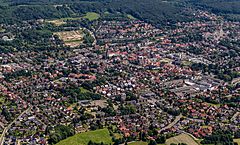
Lengerich (Nadrenia Północna-Westfalia)
| |||||
| |||||
| Państwo | |||||
|---|---|---|---|---|---|
| Kraj związkowy | |||||
| Powiat | Powiat Steinfurt | ||||
| Powierzchnia | 90,77 km² | ||||
| Wysokość | 80 m n.p.m. | ||||
| Populacja (31.12.2010) • liczba ludności • gęstość | 22 234 245 os./km² | ||||
| Nr kierunkowy | 05481, 05482, 05484 | ||||
| Kod pocztowy | 49525 | ||||
| Tablice rejestracyjne | ST, BF, TE | ||||
| Strona internetowa | |||||
| Portal | |||||
Lengerich – miasto w Niemczech, w kraju związkowym Nadrenia Północna-Westfalia, w rejencji Münster, w powiecie Steinfurt. Prawa miejskie posiada od 1147 roku.
Współpraca
Miejscowości partnerskie:
Media użyte na tej stronie
Autor: NordNordWest, Licencja: CC BY-SA 3.0
Location map of Germany (Wp article: en:Germany)
The flag of Navassa Island is simply the United States flag. It does not have a "local" flag or "unofficial" flag; it is an uninhabited island. The version with a profile view was based on Flags of the World and as a fictional design has no status warranting a place on any Wiki. It was made up by a random person with no connection to the island, it has never flown on the island, and it has never received any sort of recognition or validation by any authority. The person quoted on that page has no authority to bestow a flag, "unofficial" or otherwise, on the island.
Flagge der Stadt Lengerich: „Die Flagge ist in zwei Bahnen im Verhältnis 1:1 in den Farben Grün/Weiß längsgestreift (gemeint ist quergestreift). Sie zeigt in der Mitte das Wappenschild der Stadt.“
Autor: Hanhil based on previous work by TUBS, Licencja: CC BY-SA 3.0
Location map North Rhine-Westphalia showing position of NRW within Germany. Geographic limits of the map:


