Leninogorsk
(c) Timur Y, CC BY 3.0 | |||||
| |||||
| Państwo | |||||
|---|---|---|---|---|---|
| Republika | |||||
| Powierzchnia | 24,65[1] km² | ||||
| Populacja (2020) • liczba ludności • gęstość | 61 695[2] 2502,84 os./km² | ||||
| Nr kierunkowy | 85595 | ||||
| Kod pocztowy | 423250 | ||||
| Strona internetowa | |||||
| Portal | |||||
Leninogorsk (ros. Лениногорск) – miasto w Rosji w Tatarstanie. Osada założona w 1948, miasto od 1955. Liczy 61 695 mieszkańców (2020).
W mieście rozwinął się przemysł materiałów budowlanych[3]. Ośrodek wydobycia ropy naftowej oraz gazu ziemnego[3].
Sport
- Nieftianik Leninogorsk – klub hokejowy
Zobacz też
- Ridder – miasto w Kazachstanie noszące w latach 1941-2002 nazwę Leninogorsk.
Przypisy
- ↑ Город Лениногорск [dostęp 2021-07-23] (ros.).
- ↑ Численность населения Российской Федерации по муниципальным образованиям на 1 января 2020 года [dostęp 2021-07-23] [zarchiwizowane z adresu 2020-08-22] (ros.).
- ↑ a b Leninogorsk, [w:] Encyklopedia PWN [online] [dostęp 2021-09-19].
Media użyte na tej stronie
Autor: Uwe Dedering, Licencja: CC BY-SA 3.0
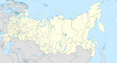
Location map of Russia.
EquiDistantConicProjection : Central parallel :
* N: 54.0° N
Central meridian :
* E: 100.0° E
Standard parallels:
* 1: 49.0° N
* 2: 59.0° N
Made with Natural Earth. Free vector and raster map data @ naturalearthdata.com.
Because the southern Kuril islands are claimed by Russia and Japan, they are shown as disputed. For more information about this see: en:Kuril Islands dispute. These islands are since 1945 under the jurisdiction of the Russian Federation.
Leninogorsk (Tatarstan), flag
Leninogorsk (Tatarstan), coat of arms
Position map of the Republic of Tatarstan ~
Equiangular projection, stretching - 175%. Coordinates of the edges:
- North - 56.8° C
- South - 53.9° C
- East - 54.5° B
- West - 47.0° V
(c) Timur Y, CC BY 3.0
Leninogorsky District, Tatarstan, Russia
The Coat of Arms of Tatarstan.


