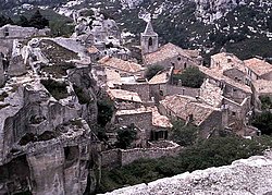
Les Baux-de-Provence
| miejscowość i gmina | |||
 Les Baux de Provence | |||
| |||
| Państwo | |||
|---|---|---|---|
| Region | |||
| Departament | |||
| Okręg | |||
| Kod INSEE | 13011 | ||
| Powierzchnia | 18,28 km² | ||
| Populacja (1990) • liczba ludności |
| ||
| • gęstość | 25 os./km² | ||
| Kod pocztowy | 13520 | ||
| Portal | |||
Les Baux-de-Provence – miejscowość i gmina we Francji, w regionie Prowansja-Alpy-Lazurowe Wybrzeże, w departamencie Delta Rodanu.
Według danych na rok 1990 gminę zamieszkiwało 457 osób, a gęstość zaludnienia wynosiła 25 osób/km² (wśród 963 gmin regionu Prowansja-Alpy-Lazurowe Wybrzeże LesBaux-de-Provence plasuje się na 501. miejscu pod względem liczby ludności, natomiast pod względem powierzchni na miejscu 528.).
Nazwa miejscowości pochodzi od oksytańskiego słowa baus, oznaczającego urwisko, skalisty stok. Pierwotnie nazywana po prostu Les Baux, od 13 sierpnia 1958 r. nosi aktualną nazwę Les Baux-de-Provence.
Miejscowość dała swą nazwę boksytowi (fr. bauxite) – rudzie aluminium, która tu właśnie została w 1821 r. odkryta i opisana przez francuskiego mineraloga i geologa Pierre’a Berthiera. W okolicy tej boksyty wydobywano na skalę przemysłową od początku lat 70. do początków lat 90. XX w.
Bibliografia
- Francuski urząd statystyczny (fr.).
Media użyte na tej stronie
Autor: Bourrichon (talk) - fr:Bourrichon, Licencja: CC BY-SA 3.0
Blank map of the department of Bouches-du-Rhône, France, for geo-location purpose, with distinct boundaries for regions, departments and arrondissements.
Autor: Superbenjamin, Licencja: CC BY-SA 4.0
Blank administrative map of France for geo-location purpose, with regions and departements distinguished. Approximate scale : 1:3,000,000
Autor: Flappiefh, Licencja: CC BY-SA 4.0
Blank administrative map of the region of Provence-Alpes-Côte d'Azur, France, for geo-location purpose.
Les Baux de Provence.
Photographed by Adrian Pingstone.
Autor: Benh LIEU SONG, Licencja: CC BY-SA 3.0
Les Baux-de-Provence village, seen from the D27 road, on the North-West side. This panorama is a mosaic of 2x4 landscape pictures taken at 105mm (168mm in 35mm equiv.), f/8.0, 1/125sec and ISO 100. Sitching was done with Hugin and Enblend and resulting image was postprocessed in Gimp.


