Leudal
| |||||
| Państwo | |||||
|---|---|---|---|---|---|
| Burmistrz | Arno Verhoeven (2014)[1] | ||||
| Powierzchnia | 164,89 km² | ||||
| Populacja • liczba ludności |
| ||||
| Strona internetowa | |||||
Leudal – gmina w prowincji Limburgia w Holandii. Zajmuje powierzchnię 164.86 km², a jej teren zamieszkuje 36.859 osób
Miejscowości:
- Baexem
- Buggenum
- Ell
- Grathem
- Haelen
- Haler
- Heibloem
- Heythuysen
- Horn
- Hunsel
- Ittervoort
- Kelpen-Oler
- Neer
- Neeritter
- Nunh
Przypisy
- ↑ leudal.nl: Samenstelling college van B&W (niderl.). [dostęp 2014-07-11]. [zarchiwizowane z tego adresu (2016-10-08)].
Linki zewnętrzne
Media użyte na tej stronie
Flag of Leudal, Netherlands
Autor: Erik Frohne, Licencja: CC BY-SA 3.0
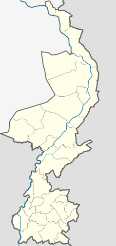
Location map of province Limburg in the Netherlands
Equirectangular projection, N/S stretching 160 %. Geographic limits of the map:
- N: 51.782° N
- S: 50.744° N
- W: 5.56° E
- E: 6.34° E
Coat of arms of the Dutch municipality of Leudal, Limburg.


