Ligeia Mare
| ||
 Mapa radarowa Ligeia Mare (w fałszywych barwach) | ||
| Położenie | ||
| Państwo | nie dotyczy terytorium pozaziemskie | |
| Region | Tytan | |
| Morfometria | ||
| Powierzchnia | 126 000 km²[1] | |
| Wymiary • max długość • max szerokość | 500 km[2] 500 km[2] | |
| Głębokość • średnia • maksymalna | > 6 m ~100 m | |
| Hydrologia | ||
| Rodzaj jeziora | jezioro węglowodorów | |
 Mapa Ligeia Mare | ||
Ligeia Mare – jezioro na Tytanie o współrzędnych 79,7°N; 247,9°W[2], wypełnione płynnymi węglowodorami, głównie metanem, mające średnicę ok. 500 km oraz powierzchnię ok. 126 000 km². Nazwa pochodzi od syreny Ligei z mitologii greckiej[2].
Proponowany lądownik
Na rok 2020 planowano wysłanie misji TSSM (Titan Saturn System Mission), wyposażonej w lądownik, który osiadłby na powierzchni jeziora i przeprowadził badania in situ[3], m.in. zrzucając sondę na dno jeziora. Początkowo proponowano wysłanie lądownika jako osobną misję TiME (Titan Mare Explorer). Żadna z tych misji nie wyszła jednak poza etap prac koncepcyjnych i nie została wybrana do realizacji[4].
Przypisy
- ↑ Titan Polar Maps - 2015 (ang.). W: Cassini Solstice Mission [on-line]. Jet Propulsion Laboratory, 2015-10-09. [dostęp 2016-02-22]. [zarchiwizowane z tego adresu (2016-04-12)].
- ↑ a b c d Ligeia Mare (ang.). W: Gazetteer of Planetary Nomenclature [on-line]. IAU, USGS, NASA. [dostęp 2016-02-22].
- ↑ Jeremy Hsu: Nuclear-Powered Robot Ship Could Sail Seas of Titan (ang.). W: Space.com [on-line]. 2009-10-14. [dostęp 2016-02-22].
- ↑ Leigh Fletcher. Future exploration of the outer solar system. „Astronomy & Geophysics”. 54 (2), s. 2.14-2.20, 2013. DOI: 10.1093/astrogeo/att032 (ang.).
Linki zewnętrzne
Media użyte na tej stronie
Autor: Tzugaj, Licencja: CC0
znak graficzny do map, ukazujący przykładowe jezioro
Ligeia Mare, shown here in a false-color image from NASA's Cassini mission, is the second largest known body of liquid on Saturn's moon Titan. It is filled with liquid hydrocarbons, such as ethane and methane, and is one of the many seas and lakes that bejewel Titan's north polar region. Cassini has yet to observe waves on Ligeia Mare and will look again during its next encounter on May 23, 2013. The image is a false-color mosaic of synthetic aperture radar images obtained by the Cassini spacecraft between February 2006 and April 2007. Dark areas (low radar return) are colored black while bright regions (high radar return) are colored yellow to white. In this color scheme, liquids, which are dark to the radar, end up appearing black and the solid surface of Titan, which appears bright to the radar, ends up appearing yellow.
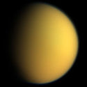
This natural color composite was taken during the Cassini spacecraft's April 16, 2005, flyby of Titan. It is a combination of images taken through three filters that are sensitive to red, green and violet light. It shows approximately what Titan would look like to the human eye: a hazy orange globe surrounded by a tenuous, bluish haze. The orange color is due to the hydrocarbon particles which make up Titan's atmospheric haze. This obscuring haze was particularly frustrating for planetary scientists following the NASA Voyager mission encounters in 1980-81. Fortunately, Cassini is able to pierce Titan's veil at infrared wavelengths (see PIA06228). North on Titan is up and tilted 30 degrees to the right. The images to create this composite were taken with the Cassini spacecraft wide angle camera on April 16, 2005, at distances ranging from approximately 173,000 to 168,200 kilometers (107,500 to 104,500 miles) from Titan and from a Sun-Titan-spacecraft, or phase, angle of 56 degrees. Resolution in the images is approximately 10 kilometers per pixel. The Cassini-Huygens mission is a cooperative project of NASA, the European Space Agency and the Italian Space Agency. The Jet Propulsion Laboratory, a division of the California Institute of Technology in Pasadena, manages the mission for NASA's Science Mission Directorate, Washington, D.C. The Cassini orbiter and its two onboard cameras were designed, developed and assembled at JPL. The imaging team is based at the Space Science Institute, Boulder, Colo. For more information about the Cassini-Huygens mission, visit http://saturn.jpl.nasa.gov and the Cassini imaging team home page, http://ciclops.org.
Mapa powierzchni Tytana, bez ramki i zmniejszona w celu użycia w szablonach, przede wszystkim lokalizacyjnych. Mapa przedstawia stan wiedzy z grudnia 2018 roku.
Autor: Peter Minton, Licencja: CC BY 2.0
A map showing en:Ligeia Mare on Titan. Converted to PNG by uploader. The longitudes are 180° off, see [1].
The Titan Mare Explorer (TiME) probe as envisioned for the Titan Saturn System Mission (TSSM) slated for launch in 2020 and bound for a splash down on Titan around 2030 in Ligeia Mare (the backup target is lake Kraken Mare).


