Lindenhurst (Nowy Jork)
| ||||
 | ||||
| Państwo | ||||
|---|---|---|---|---|
| Stan | ||||
| Hrabstwo | ||||
| Kod statystyczny | ||||
| Powierzchnia | 9,9 km² | |||
| Wysokość | 9 m n.p.m. | |||
| Populacja (2010) • liczba ludności • gęstość |
| |||
| Nr kierunkowy | 631 | |||
| Kod pocztowy | 11757 | |||
| Strefa czasowa | ||||
Położenie na mapie stanu Nowy Jork (c) NordNordWest, CC BY 3.0 | ||||
| Portal | ||||
Lindenhurst – wieś w Hrabstwie Suffolk, w stanie Nowy Jork w Stanach Zjednoczonych.
Liczba ludności wynosi 27 253 mieszkańców (według wyników spisu ludności w 2010 roku).
Historia
Miejscowość założona przez niemieckich osadnikòw z Breslau w roku 1873. Stąd też pierwsza nazwa miejscowości: Breslau. Nazwę zmieniono na Lindenhurst w 1891 roku.
Geografia
Miejscowość położona jest w południowej części wyspy Long Island.
Znane osoby z Lindenhurst
Wokalistka Pat Benatar dorastała w Lindenhurst i uczęszczała do tamtejszego liceum.
Szkolnictwo
W Lindenhurst znajduje się 6 szkół podstawowych, 1 gimnazjum, 1 liceum.
Media użyte na tej stronie
(c) NordNordWest, CC BY 3.0
Location map of the State of New York, USA
Autor: Uwe Dedering, Licencja: CC BY-SA 3.0
Location map of the USA (without Hawaii and Alaska).
EquiDistantConicProjection:
Central parallel:
* N: 37.0° N
Central meridian:
* E: 96.0° W
Standard parallels:
* 1: 32.0° N
* 2: 42.0° N
Made with Natural Earth. Free vector and raster map data @ naturalearthdata.com.
Formulas for x and y:
x = 50.0 + 124.03149777329222 * ((1.9694462586094064-({{{2}}}* pi / 180))
      * sin(0.6010514667026994 * ({{{3}}} + 96) * pi / 180))
y = 50.0 + 1.6155950752393982 * 124.03149777329222 * 0.02613325650382181
      - 1.6155950752393982  * 124.03149777329222 *
     (1.3236744353715044  - (1.9694462586094064-({{{2}}}* pi / 180))
      * cos(0.6010514667026994 * ({{{3}}} + 96) * pi / 180))
The flag of Navassa Island is simply the United States flag. It does not have a "local" flag or "unofficial" flag; it is an uninhabited island. The version with a profile view was based on Flags of the World and as a fictional design has no status warranting a place on any Wiki. It was made up by a random person with no connection to the island, it has never flown on the island, and it has never received any sort of recognition or validation by any authority. The person quoted on that page has no authority to bestow a flag, "unofficial" or otherwise, on the island.
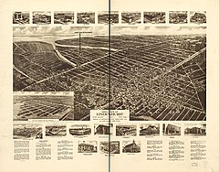
Perspective map not drawn to scale. Bird's-eye-view. LC Panoramic maps (2nd ed.), 581 Available also through the Library of Congress Web site as a raster image. Includes illus., directory, and text. AACR2 Copyright not renewed, 01-14-1998.


