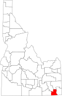
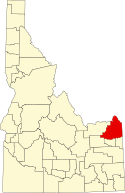
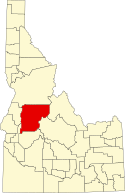
Lista hrabstw w stanie Idaho
Lista hrabstw w stanie Idaho obejmuje 44 jednostki administracyjne.
| Nazwa | kod FIPS[1] | Siedziba | Powierzchnia całkowita (km²)[2] | Populacja (2009)[1] | Data powstania[3] | Położenie na mapie |
|---|---|---|---|---|---|---|
| Ada | 16001 | Boise | 2746,24 | 384 656 | 22 grudnia 1864 |  |
| Adams | 16003 | Council | 3548,28 | 3520 | 3 marca 1911 |  |
| Bannock | 16005 | Pocatello | 2971,91 | 82 539 | 6 marca 1893 |  |
| Bear Lake | 16007 | Paris | 2718,04 | 5774 | 5 stycznia 1875 | 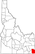 |
| Benewah | 16009 | St. Maries | 2030,5 | 9258 | 23 stycznia 1915 |  |
| Bingham | 16011 | Blackfoot | 5491,4 | 44 668 | 13 stycznia 1885 |  |
| Blaine | 16013 | Hailey | 6892,01 | 22 328 | 5 marca 1895 |  |
| Boise | 16015 | Idaho City | 4938,49 | 7445 | 4 lutego 1864 |  |
| Bonner | 16017 | Sandpoint | 4971,71 | 41 403 | 21 lutego 1907 | 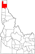 |
| Bonneville | 16019 | Idaho Falls | 4971,71 | 101 329 | 7 lutego 1911 |  |
| Boundary | 16021 | Bonners Ferry | 3310,55 | 10 951 | 23 stycznia 1915 |  |
| Butte | 16023 | Arco | 5784,97 | 2764 | 6 lutego 1917 |  |
| Camas | 16025 | Fairfield | 2794,65 | 1109 | 6 lutego 1917 |  |
| Canyon | 16027 | Caldwell | 1563,08 | 186 615 | 7 marca 1891 |  |
| Caribou | 16029 | Soda Springs | 4658,4 | 6914 | 11 lutego 1919 |  |
| Cassia | 16031 | Burley | 6682,97 | 21 698 | 20 lutego 1879 |  |
| Clark | 16033 | Dubois | 4571,87 | 952 | 1 lutego 1919 |  |
| Clearwater | 16035 | Orofino | 6444,15 | 8043 | 27 lutego 1911 |  |
| Custer | 16037 | Challis | 12 786,23 | 4240 | 8 stycznia 1881 |  |
| Elmore | 16039 | Mountain Home | 8030,28 | 28 820 | 7 lutego 1889 |  |
| Franklin | 16041 | Preston | 1731,04 | 12 676 | 20 stycznia 1913 |  |
| Fremont | 16043 | St. Anthony | 4909,56 | 12 691 | 4 marca 1893 |  |
| Gem | 16045 | Emmett | 1465,29 | 16 437 | 15 marca 1915 |  |
| Gooding | 16047 | Gooding | 1900,64 | 14 430 | 28 stycznia 1913 |  |
| Idaho | 16049 | Grangeville | 22 021,32 | 15 461 | 4 lutego 1864 | 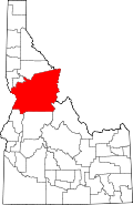 |
| Jefferson | 16051 | Rigby | 2863,36 | 24 802 | 18 lutego 1913 |  |
| Jerome | 16053 | Jerome | 1558,84 | 21 262 | 8 lutego 1919 |  |
| Kootenai | 16055 | Coeur d’Alene | 3407,62 | 139 390 | 22 grudnia 1864 |  |
| Latah | 16057 | Moscow | 2789,13 | 38 046 | 14 maja 1888 |  |
| Lemhi | 16059 | Salmon | 11 834,95 | 7908 | 9 stycznia 1869 |  |
| Lewis | 16061 | Nezperce | 1242,7 | 3735 | 3 marca 1911 |  |
| Lincoln | 16063 | Shoshone | 3123,16 | 4645 | 18 marca 1895 |  |
| Madison | 16065 | Rexburg | 1226 | 38 440 | 18 lutego 1913 |  |
| Minidoka | 16067 | Rupert | 1976,11 | 19 226 | 28 stycznia 1913 |  |
| Nez Perce | 16069 | Lewiston | 2217,96 | 39 211 | 4 lutego 1864 |  |
| Oneida | 16071 | Malad City | 3112,16 | 4221 | 22 stycznia 1864 |  |
| Owyhee | 16073 | Murphy | 19 934,39 | 11 223 | 31 grudnia 1863 |  |
| Payette | 16075 | Payette | 1062,39 | 23 099 | 28 lutego 1917 |  |
| Power | 16077 | American Falls | 3736,32 | 7734 | 30 stycznia 1913 |  |
| Shoshone | 16079 | Wallace | 6825,91 | 12 660 | 4 lutego 1864 |  |
| Teton | 16081 | Driggs | 1166,97 | 9337 | 26 stycznia 1915 |  |
| Twin Falls | 16083 | Twin Falls | 4994,71 | 75 296 | 21 lutego 1907 |  |
| Valley | 16085 | Cascade | 9670,13 | 8726 | 26 lutego 1917 |  |
| Washington | 16087 | Weiser | 3816,45 | 10 119 | 20 lutego 1879 |  |
Przypisy
- ↑ a b US Census Bureau: Idaho Quickfacts (ang.). [dostęp 2010-10-17].
- ↑ US Census Bureau: Idaho County. Population, Housing Units, Area, and Density: 2000 (ang.). [dostęp 2010-10-17].
- ↑ Idaho Counties (ang.). Official Website of the State of Idaho. [dostęp 2010-10-17].
| ||||||
| ||||
Media użyte na tej stronie
Map of Idaho highlighting Canyon County.svg
This is a locator map showing Canyon County in Idaho. For more information, see Commons:United States county locator maps.
This is a locator map showing Canyon County in Idaho. For more information, see Commons:United States county locator maps.
Map of Idaho highlighting Latah County.svg
This is a locator map showing Latah County in northern Idaho.
This is a locator map showing Latah County in northern Idaho.
- Credits
- For more information, see Commons:United States county locator maps.
Map of Idaho highlighting Bannock County.svg
This is a locator map showing Bannock County in Idaho. For more information, see Commons:United States county locator maps.
This is a locator map showing Bannock County in Idaho. For more information, see Commons:United States county locator maps.
Map of Idaho highlighting Bear Lake County.svg
This is a locator map showing Bear Lake County in Idaho. For more information, see Commons:United States county locator maps.
This is a locator map showing Bear Lake County in Idaho. For more information, see Commons:United States county locator maps.
Map of Idaho highlighting Minidoka County.svg
This is a locator map showing Minidoka County in Idaho. For more information, see Commons:United States county locator maps.
This is a locator map showing Minidoka County in Idaho. For more information, see Commons:United States county locator maps.
Map of Idaho highlighting Clark County.svg
This is a locator map showing Clark County in Idaho. For more information, see Commons:United States county locator maps.
This is a locator map showing Clark County in Idaho. For more information, see Commons:United States county locator maps.
Map of Idaho highlighting Power County.svg
This is a locator map showing Power County in Idaho. For more information, see Commons:United States county locator maps.
This is a locator map showing Power County in Idaho. For more information, see Commons:United States county locator maps.
Map of Idaho highlighting Nez Perce County.svg
This is a locator map showing Nez Perce County in Idaho. For more information, see Commons:United States county locator maps.
This is a locator map showing Nez Perce County in Idaho. For more information, see Commons:United States county locator maps.
Map of Idaho highlighting Boundary County.svg
This is a locator map showing Boundary County in Idaho. For more information, see Commons:United States county locator maps.
This is a locator map showing Boundary County in Idaho. For more information, see Commons:United States county locator maps.
Map of Idaho highlighting Madison County.svg
This is a locator map showing Madison County in Idaho. For more information, see Commons:United States county locator maps.
This is a locator map showing Madison County in Idaho. For more information, see Commons:United States county locator maps.
Map of Idaho highlighting Camas County.svg
This is a locator map showing Camas County in Idaho. For more information, see Commons:United States county locator maps.
This is a locator map showing Camas County in Idaho. For more information, see Commons:United States county locator maps.
Map of Idaho highlighting Franklin County.svg
This is a locator map showing Franklin County in Idaho. For more information, see Commons:United States county locator maps.
This is a locator map showing Franklin County in Idaho. For more information, see Commons:United States county locator maps.
Map of Idaho highlighting Bonneville County.svg
This is a locator map showing Bonneville County in Idaho. For more information, see Commons:United States county locator maps.
This is a locator map showing Bonneville County in Idaho. For more information, see Commons:United States county locator maps.
Idaho Locator Map.PNG
Locator Map of Idaho, United States
Locator Map of Idaho, United States
Map of Idaho highlighting Owyhee County.svg
Locator map showing Owyhee County in southwestern Idaho.
Locator map showing Owyhee County in southwestern Idaho.
- For more information, see Commons:United States county locator maps.
Map of Idaho highlighting Clearwater County.svg
This is a locator map showing Clearwater County in Idaho. For more information, see Commons:United States county locator maps.
This is a locator map showing Clearwater County in Idaho. For more information, see Commons:United States county locator maps.
Map of Idaho highlighting Butte County.svg
This is a locator map showing Butte County in Idaho. For more information, see Commons:United States county locator maps.
This is a locator map showing Butte County in Idaho. For more information, see Commons:United States county locator maps.
Map of Idaho highlighting Elmore County.svg
This is a locator map showing Elmore County in Idaho. For more information, see Commons:United States county locator maps.
This is a locator map showing Elmore County in Idaho. For more information, see Commons:United States county locator maps.
Map of Idaho highlighting Lewis County.svg
This is a locator map showing Lewis County in Idaho. For more information, see Commons:United States county locator maps.
This is a locator map showing Lewis County in Idaho. For more information, see Commons:United States county locator maps.
Map of Idaho highlighting Jefferson County.svg
This is a locator map showing Jefferson County in Idaho. For more information, see Commons:United States county locator maps.
This is a locator map showing Jefferson County in Idaho. For more information, see Commons:United States county locator maps.
Map of Idaho highlighting Lincoln County.svg
This is a locator map showing Lincoln County in Idaho. For more information, see Commons:United States county locator maps.
This is a locator map showing Lincoln County in Idaho. For more information, see Commons:United States county locator maps.
Map of Idaho highlighting Shoshone County.svg
This is a locator map showing Shoshone County in Idaho. For more information, see Commons:United States county locator maps.
This is a locator map showing Shoshone County in Idaho. For more information, see Commons:United States county locator maps.
Map of Idaho highlighting Boise County.svg
Locator map showing Boise County in southwestern Idaho.
Locator map showing Boise County in southwestern Idaho.
Map of Idaho highlighting Ada County.svg
This is a locator map showing Ada County in Idaho. For more information, see Commons:United States county locator maps.
This is a locator map showing Ada County in Idaho. For more information, see Commons:United States county locator maps.
Map of Idaho highlighting Jerome County.svg
This is a locator map showing Jerome County in Idaho. For more information, see Commons:United States county locator maps.
This is a locator map showing Jerome County in Idaho. For more information, see Commons:United States county locator maps.
Map of Idaho highlighting Lemhi County.svg
This is a locator map showing Lemhi County in Idaho. For more information, see Commons:United States county locator maps.
This is a locator map showing Lemhi County in Idaho. For more information, see Commons:United States county locator maps.
Map of Idaho highlighting Custer County.svg
This is a locator map showing Custer County in Idaho. For more information, see Commons:United States county locator maps.
This is a locator map showing Custer County in Idaho. For more information, see Commons:United States county locator maps.
Map of Idaho highlighting Payette County.svg
This is a locator map showing Payette County in Idaho. For more information, see Commons:United States county locator maps.
This is a locator map showing Payette County in Idaho. For more information, see Commons:United States county locator maps.
Map of Idaho highlighting Benewah County.svg
This is a locator map showing Benewah County in Idaho. For more information, see Commons:United States county locator maps.
This is a locator map showing Benewah County in Idaho. For more information, see Commons:United States county locator maps.
Map of Idaho highlighting Teton County.svg
This is a locator map showing Teton County in Idaho. For more information, see Commons:United States county locator maps.
This is a locator map showing Teton County in Idaho. For more information, see Commons:United States county locator maps.
Map of Idaho highlighting Adams County.svg
This is a locator map showing Adams County in Idaho. For more information, see Commons:United States county locator maps.
This is a locator map showing Adams County in Idaho. For more information, see Commons:United States county locator maps.
Map of Idaho highlighting Caribou County.svg
This is a locator map showing Caribou County in Idaho. For more information, see Commons:United States county locator maps.
This is a locator map showing Caribou County in Idaho. For more information, see Commons:United States county locator maps.
Map of Idaho highlighting Washington County.svg
This is a locator map showing Washington County in Idaho. For more information, see Commons:United States county locator maps.
This is a locator map showing Washington County in Idaho. For more information, see Commons:United States county locator maps.
Map of Idaho highlighting Fremont County.svg
This is a locator map showing Fremont County in Idaho. For more information, see Commons:United States county locator maps.
This is a locator map showing Fremont County in Idaho. For more information, see Commons:United States county locator maps.
Map of Idaho highlighting Bingham County.svg
This is a locator map showing Bingham County in Idaho. For more information, see Commons:United States county locator maps.
This is a locator map showing Bingham County in Idaho. For more information, see Commons:United States county locator maps.
Map of Idaho highlighting Blaine County.svg
This is a locator map showing Blaine County in Idaho. For more information, see Commons:United States county locator maps.
This is a locator map showing Blaine County in Idaho. For more information, see Commons:United States county locator maps.
Map of Idaho highlighting Bonner County.svg
This is a locator map showing Bonner County in Idaho. For more information, see Commons:United States county locator maps.
This is a locator map showing Bonner County in Idaho. For more information, see Commons:United States county locator maps.
Map of Idaho highlighting Valley County.svg
This is a locator map showing Valley County in Idaho. For more information, see Commons:United States county locator maps.
This is a locator map showing Valley County in Idaho. For more information, see Commons:United States county locator maps.
Map of Idaho highlighting Twin Falls County.svg
Locator map showing Twin Falls County in southern Idaho.
Locator map showing Twin Falls County in southern Idaho.
- For more information, see Commons:United States county locator maps.
Map of Idaho highlighting Gem County.svg
This is a locator map showing Gem County in Idaho. For more information, see Commons:United States county locator maps.
This is a locator map showing Gem County in Idaho. For more information, see Commons:United States county locator maps.
Map of Idaho highlighting Oneida County.svg
This is a locator map showing Oneida County in Idaho. For more information, see Commons:United States county locator maps.
This is a locator map showing Oneida County in Idaho. For more information, see Commons:United States county locator maps.
Map of Idaho highlighting Gooding County.svg
This is a locator map showing Gooding County in Idaho. For more information, see Commons:United States county locator maps.
This is a locator map showing Gooding County in Idaho. For more information, see Commons:United States county locator maps.
Map of Idaho highlighting Kootenai County.svg
This is a locator map showing Kootenai County in Idaho. For more information, see Commons:United States county locator maps.
This is a locator map showing Kootenai County in Idaho. For more information, see Commons:United States county locator maps.
Map of Idaho highlighting Idaho County.svg
This is a locator map showing Idaho County in Idaho. For more information, see Commons:United States county locator maps.
This is a locator map showing Idaho County in Idaho. For more information, see Commons:United States county locator maps.
Map of Idaho highlighting Cassia County.svg
This is a locator map showing Cassia County in Idaho. For more information, see Commons:United States county locator maps.
This is a locator map showing Cassia County in Idaho. For more information, see Commons:United States county locator maps.


