Lista hrabstw w stanie Illinois
To jest lista hrabstw w stanie Illinois. Stan Illinois podzielony jest na 102 hrabstwa.
Lista alfabetyczna
| Nazwa | Kod FIPS | Siedziba | Powierzchnia całkowita (km²) | Powierzchnia wodna (km²) | Powierzchnia lądowa (km²) | Populacja (2000) | Gęstość zaludnienia (os/km²) (2000) | Położenie na mapie |
|---|---|---|---|---|---|---|---|---|
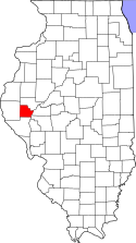
| Hrabstwo Adams | 17001 | Quincy | 2256,60 | 37,92 | 2218,66 | 68277 | 30,8 |  |
| Hrabstwo Alexander | 17003 | Cairo | 654,08 | 41,85 | 612,22 | 9590 | 15,7 |  |
| Hrabstwo Bond | 17005 | Greenville | 991,11 | 6,37 | 984,71 | 17633 | 17,9 |  |
| Hrabstwo Boone | 17007 | Belvidere | 730,22 | 1,76 | 728,49 | 41786 | 57,4 |  |
| Hrabstwo Brown | 17009 | Mount Sterling | 795,75 | 4,12 | 791,63 | 6950 | 8,8 |  |
| Hrabstwo Bureau | 17011 | Princeton | 2261,84 | 12,28 | 2249,56 | 35503 | 15,8 |  |
| Hrabstwo Calhoun | 17013 | Hardin (Illinois) | 734,75 | 77,36 | 657,39 | 5084 | 7,7 |  |
| Hrabstwo Carroll | 17015 | Mount Carroll | 1206,34 | 55,84 | 1150,50 | 16674 | 14,5 |  |
| Hrabstwo Cass | 17017 | Virginia | 993,86 | 20,28 | 973,58 | 13695 | 14,1 | 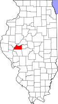 |
| Hrabstwo Champaign | 17019 | Urbana | 2583,59 | 1,89 | 2581,73 | 179669 | 69,6 |  |
| Hrabstwo Christian | 17021 | Taylorville | 1853,68 | 17,22 | 1836,46 | 35372 | 19,3 |  |
| Hrabstwo Clark | 17023 | Marshall | 1307,63 | 8,75 | 1298,88 | 17008 | 13,1 |  |
| Hrabstwo Clay | 17025 | Louisville | 1216,88 | 1,53 | 1215,35 | 14560 | 12,0 |  |
| Hrabstwo Clinton | 17027 | Carlyle | 1304,01 | 75,76 | 1228,25 | 35535 | 28,9 | 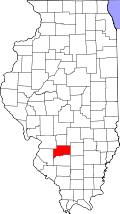 |
| Hrabstwo Coles | 17029 | Charleston | 1321,08 | 4,61 | 1316,47 | 53196 | 40,4 |  |
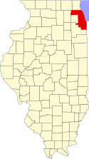
| Hrabstwo Cook | 17031 | Chicago | 4234,73 | 1785,43 | 2449,30 | 5376741 | 2195,2 |  |
| Hrabstwo Crawford | 17033 | Robinson | 1154,46 | 5,70 | 1148,74 | 20452 | 17,8 |  |
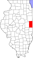
| Hrabstwo Cumberland | 17035 | Toledo | 898,73 | 2,54 | 896,19 | 11253 | 12,5 |  |
| Hrabstwo DeKalb | 17037 | Sycamore | 1644,56 | 2,10 | 1642,47 | 88969 | 54,2 |  |
| Hrabstwo DeWitt | 17039 | Clinton | 1049,33 | 19,63 | 1029,73 | 16798 | 16,3 |  |
| Hrabstwo Douglas | 17041 | Tuscola | 1081,11 | 1,45 | 1079,66 | 19922 | 18,5 |  |
| Hrabstwo DuPage | 17043 | Wheaton | 871,66 | 7,64 | 864,05 | 904161 | 1046,5 |  |
| Hrabstwo Edgar | 17045 | Paris | 1616,62 | 1,63 | 1614,99 | 19704 | 12,2 |  |
| Hrabstwo Edwards | 17047 | Albion | 576,69 | 0,80 | 575,88 | 6971 | 12,1 |  |
| Hrabstwo Effingham | 17049 | Effingham | 1242,94 | 3,11 | 1239,83 | 34264 | 27,6 |  |
| Hrabstwo Fayette | 17051 | Vandalia | 1878,67 | 22,97 | 1855,70 | 21802 | 11,7 |  |
| Hrabstwo Ford | 17053 | Paxton | 1259,82 | 1,35 | 1258,48 | 14241 | 11,3 | 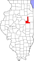 |
| Hrabstwo Franklin | 17055 | Benton | 1117,32 | 50,04 | 1067,28 | 39018 | 36,6 |  |
| Hrabstwo Fulton | 17057 | Lewistown | 2285,90 | 43,95 | 2241,95 | 38250 | 17,1 |  |
| Hrabstwo Gallatin | 17059 | Shawneetown | 850,58 | 12,12 | 838,46 | 6445 | 7,7 |  |
| Hrabstwo Greene | 17061 | Carrollton | 1415,01 | 8,42 | 1406,60 | 14761 | 10,5 |  |
| Hrabstwo Grundy | 17063 | Morris | 1114,78 | 27,25 | 1087,54 | 37535 | 34,5 |  |
| Hrabstwo Hamilton | 17065 | McLeansboro | 1128,82 | 1,74 | 1127,06 | 8621 | 7,6 |  |
| Hrabstwo Hancock | 17067 | Carthage | 2109,65 | 51,59 | 2058,06 | 20121 | 9,8 |  |
| Hrabstwo Hardin | 17069 | Elizabethtown | 470,16 | 8,29 | 461,87 | 4800 | 10,4 |  |
| Hrabstwo Henderson | 17071 | Oquawka | 1023,36 | 42,24 | 981,11 | 8213 | 8,4 |  |
| Hrabstwo Henry | 17073 | Cambridge | 2138,29 | 6,16 | 2132,10 | 51020 | 23,9 |  |
| Hrabstwo Iroquois | 17075 | Watseka | 2895,68 | 4,14 | 2891,54 | 31334 | 10,8 |  |
| Hrabstwo Jackson | 17077 | Murphysboro | 1560,55 | 37,30 | 1523,22 | 59612 | 39,2 |  |
| Hrabstwo Jasper | 17079 | Newton | 1289,87 | 9,38 | 1280,49 | 10117 | 7,9 |  |
| Hrabstwo Jefferson | 17081 | Mount Vernon | 1511,80 | 33,05 | 1478,78 | 40045 | 27,1 |  |
| Hrabstwo Jersey | 17083 | Jerseyville | 976,48 | 20,36 | 956,12 | 21668 | 22,7 |  |
| Hrabstwo Jo Daviess | 17085 | Galena | 1602,48 | 45,69 | 1556,79 | 22289 | 14,3 |  |
| Hrabstwo Johnson | 17087 | Vienna | 903,60 | 11,01 | 892,59 | 12878 | 14,4 |  |
| Hrabstwo Kane | 17089 | Geneva | 1357,36 | 9,43 | 1347,93 | 404119 | 299,8 |  |
| Hrabstwo Kankakee | 17091 | Kankakee | 1764,92 | 12,17 | 1752,77 | 103833 | 59,2 |  |
| Hrabstwo Kendall | 17093 | Yorkville | 835,71 | 5,41 | 830,30 | 54544 | 65,7 |  |
| Hrabstwo Knox | 17095 | Galesburg | 1864,01 | 8,86 | 1855,16 | 55836 | 30,1 |  |
| Hrabstwo Lake | 17097 | Waukegan | 3542,97 | 2383,80 | 1159,18 | 644356 | 555,9 |  |
| Hrabstwo La Salle | 17099 | Ottawa | 2973,41 | 33,98 | 2939,43 | 111509 | 38,0 |  |
| Hrabstwo Lawrence | 17101 | Lawrenceville | 968,50 | 5,08 | 963,42 | 15452 | 16,0 |  |
| Hrabstwo Lee | 17103 | Dixon | 1888,85 | 10,15 | 1878,67 | 36062 | 19,2 |  |
| Hrabstwo Livingston | 17105 | Pontiac | 2707,65 | 4,33 | 2703,33 | 39678 | 14,7 |  |
| Hrabstwo Logan | 17107 | Lincoln | 1603,23 | 2,25 | 1600,98 | 31183 | 19,5 |  |
| Hrabstwo McDonough | 17109 | Macomb | 1528,14 | 1,94 | 1526,20 | 32913 | 21,6 |  |
| Hrabstwo McHenry | 17111 | Woodstoc | 1582,82 | 19,74 | 1563,08 | 260077 | 166,4 |  |
| Hrabstwo McLean | 17113 | Bloomington | 3072,48 | 7,15 | 3065,33 | 150433 | 49,1 |  |
| Hrabstwo Macon | 17115 | Decatur | 1516,13 | 12,59 | 1503,54 | 114706 | 76,3 |  |
| Hrabstwo Macoupin | 17117 | Carlinville | 2247,10 | 10,46 | 2236,64 | 49019 | 21,9 |  |
| Hrabstwo Madison | 17119 | Edwardsville | 1917,50 | 39,70 | 1877,79 | 258941 | 137,9 |  |
| Hrabstwo Marion | 17121 | Salem | 1491,08 | 8,91 | 1482,15 | 41691 | 28,1 |  |
| Hrabstwo Marshall | 17123 | Lacon | 1032,16 | 32,25 | 999,89 | 13180 | 13,2 |  |
| Hrabstwo Mason | 17125 | Havana | 1459,12 | 63,27 | 1395,85 | 16038 | 11,5 |  |
| Hrabstwo Massac | 17127 | Metropolis | 627,09 | 7,93 | 619,14 | 15161 | 24,5 |  |
| Hrabstwo Menard | 17129 | Petersburg | 816,80 | 2,93 | 813,90 | 12486 | 15,3 |  |
| Hrabstwo Mercer | 17131 | Aledo | 1473,39 | 20,36 | 1453,04 | 16957 | 11,7 |  |
| Hrabstwo Monroe | 17133 | Waterloo | 1030,06 | 24,40 | 1005,67 | 27619 | 27,5 |  |
| Hrabstwo Montgomery | 17135 | Hillsboro | 1838,24 | 15,44 | 1822,83 | 30652 | 16,8 |  |
| Hrabstwo Morgan | 17137 | Jacksonville | 1482,15 | 9,09 | 1473,08 | 36616 | 24,9 |  |
| Hrabstwo Moultrie | 17139 | Sullivan | 892,17 | 22,97 | 869,20 | 14287 | 16,4 |  |
| Hrabstwo Ogle | 17141 | Oregon | 1976,86 | 11,47 | 1965,36 | 51032 | 26,0 |  |
| Hrabstwo Peoria | 17143 | Peoria | 1634,00 | 29,42 | 1604,55 | 183433 | 114,3 |  |
| Hrabstwo Perry | 17145 | Pinckneyville | 1157,23 | 15,15 | 1142,08 | 23094 | 20,2 |  |
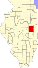
| Hrabstwo Piatt | 17147 | Monticello | 1140,45 | 0,80 | 1139,65 | 16365 | 14,4 |  |
| Hrabstwo Pike | 17149 | Pittsfield | 2198,56 | 48,10 | 2150,47 | 17384 | 8,1 |  |
| Hrabstwo Pope | 17151 | Golconda | 970,31 | 9,76 | 960,52 | 4413 | 4,6 |  |
| Hrabstwo Pulaski | 17153 | Mound City | 526,62 | 6,60 | 520,04 | 7348 | 14,1 |  |
| Hrabstwo Putnam | 17155 | Hennepin | 446,10 | 32,25 | 413,88 | 6086 | 14,7 |  |
| Hrabstwo Randolph | 17157 | Chester | 1546,90 | 48,80 | 1498,10 | 33893 | 22,6 |  |
| Hrabstwo Richland | 17159 | Olney | 937,60 | 4,84 | 932,76 | 16149 | 17,3 |  |
| Hrabstwo Rock Island | 17161 | Rock Island | 1168,50 | 63,20 | 1105,28 | 149374 | 135,1 |  |
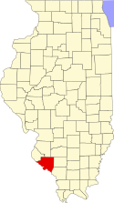
| Hrabstwo Saint Clair | 17163 | Belleville | 1745,52 | 26,29 | 1719,26 | 256082 | 149 | (c) Timneu22, CC-BY-SA-3.0 |
| Hrabstwo Saline | 17165 | Harrisburg | 1002,27 | 9,51 | 992,77 | 26733 | 26,9 |  |
| Hrabstwo Sangamon | 17167 | Springfield | 2271,45 | 22,84 | 2248,58 | 188951 | 84 |  |
| Hrabstwo Schuyler | 17169 | Rushville | 1143,19 | 10,54 | 1132,63 | 7189 | 6,3 |  |
| Hrabstwo Scott | 17171 | Winchester | 654,67 | 4,79 | 649,88 | 5537 | 8,5 |  |
| Hrabstwo Shelby | 17173 | Shelbyville | 1989,24 | 24,71 | 1964,53 | 22893 | 11,7 |  |
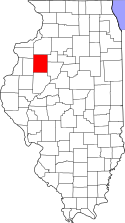
| Hrabstwo Stark | 17175 | Toulon | 746,46 | 0,73 | 745,76 | 6332 | 8,5 |  |
| Hrabstwo Stephenson | 17177 | Freeport | 1462,62 | 1,40 | 1461,22 | 48979 | 33,5 |  |
| Hrabstwo Tazewell | 17179 | Pekin | 1703,93 | 23,39 | 1680,54 | 128485 | 76,4 |  |
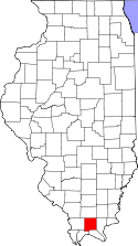
| Hrabstwo Union | 17181 | Jonesboro | 1093,31 | 15,46 | 1077,85 | 18293 | 17,0 |  |
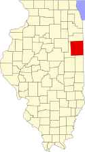
| Hrabstwo Vermilion | 17183 | Danville | 2336,53 | 7,93 | 2328,61 | 83919 | 36,0 |  |
| Hrabstwo Wabash | 17185 | Mount Carmel | 589,90 | 11,11 | 578,78 | 12937 | 22,4 |  |
| Hrabstwo Warren | 17187 | Monmouth | 1406,80 | 1,68 | 1405,12 | 18735 | 13,3 |  |
| Hrabstwo Washington | 17189 | Nashville | 1461,06 | 3,91 | 1457,15 | 15148 | 10,4 |  |
| Hrabstwo Wayne | 17191 | Fairfield | 1853,29 | 4,30 | 1848,99 | 17151 | 9,3 |  |
| Hrabstwo White | 17193 | Carmi | 1299,40 | 17,69 | 1281,71 | 15371 | 12,0 |  |
| Hrabstwo Whiteside | 17195 | Morrison | 1805,25 | 31,70 | 1773,55 | 60653 | 34,2 |  |
| Hrabstwo Will | 17197 | Joliet | 2199,91 | 32,25 | 2167,66 | 502266 | 231,7 |  |
| Hrabstwo Williamson | 17199 | Marion | 1150,94 | 54,29 | 1096,63 | 61296 | 55,9 |  |
| Hrabstwo Winnebago | 17201 | Rockford | 1344,90 | 14,35 | 1330,58 | 278418 | 209,2 |  |
| Hrabstwo Woodford | 17203 | Eureka | 1405,69 | 38,31 | 1367,38 | 35469 | 25,9 |  |
Bibliografia
Media użyte na tej stronie
Map of Illinois highlighting Tazewell County.svg
This is a locator map showing Tazewell County in Illinois. For more information, see Commons:United States county locator maps.
This is a locator map showing Tazewell County in Illinois. For more information, see Commons:United States county locator maps.
Map of Illinois highlighting Grundy County.svg
This is a locator map showing Grundy County in Illinois. For more information, see Commons:United States county locator maps.
This is a locator map showing Grundy County in Illinois. For more information, see Commons:United States county locator maps.
Map of Illinois highlighting Cumberland County.svg
This is a locator map showing Cumberland County in Illinois. For more information, see Commons:United States county locator maps.
This is a locator map showing Cumberland County in Illinois. For more information, see Commons:United States county locator maps.
Map of Illinois highlighting Wabash County.svg
This is a locator map showing Wabash County in Illinois. For more information, see Commons:United States county locator maps.
This is a locator map showing Wabash County in Illinois. For more information, see Commons:United States county locator maps.
Map of Illinois highlighting Sangamon County.svg
This is a locator map showing Sangamon County in Illinois. For more information, see Commons:United States county locator maps.
This is a locator map showing Sangamon County in Illinois. For more information, see Commons:United States county locator maps.
Map of Illinois highlighting Menard County.svg
This is a locator map showing Menard County in Illinois. For more information, see Commons:United States county locator maps.
This is a locator map showing Menard County in Illinois. For more information, see Commons:United States county locator maps.
Map of Illinois highlighting Stark County.svg
This is a locator map showing Stark County in Illinois. For more information, see Commons:United States county locator maps.
This is a locator map showing Stark County in Illinois. For more information, see Commons:United States county locator maps.
Map of Illinois highlighting Johnson County.svg
This is a locator map showing Johnson County in Illinois. For more information, see Commons:United States county locator maps.
This is a locator map showing Johnson County in Illinois. For more information, see Commons:United States county locator maps.
Map of Illinois highlighting Union County.svg
This is a locator map showing Union County in Illinois. For more information, see Commons:United States county locator maps.
This is a locator map showing Union County in Illinois. For more information, see Commons:United States county locator maps.
Map of Illinois highlighting Carroll County.svg
This is a locator map showing Carroll County in Illinois. For more information, see Commons:United States county locator maps.
This is a locator map showing Carroll County in Illinois. For more information, see Commons:United States county locator maps.
Map of Illinois highlighting Whiteside County.svg
This is a locator map showing Whiteside County in Illinois. For more information, see Commons:United States county locator maps.
This is a locator map showing Whiteside County in Illinois. For more information, see Commons:United States county locator maps.
Map of Illinois highlighting DeKalb County.svg
This is a locator map showing DeKalb County in Illinois. For more information, see Commons:United States county locator maps.
This is a locator map showing DeKalb County in Illinois. For more information, see Commons:United States county locator maps.
Map of Illinois highlighting Piatt County.svg
This is a locator map showing Piatt County in Illinois. For more information, see Commons:United States county locator maps.
This is a locator map showing Piatt County in Illinois. For more information, see Commons:United States county locator maps.
Map of Illinois highlighting Bureau County.svg
This is a locator map showing Bureau County in Illinois. For more information, see Commons:United States county locator maps.
This is a locator map showing Bureau County in Illinois. For more information, see Commons:United States county locator maps.
Map of Illinois highlighting Cass County.svg
This is a locator map showing Cass County in Illinois. For more information, see Commons:United States county locator maps.
This is a locator map showing Cass County in Illinois. For more information, see Commons:United States county locator maps.
Map of Illinois highlighting Clark County.svg
This is a locator map showing Clark County in Illinois. For more information, see Commons:United States county locator maps.
This is a locator map showing Clark County in Illinois. For more information, see Commons:United States county locator maps.
Map of Illinois highlighting Henry County.svg
This is a locator map showing Henry County in Illinois. For more information, see Commons:United States county locator maps.
This is a locator map showing Henry County in Illinois. For more information, see Commons:United States county locator maps.
Map of Illinois highlighting Macon County.svg
This is a locator map showing Macon County in Illinois. For more information, see Commons:United States county locator maps.
This is a locator map showing Macon County in Illinois. For more information, see Commons:United States county locator maps.
Map of Illinois highlighting Monroe County.svg
This is a locator map showing Monroe County in Illinois. For more information, see Commons:United States county locator maps.
This is a locator map showing Monroe County in Illinois. For more information, see Commons:United States county locator maps.
Map of Illinois highlighting Christian County.svg
This is a locator map showing Christian County in Illinois. For more information, see Commons:United States county locator maps.
This is a locator map showing Christian County in Illinois. For more information, see Commons:United States county locator maps.
Map of Illinois highlighting Massac County.svg
This is a locator map showing Massac County in Illinois. For more information, see Commons:United States county locator maps.
This is a locator map showing Massac County in Illinois. For more information, see Commons:United States county locator maps.
Map of Illinois highlighting Cook County.svg
This is a locator map showing Cook County in Illinois. For more information, see Commons:United States county locator maps.
This is a locator map showing Cook County in Illinois. For more information, see Commons:United States county locator maps.
Map of Illinois highlighting Shelby County.svg
This is a locator map showing Shelby County in Illinois. For more information, see Commons:United States county locator maps.
This is a locator map showing Shelby County in Illinois. For more information, see Commons:United States county locator maps.
Map of Illinois highlighting Gallatin County.svg
This is a locator map showing Gallatin County in Illinois. For more information, see Commons:United States county locator maps.
This is a locator map showing Gallatin County in Illinois. For more information, see Commons:United States county locator maps.
Map of Illinois highlighting Stephenson County.svg
This is a locator map showing Stephenson County in Illinois. For more information, see Commons:United States county locator maps.
This is a locator map showing Stephenson County in Illinois. For more information, see Commons:United States county locator maps.
Map of Illinois highlighting Crawford County.svg
This is a locator map showing Crawford County in Illinois. For more information, see Commons:United States county locator maps.
This is a locator map showing Crawford County in Illinois. For more information, see Commons:United States county locator maps.
Map of Illinois highlighting Pope County.svg
This is a locator map showing Pope County in Illinois. For more information, see Commons:United States county locator maps.
This is a locator map showing Pope County in Illinois. For more information, see Commons:United States county locator maps.
Map of Illinois highlighting Marshall County.svg
This is a locator map showing Marshall County in Illinois. For more information, see Commons:United States county locator maps.
This is a locator map showing Marshall County in Illinois. For more information, see Commons:United States county locator maps.
Map of Illinois highlighting Iroquois County.svg
This is a locator map showing Iroquois County in Illinois. For more information, see Commons:United States county locator maps.
This is a locator map showing Iroquois County in Illinois. For more information, see Commons:United States county locator maps.
Map of Illinois highlighting Ogle County.svg
This is a locator map showing Ogle County in Illinois. For more information, see Commons:United States county locator maps.
This is a locator map showing Ogle County in Illinois. For more information, see Commons:United States county locator maps.
Map of Illinois highlighting DeWitt County.svg
This is a locator map showing DeWitt County in Illinois. For more information, see Commons:United States county locator maps.
This is a locator map showing DeWitt County in Illinois. For more information, see Commons:United States county locator maps.
Map of Illinois highlighting Williamson County.svg
This is a locator map showing Williamson County in Illinois. For more information, see Commons:United States county locator maps.
This is a locator map showing Williamson County in Illinois. For more information, see Commons:United States county locator maps.
Map of Illinois highlighting McLean County.svg
This is a locator map showing McLean County in Illinois. For more information, see Commons:United States county locator maps.
This is a locator map showing McLean County in Illinois. For more information, see Commons:United States county locator maps.
Map of Illinois highlighting Washington County.svg
This is a locator map showing Washington County in Illinois. For more information, see Commons:United States county locator maps.
This is a locator map showing Washington County in Illinois. For more information, see Commons:United States county locator maps.
Map of Illinois highlighting Marion County.svg
This is a locator map showing Marion County in Illinois. For more information, see Commons:United States county locator maps.
This is a locator map showing Marion County in Illinois. For more information, see Commons:United States county locator maps.
Map of Illinois highlighting Kane County.svg
This is a locator map showing Kane County in Illinois. For more information, see Commons:United States county locator maps.
This is a locator map showing Kane County in Illinois. For more information, see Commons:United States county locator maps.
Map of Illinois highlighting Richland County.svg
This is a locator map showing Richland County in Illinois. For more information, see Commons:United States county locator maps.
This is a locator map showing Richland County in Illinois. For more information, see Commons:United States county locator maps.
Map of Illinois highlighting Logan County.svg
This is a locator map showing Logan County in Illinois. For more information, see Commons:United States county locator maps.
This is a locator map showing Logan County in Illinois. For more information, see Commons:United States county locator maps.
Map of Illinois highlighting Will County.svg
This is a locator map showing Will County in Illinois. For more information, see Commons:United States county locator maps.
This is a locator map showing Will County in Illinois. For more information, see Commons:United States county locator maps.
Map of Illinois highlighting Franklin County.svg
This is a locator map showing Franklin County in Illinois. For more information, see Commons:United States county locator maps.
This is a locator map showing Franklin County in Illinois. For more information, see Commons:United States county locator maps.
Map of Illinois highlighting White County.svg
This is a locator map showing White County in Illinois. For more information, see Commons:United States county locator maps.
This is a locator map showing White County in Illinois. For more information, see Commons:United States county locator maps.
Map of Illinois highlighting McHenry County.svg
This is a locator map showing McHenry County in Illinois. For more information, see Commons:United States county locator maps.
This is a locator map showing McHenry County in Illinois. For more information, see Commons:United States county locator maps.
Map of Illinois highlighting Lake County.svg
This is a locator map showing Lake County in Illinois. For more information, see Commons:United States county locator maps.
This is a locator map showing Lake County in Illinois. For more information, see Commons:United States county locator maps.
Map of Illinois highlighting Greene County.svg
This is a locator map showing Greene County in Illinois. For more information, see Commons:United States county locator maps.
This is a locator map showing Greene County in Illinois. For more information, see Commons:United States county locator maps.
Map of Illinois highlighting Schuyler County.svg
This is a locator map showing Schuyler County in Illinois. For more information, see Commons:United States county locator maps.
This is a locator map showing Schuyler County in Illinois. For more information, see Commons:United States county locator maps.
Map of Illinois highlighting Jefferson County.svg
This is a locator map showing Jefferson County in Illinois. For more information, see Commons:United States county locator maps.
This is a locator map showing Jefferson County in Illinois. For more information, see Commons:United States county locator maps.
Map of Illinois highlighting Kendall County.svg
This is a locator map showing Kendall County in Illinois. For more information, see Commons:United States county locator maps.
This is a locator map showing Kendall County in Illinois. For more information, see Commons:United States county locator maps.
Map of Illinois highlighting Henderson County.svg
This is a locator map showing Henderson County in Illinois. For more information, see Commons:United States county locator maps.
This is a locator map showing Henderson County in Illinois. For more information, see Commons:United States county locator maps.
Map of Illinois highlighting McDonough County.svg
This is a locator map showing McDonough County in Illinois. For more information, see Commons:United States county locator maps.
This is a locator map showing McDonough County in Illinois. For more information, see Commons:United States county locator maps.
Map of Illinois highlighting Hardin County.svg
This is a locator map showing Hardin County in Illinois. For more information, see Commons:United States county locator maps.
This is a locator map showing Hardin County in Illinois. For more information, see Commons:United States county locator maps.
Map of Illinois highlighting Alexander County.svg
This is a locator map showing Alexander County in Illinois. For more information, see Commons:United States county locator maps.
This is a locator map showing Alexander County in Illinois. For more information, see Commons:United States county locator maps.
Map of Illinois highlighting Perry County.svg
This is a locator map showing Perry County in Illinois. For more information, see Commons:United States county locator maps.
This is a locator map showing Perry County in Illinois. For more information, see Commons:United States county locator maps.
Map of Illinois highlighting Knox County.svg
This is a locator map showing Knox County in Illinois. For more information, see Commons:United States county locator maps.
This is a locator map showing Knox County in Illinois. For more information, see Commons:United States county locator maps.
Map of Illinois highlighting Madison County.svg
This is a locator map showing Madison County in Illinois. For more information, see Commons:United States county locator maps.
This is a locator map showing Madison County in Illinois. For more information, see Commons:United States county locator maps.
Map of Illinois highlighting DuPage County.svg
This is a locator map showing DuPage County in Illinois. For more information, see Commons:United States county locator maps.
This is a locator map showing DuPage County in Illinois. For more information, see Commons:United States county locator maps.
Map of Illinois highlighting Wayne County.svg
This is a locator map showing Wayne County in Illinois. For more information, see Commons:United States county locator maps.
This is a locator map showing Wayne County in Illinois. For more information, see Commons:United States county locator maps.
Map of Illinois highlighting Woodford County.svg
This is a locator map showing Woodford County in Illinois. For more information, see Commons:United States county locator maps.
This is a locator map showing Woodford County in Illinois. For more information, see Commons:United States county locator maps.
Map of Illinois highlighting Clay County.svg
This is a locator map showing Clay County in Illinois. For more information, see Commons:United States county locator maps.
This is a locator map showing Clay County in Illinois. For more information, see Commons:United States county locator maps.
Map of Illinois highlighting Ford County.svg
This is a locator map showing Ford County in Illinois. For more information, see Commons:United States county locator maps.
This is a locator map showing Ford County in Illinois. For more information, see Commons:United States county locator maps.
Map of Illinois highlighting Winnebago County.svg
This is a locator map showing Winnebago County in Illinois. For more information, see Commons:United States county locator maps.
This is a locator map showing Winnebago County in Illinois. For more information, see Commons:United States county locator maps.
Map of Illinois highlighting Randolph County.svg
This is a locator map showing Randolph County in Illinois. For more information, see Commons:United States county locator maps.
This is a locator map showing Randolph County in Illinois. For more information, see Commons:United States county locator maps.
Map of Illinois highlighting Montgomery County.svg
This is a locator map showing Montgomery County in Illinois. For more information, see Commons:United States county locator maps.
This is a locator map showing Montgomery County in Illinois. For more information, see Commons:United States county locator maps.
Map of Illinois highlighting Jersey County.svg
This is a locator map showing Jersey County in Illinois. For more information, see Commons:United States county locator maps.
This is a locator map showing Jersey County in Illinois. For more information, see Commons:United States county locator maps.
Map of Illinois highlighting Morgan County.svg
This is a locator map showing Morgan County in Illinois. For more information, see Commons:United States county locator maps.
This is a locator map showing Morgan County in Illinois. For more information, see Commons:United States county locator maps.
Map of Illinois highlighting Mason County.svg
This is a locator map showing Mason County in Illinois. For more information, see Commons:United States county locator maps.
This is a locator map showing Mason County in Illinois. For more information, see Commons:United States county locator maps.
Map of Illinois highlighting Kankakee County.svg
This is a locator map showing Kankakee County in Illinois. For more information, see Commons:United States county locator maps.
This is a locator map showing Kankakee County in Illinois. For more information, see Commons:United States county locator maps.
Map of Illinois highlighting Adams County.svg
This is a locator map showing Adams County in Illinois. For more information, see Commons:United States county locator maps.
This is a locator map showing Adams County in Illinois. For more information, see Commons:United States county locator maps.
Map of Illinois highlighting Clinton County.svg
This is a locator map showing Clinton County in Illinois. For more information, see Commons:United States county locator maps.
This is a locator map showing Clinton County in Illinois. For more information, see Commons:United States county locator maps.
Map of Illinois highlighting Jo Daviess County.svg
This is a locator map showing Jo Daviess County in Illinois. For more information, see Commons:United States county locator maps.
This is a locator map showing Jo Daviess County in Illinois. For more information, see Commons:United States county locator maps.
Map of Illinois highlighting Macoupin County.svg
This is a locator map showing Macoupin County in Illinois. For more information, see Commons:United States county locator maps.
This is a locator map showing Macoupin County in Illinois. For more information, see Commons:United States county locator maps.
Map of Illinois highlighting Lawrence County.svg
This is a locator map showing Lawrence County in Illinois.
This is a locator map showing Lawrence County in Illinois.
Map of Illinois highlighting Brown County.svg
This is a locator map showing Brown County in Illinois. For more information, see Commons:United States county locator maps.
This is a locator map showing Brown County in Illinois. For more information, see Commons:United States county locator maps.
Map of Illinois highlighting Effingham County.svg
This is a locator map showing Effingham County in Illinois. For more information, see Commons:United States county locator maps.
This is a locator map showing Effingham County in Illinois. For more information, see Commons:United States county locator maps.
Map of Illinois highlighting Pike County.svg
This is a locator map showing Pike County in Illinois. For more information, see Commons:United States county locator maps.
This is a locator map showing Pike County in Illinois. For more information, see Commons:United States county locator maps.
Map of Illinois highlighting Rock Island County.svg
This is a locator map showing Rock Island County in Illinois. For more information, see Commons:United States county locator maps.
This is a locator map showing Rock Island County in Illinois. For more information, see Commons:United States county locator maps.
Map of Illinois highlighting Jackson County.svg
This is a locator map showing Jackson County in Illinois. For more information, see Commons:United States county locator maps.
This is a locator map showing Jackson County in Illinois. For more information, see Commons:United States county locator maps.
Map of Illinois highlighting Edgar County.svg
This is a locator map showing Edgar County in Illinois. For more information, see Commons:United States county locator maps.
This is a locator map showing Edgar County in Illinois. For more information, see Commons:United States county locator maps.
Map of Illinois highlighting Lee County.svg
This is a locator map showing Lee County in Illinois. For more information, see Commons:United States county locator maps.
This is a locator map showing Lee County in Illinois. For more information, see Commons:United States county locator maps.
Map of Illinois highlighting Fayette County.svg
This is a locator map showing Fayette County in Illinois. For more information, see Commons:United States county locator maps.
This is a locator map showing Fayette County in Illinois. For more information, see Commons:United States county locator maps.
Map of Illinois highlighting Jasper County.svg
This is a locator map showing Jasper County in Illinois. For more information, see Commons:United States county locator maps.
This is a locator map showing Jasper County in Illinois. For more information, see Commons:United States county locator maps.
Map of Illinois highlighting Warren County.svg
This is a locator map showing Warren County in Illinois. For more information, see Commons:United States county locator maps.
This is a locator map showing Warren County in Illinois. For more information, see Commons:United States county locator maps.
Map of Illinois highlighting Livingston County.svg
This is a locator map showing Livingston County in Illinois. For more information, see Commons:United States county locator maps.
This is a locator map showing Livingston County in Illinois. For more information, see Commons:United States county locator maps.
Map of Illinois highlighting Pulaski County.svg
This is a locator map showing Pulaski County in Illinois. For more information, see Commons:United States county locator maps.
This is a locator map showing Pulaski County in Illinois. For more information, see Commons:United States county locator maps.
Map of Illinois highlighting Saline County.svg
This is a locator map showing Saline County in Illinois. For more information, see Commons:United States county locator maps.
This is a locator map showing Saline County in Illinois. For more information, see Commons:United States county locator maps.
Map of Illinois highlighting Moultrie County.svg
This is a locator map showing Moultrie County in Illinois. For more information, see Commons:United States county locator maps.
This is a locator map showing Moultrie County in Illinois. For more information, see Commons:United States county locator maps.
Map of Illinois highlighting Scott County.svg
This is a locator map showing Scott County in Illinois. For more information, see Commons:United States county locator maps.
This is a locator map showing Scott County in Illinois. For more information, see Commons:United States county locator maps.
Map of Illinois highlighting Vermilion County.svg
This is a locator map showing Vermilion County in Illinois. For more information, see Commons:United States county locator maps.
This is a locator map showing Vermilion County in Illinois. For more information, see Commons:United States county locator maps.
Map of Illinois highlighting Mercer County.svg
This is a locator map showing Mercer County in Illinois. For more information, see Commons:United States county locator maps.
This is a locator map showing Mercer County in Illinois. For more information, see Commons:United States county locator maps.
Map of Illinois highlighting Calhoun County.svg
This is a locator map showing Calhoun County in Illinois. For more information, see Commons:United States county locator maps.
This is a locator map showing Calhoun County in Illinois. For more information, see Commons:United States county locator maps.
Map of Illinois highlighting Boone County.svg
This is a locator map showing Boone County in Illinois. For more information, see Commons:United States county locator maps.
This is a locator map showing Boone County in Illinois. For more information, see Commons:United States county locator maps.
Map of Illinois highlighting Coles County.svg
This is a locator map showing Coles County in Illinois. For more information, see Commons:United States county locator maps.
This is a locator map showing Coles County in Illinois. For more information, see Commons:United States county locator maps.
Map of Illinois highlighting Peoria County.svg
This is a locator map showing Peoria County in Illinois. For more information, see Commons:United States county locator maps.
This is a locator map showing Peoria County in Illinois. For more information, see Commons:United States county locator maps.
Map of Illinois highlighting Champaign County.svg
This is a locator map showing Champaign County in Illinois. For more information, see Commons:United States county locator maps.
This is a locator map showing Champaign County in Illinois. For more information, see Commons:United States county locator maps.
Map of Illinois highlighting Bond County.svg
This is a locator map showing Bond County in Illinois. For more information, see Commons:United States county locator maps.
This is a locator map showing Bond County in Illinois. For more information, see Commons:United States county locator maps.
Map of Illinois highlighting Hamilton County.svg
This is a locator map showing Hamilton County in Illinois. For more information, see Commons:United States county locator maps.
This is a locator map showing Hamilton County in Illinois. For more information, see Commons:United States county locator maps.
Map of Illinois highlighting Hancock County.svg
This is a locator map showing Hancock County in Illinois. For more information, see Commons:United States county locator maps.
This is a locator map showing Hancock County in Illinois. For more information, see Commons:United States county locator maps.
Map of Illinois highlighting Douglas County.svg
This is a locator map showing Douglas County in Illinois. For more information, see Commons:United States county locator maps.
This is a locator map showing Douglas County in Illinois. For more information, see Commons:United States county locator maps.
Map of Illinois highlighting Edwards County.svg
This is a locator map showing Edwards County in Illinois. For more information, see Commons:United States county locator maps.
This is a locator map showing Edwards County in Illinois. For more information, see Commons:United States county locator maps.
Map of Illinois highlighting Fulton County.svg
This is a locator map showing Fulton County in Illinois. For more information, see Commons:United States county locator maps.
This is a locator map showing Fulton County in Illinois. For more information, see Commons:United States county locator maps.
Map of Illinois highlighting Putnam County.svg
This is a locator map showing Putnam County in Illinois. For more information, see Commons:United States county locator maps.
This is a locator map showing Putnam County in Illinois. For more information, see Commons:United States county locator maps.


