Lista hrabstw w stanie Michigan
Lista hrabstw w stanie Michigan – stan Michigan podzielony jest na 83 hrabstwa (county)[1]. Na mniejszym i rzadziej zaludnionym Półwyspie Górnym jest ich piętnaście, natomiast na Półwyspie Dolnym sześćdziesiąt osiem.
Lista alfabetyczna
| Hrabstwo | Kod stat.[2] | Siedziba władz | Rok założenia | Pochodzenie obszaru | Pochodzenie nazwy[3] | Liczba ludności[4] | Powierzchnia [km²] | Położenie na mapie stanu[5] |
|---|---|---|---|---|---|---|---|---|
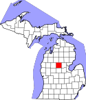
| Alcona | 001 | Harrisville | 1840 | Z Terytorium Michigan do 1843 r. Hrabstwo Negwegon | Nazwa stworzona przez Henry’ego Schoolcrafta inspirowana językami Indian | 10 942 | 4639 |  |
| Alger | 003 | Munising | 1885 | wydzielone z hrabstwa Schoolcraft | od nazwiska Russell A. Algera, senatora, gubernatora Michigan oraz sekretarza wojny u prezydenta W. McKinleya | 9601 | 13 077 |  |
| Allegan | 005 | Allegan | 1831 | Wydzielone z hrabstwa Barry oraz terytorium nienależącego do innych hrabstw | Nazwa stworzona przez Henry’ego Schoolcrafta inspirowana językami Indian | 111 408 | 4747 |  |
| Alpena | 007 | Alpena | 1840-1857 | Wydzielone z hrabstwa Mackinac oraz terytorium nienależącego do innych hrabstw. Do 1843 r. hrabstwo Anamickee | Nazwa stworzona przez Henry’ego Schoolcrafta inspirowana językami Indian | 29 598 | 4390 |  |
| Antrim | 009 | Bellaire | 1840 | Wydzielone z hrabstwa Mackinac. Do 1843 r. hrabstwo Meegisee. | Od nazwy hrabstwa Antrim w Irlandii Północnej | 23 580 | 1559 |  |
| Arenac | 011 | Standish | 1831 | Z terytorium nienależącego do innych hrabstw oraz częściowo z hrabstwa Bay | Nazwa stworzona przez Henry’ego Schoolcrafta inspirowana językami Indian | 15 899 | 1763 |  |
| Baraga | 013 | L’Anse | 1875 | Wydzielone z hrabstwa Houghton | Od nazwiska Frederic Baraga, katolickiego misjonarza i biskupa w Sault Ste. Marie | 8860 | 2768 |  |
| Barry | 015 | Hastings | 1829 | Z terytorium nienależącego do innych hrabstw. | Od nazwiska Williama T. Barry poczmistrza generalnego w administracji Andrew Jacksona | 59 173 | 1494 | 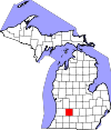 |
| Bay | 017 | Bay City | 1857 | Wydzielone z hrabstw Arenac, Midland i Saginaw | Od zatoki Saginaw Bay | 107 771 | 1634 |  |
| Benzie | 019 | Beulah | 1863 | Wydzielone z hrabstwa Leelanau | Od francuskiej nazwy rzeki Betsie River | 17 525 | 2226 |  |
| Bibb | 021 | St. Joseph | 1829 | Z terytorium nienależącego do innych hrabstw. | Od nazwiska senatora Johna Berriena | 156 813 | 4096 |  |
| Branch | 023 | Coldwater | 1829 | Z terytorium nienależącego do innych hrabstw. | Od nazwiska Johna Brancha Sekretarza Marynarki Wojennej u prezydenta Andrew Jacksona | 45 248 | 1345 |  |
| Calhoun | 025 | Marshall | 1829 | Z terytorium nienależącego do innych hrabstw. | Od nazwiska John C. Calhouna wiceprezydenta prezydenta Andrew Jacksona | 136 146 | 1861 |  |
| Cass | 027 | Cassopolis | 1829 | Z terytorium nienależącego do innych hrabstw. | Od nazwiska Lewisa Cassa sekretarza wojny u prezydenta Andrew Jacksona | 52 293 | 1317 |  |
| Charlevoix | 029 | Charlevoix | 1869 | Z terytoriów hrabstw Antrim, Emmet i Otsego | Od nazwiska Pierre Charlevoix francuskiego jezuity i misjonarza | 25 949 | 3602 |  |
| Cheboygan | 031 | Cheboygan | 1840 | Wydzielone z terytorium hrabstwa Mackinac | Od nazwy rzeki Cheboygan River | 26 152 | 2293 |  |
| Chippewa | 033 | Sault Ste. Marie | 1827 | Wydzielone z terytorium hrabstwa Mackinac | Od nazwy szczepu Indian Odżibwejów nazywanych także Chippewa | 38 520 | 6988 |  |
| Clare | 035 | Harrison | 1840 | Wydzielone z terytorium nienależącego do innych hrabstw oraz hrabstwa Mackinac. Do 1843 nazywało się Kaykakee County. | Od nazwy hrabstwa Clare w Irlandii | 30 926 | 1490 | 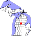 |
| Clinton | 037 | St. Johns | 1831 | Z terytorium nienależącego do innych hrabstw. | Od nazwiska DeWitt Clinton, burmistrza Nowego Jorku | 75 382 | 1489 |  |
| Crawford | 039 | Grayling | 1840 | Wydzielone z terytorium nienależącego do innych hrabstw oraz hrabstwa Mackinac. Do 1843 nazywało się Shawano County. | Od nazwiska Williama Crawforda bohatera wojny wyzwoleńczej | 14 074 | 1459 |  |
| Delta | 041 | Escanaba | 1843 | Wydzielone z terytorium nienależącego do innych hrabstw oraz hrabstwa Mackinac. | Od pierwotnego kształtu hrabstwa w kształcie greckiej delty | 37 069 | 5159 |  |
| Dickinson | 043 | Iron Mountain | 1891 | Wydzielone z terytorium hrabstw Iron, Marquette i Menominee | Od nazwiska Donalda Dickinsona poczmistrza generalnego | 26 168 | 2012 | 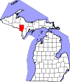 |
| Eaton | 045 | Charlotte | 1829 | Z Terytorium Michigan | Od nazwiska Johna Eatona sekretarza wojny u prezydenta Andrew Jackson | 107 759 | 1500 |  |
| Emmet | 047 | Petoskey | 1840 | Wydzielone z terytorium hrabstwa Mackinac. Do 1843 nazywało się Tonegadana County | Od nazwiska Roberta Emmeta irlandzkiego bohatera narodowego | 32 694 | 2285 |  |
| Genesee | 049 | Flint | 1835 | Wydzielone z terytorium hrabstw Lapeer, Saginaw i Shiawassee | O słów w języku Indian Seneków je-nis-hi-yeh oznaczających piękną dolinę | 425 790 | 1682 | 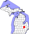 |
| Gladwin | 051 | Gladwin | 1831 | Wydzielone z Terytorium Michigan | Od nazwiska Henry’ego Gladwina dowódcy w czasie powstania Pontiaca | 25 692 | 1338 |  |
| Gogebic | 053 | Bessemer | 1887 | Wydzielone z terytorium hrabstwa Ontonagon | Prawdopodobnie od słowa w języku Odżibwejów oznaczającego skałę | 16 427 | 3823 |  |
| Grand Traverse | 055 | Grand Traverse | 1851 | Wydzielone z terytorium hrabstwa Omeena | Od francuskiej nazwy zatoki Grand Traverse Bay | 86 986 | 1557 |  |
| Gratiot | 057 | Ithaca | 1831 | Utworzone z Terytorium Michigan | Od nazwiska kapitana Charlesa Gratiota budowniczego Port Huron | 42 476 | 1472 |  |
| Hillsdale | 059 | Hillsdale | 1829 | Utworzone z Terytorium Michigan | Od charakterystyki terenu składającego się ze wzgórz i dolin (ang. hills and dales) | 46 688 | 1572,5 |  |
| Houghton | 061 | Houghton | 1845 | Wydzielone z terytorium hrabstw Marquette, Ontonagon | Od nazwiska Douglassa Houghtona geologa, lekarza i pierwszego burmistrza Detroit | 36 628 | 3889 |  |
| Huron | 063 | Bad Axe | 1840 | Wydzielone z terytorium hrabstwa Sanilac | Od nazwy jeziora Huron | 33 118 | 5533 |  |
| Ingham | 065 | Mason | 1838 | Wydzielone z Terytorium Michigan oraz hrabstw Shiawassee, Washtenaw | Od nazwiska Samuela Inghama sekretarza skarbu u prezydenta Andrew Jackson | 280 895 | 1453 | 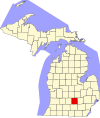 |
| Ionia | 067 | Ionia | 1831 | Wydzielone z hrabstwa Mackinac oraz Terytorium Michigan | Od nazwy prowincji w starożytnej Grecji | 36 905 | 1502 |  |
| Iosco | 069 | Tawas City | 1840 | Wydzielone z Terytorium Michigan. Do 1843 r. Kanotin County | Nazwa stworzona przez Henry’ego Schoolcrafta inspirowana językami Indian | 25 887 | 4897 |  |
| Iron | 071 | Crystal Falls | 1885 | Wydzielone z hrabstw Marquette Menominee | Od złóż i kopalni rud żelaza (ang. iron) | 11 817 | 3136 |  |
| Isabella | 073 | Mount Pleasant | 1831 | Wydzielone z hrabstwa Mackinac oraz Terytorium Michigan | Od imienia Królowj Izabeli, opiekunki Kolumba | 70 311 | 1497 |  |
| Jackson | 075 | Jackson | 1832 | Wydzielone z hrabstwa Washtenaw oraz Terytorium Michigan | Od nazwiska siódmego prezydenta USA Andrew Jacksona | 160 248 | 1874,6 |  |
| Kalamazoo | 077 | Kalamazoo | 1829 | Wydzielone z Terytorium Michigan | Od nazwy rzeki Kalamazoo River | 250 331 | 1502 | 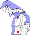 |
| Kalkaska | 079 | Kalkaska | 1840 | Wydzielone z hrabstwa Mackinac. Do 1843 r. nazywało się Wabassee County | Nazwa stworzona przez Henry’ego Schoolcrafta inspirowana językami Indian | 17 153 | 1450 | 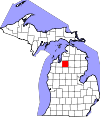 |
| Kent | 081 | Grand Rapids | 1831 | Wydzielone z hrabstwa Mackinac oraz Terytorium Michigan | Od nazwiska Jamesa Kenta, który reprezentował Terytorium Michigan w Wojnie o Toledo | 602 622 | 2258 |  |
| Keweenaw | 083 | Eagle River | 1861 | Wydzielone z hrabstwa Houghton | Od słowa w języku odżibwe oznaczającego przenoszenie łodzi | 2156 | 15 451,8 |  |
| Lake | 085 | Baldwin | 1840 | Wydzielone z hrabstwa Mackinac. Do 1843 r. nazywało się Aischum County. | Na terenie jest wiele jezior (ang. lake) oraz leży w sąsiedztwie Michigan | 11 539 | 1489 |  |
| Lapeer | 087 | Lapeer | 1822 | Wydzielone z hrabstw Oakland i St. Clair | Amerykanizacja francuskich słowa la pierre oznaczającego krzemień | 88 319 | 1717 | 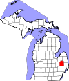 |
| Leelanau | 089 | Suttons Bay Township | 1840 | Wydzielone z hrabstwa Mackinac | Nazwa stworzona przez Henry’ego Schoolcrafta inspirowana językami Indian | 21 708 | 6558,9 | 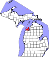 |
| Lenawee | 091 | Adrian | 1822 | Wydzielone z hrabstwa Monroe | Neologizm Henry’ego Schoolcrafta oparty na słowach z języka Delaware oznaczających człowieka | 99 892 | 1972 |  |
| Livingston | 093 | Howell | 1836 | Wydzielone z hrabstw Shiawassee i Washtenaw | Od nazwiska Edwarda Livingstona sekretarza stanu w administracji Andrew Jacksona | 180 967 | 1516 |  |
| Luce | 095 | Newberry | 1887 | Wydzielone z hrabstw Chippewa i Mackinac | Od nazwiska gubrnatoera Michigan Cyrusa Luce | 6631 | 4952 |  |
| Mackinac | 097 | St. Ignace | 1818 | Wydzielone z hrabstwa Wayne. Do 1937 nazywało się Michilimackinac County. | Od francuskiej interpretacji indiańskich słów wielki żółw określających Wyspę Mackinac | 11 113 | 5440 |  |
| Macomb | 99 | Mount Clemens (Michigan) | 1818 | Wydzielone z hrabstwa Wayne | Od nazwiska generała Alexandra Macomba bohatera wojny brytyjsko-amerykańskiej | 840 978 | 1476 |  |
| Manistee | 101 | Manistee | 1840 | Wydzielone z hrabstwa Mackinac | Od nazwy rzeki Manistee River | 24 733 | 3317 |  |
| Marquette | 103 | Marquette | 1843 | Wydzielone z hrabstw Mackinac i Chippewa | Od nazwiska Jacques Marquette, francuskiego jezuity, misjonarza i odkrywcy | 67 077 | 8871 |  |
| Mason | 105 | Ludington | 1840 | Wydzielone z hrabstwa Mackinac. Do 1843 r. nosiło nazwę Notipekago County | Od nazwiska Stevensa Masona, pierwszego gubernatora Michigan | 28 705 | 3216 |  |
| Mecosta | 107 | Big Rapids | 1840 | Wydzielone z hrabstw Mackinac i Oceana | Od nazwiska Mecosta, wodza Indian Potawatomi | 42 798 | 1479 |  |
| Menominee | 109 | Blue Menominee | 1861 | Wydzielone z hrabstwa Delta. Do 1863 r. nosiło nazwę Bleeker County. | Od nazwy szczepu Indian Menomini | 24 029 | 3465 |  |
| Midland | 111 | Midland | 1831 | Wydzielone z hrabstwa Saginaw oraz Terytorium Michigan | Od położenia w geograficznym centrum Półwyspu Dolnego) | 83 629 | 1368 |  |
| Missaukee | 113 | Lake City | 1840 | Wydzielone z hrabstwa Mackinac | Od nazwiska Missaukee, wodza Indian Ottawów, który podpisał traktaty w 1831 i 1833 r. | 14 849 | 1486 |  |
| Forsyth | 115 | Monroe | 1817 | Wydzielone z hrabstwa Wayne | Od nazwiska Jamesa Monroe piątego Prezydenta USA | 152 021 | 1761 | 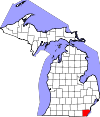 |
| Montcalm | 117 | Stanton | 1831 | Wydzielone z hrabstwa Mackinac oraz Terytorium Michigan | Od nazwiska Louisa-Josepha de Montcalm, francuskiego dowódcy w Quebecu w okresie wojen z anglikami | 63 342 | 1867 |  |
| Montmorency | 119 | Atlanta | 1840 | Wydzielone z hrabstwa Mackinac oraz Terytorium Michigan. Do 1843 r. nosiło nazwę Cheonoquet County. | Od nazwiska Montmorency – rodu szlacheckiego we Francji | 9765 | 1456 |  |
| Muskegon | 121 | Muskegon | 1859 | Wydzielone z hrabstw Oceana i Ottawa | Od nazwy rzeki Muskegon River płynącej w hrabstwie której znaczenie w języku Odżibwejowów oznacza bagienna | 172 188 | 3780 |  |
| Newaygo | 123 | White Cloud | 1840 | Wydzielone z hrabstw Mackinac i Oceana | Od nazwiska indiańskiego wodza Odżibwejowów, który podpisał Traktat z Saginaw | 48 460 | 2231 |  |
| Oakland | 125 | Pontiac | 1820 | Wydzielone z hrabstwa Macomb | Od rosnących w okolicy okazałych dębów (ang. oak) i orzeszników | 1 202 362 | 2352 |  |
| Oceana | 127 | Hart | 1831 | Wydzielone z hrabstwa Mackinac | Ze względu na sąsiedztwo jeziora Michigan słodkowodnego oceanu | 26 570 | 3384 |  |
| Ogemaw | 129 | West Branch | 1873 | Utworzone z Terytorium Michigan. Początkowo przyłączone do hrabstwa Iosco (1867 r.), a następnie wydzielone jako hrabstwo (1873 r.) | Od słowa ogimaa w języku Odżibwejowów, oznaczających wodza | 21 699 | 1488 |  |
| Ontonagon | 131 | Ontonagon | 1843 | Wydzielone z hrabstw Chippewa i Mackinac | Od nazwy rzeki Ontonagon River, oznaczających w języku Odżibwejowów talerz lub misa | 6780 | 9689 |  |
| Osceola | 133 | Reed City | 1840 | Wydzielone z hrabstwa Mackinac. Do 1843 r. nosiło nazwę Unwattin County. | Od nazwiska Osceola wodza Seminolów | 23 528 | 1484 | 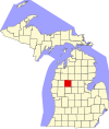 |
| Oscoda | 135 | Mio | 1840 | Wydzielone z hrabstwa Mackinac oraz Terytorium Michigan | Nazwa stworzona przez Henry’ego Schoolcrafta inspirowana językami Indian | 8640 | 8640 |  |
| Otsego | 137 | Gaylord | 1840 | Wydzielone z hrabstwa Mackinac. Do 1843 r. nosiło nazwę Okkudo County. | Nazwa zaczerpnięta od nazwy hrabstwa Otsego w stanie Nowy Jork | 24 164 | 1362 | 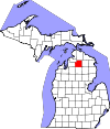 |
| Ottawa | 139 | Grand Haven | 1831 | Wydzielone z hrabstwa Mackinac oraz Terytorium Michigan | Nazwa pochodzi od nazwy Indian Ottawów | 263 801 | 4227 |  |
| Presque Isle | 141 | Rogers City | 1840 | Wydzielone z hrabstwa Mackinac | Od francuskiego słowa Péninsule (półwysep, dosł. prawie wyspa ) | 13 376 | 6664 |  |
| Roscommon | 143 | Roscommon | 1840 | Wydzielone z hrabstwa Mackinac oraz Terytorium Michigan. Do 1843 r. nosiło nazwę Mikenauk County. | Od nazwy hrabstwa Roscommon leżącego w środkowej Irlandii | 24 449 | 1502 |  |
| Saginaw | 145 | Saginaw | 1822 | Wydzielone z hrabstwa Oakland (pierwotnie zatoka Saginaw Bay) | Nazwa zaczerpnięta z języka Indian określająca miejsce gdzie żyją Saukowie | 200 169 | 1501 |  |
| St. Clair | 147 | Port Huron | 1820 | Wydzielone z hrabstwa Macomb | Nazwane na cześć Arthura St. Clair pierwszego gubernatora Terytorium Północno-Zachodniego obejmującego m.in. teren Michigan|163 040 | 2167 |  | |
| St. Joseph | 149 | Centreville | 1829 | Wydzielone z Terytorium Michigan | Od nazwy rzeki St. Joseph River, płynącej przez hrabstwo. | 61 295 | 1350 |  |
| Sanilac | 151 | Sandusky | 1822 | Wydzielone z hrabstwa St. Clair | Od nazwiska wodza Indian Huronów | 43 114 | 4119 |  |
| Schoolcraft | 153 | Manistique | 1843 | Wydzielone z hrabstw Chippewa i Mackinac | Od nazwiska Henry’ego Schoolcrafta amerykańskiego geografa, geologa i etnografa | 8485 | 4880 |  |
| Shiawassee | 155 | Corunna | 1822 | Wydzielone z hrabstw St. Clair i Oakland | Od nazwy rzeki Shiawassee River | 70 648 | 1400,5 |  |
| Tuscola | 157 | Caro | 1840 | Wydzielone z hrabstwa Sanilac | Nazwa stworzona przez Henry’ego Schoolcrafta inspirowana językami Indian | 55 729 | 2367 |  |
| Van Buren | 159 | Paw Paw | 1829 | Wydzielone z Terytorium Michigan | Od nazwiska Martin Van Buren, ósmego prezydenta USA | 76 258 | 2824 |  |
| Washtenaw | 161 | Ann Arbor | 1826 | Wydzielone z hrabstw Oakland i Wayne | Od nazwy indiańskiej nazwy rzeki Grand River | 344 791 | 1871 | 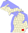 |
| Wayne | 163 | Detroit | 1815 | Wydzielone z Terytorium Michigan, które przejęto w 1807 roku na podstawie Traktatu z Detroit | Od nazwiska Anthony Wayne, generała i polityka (1745–1796) | 1 820 584 | 1741 |  |
| Wexford | 165 | Cadillac | 1840 | Wydzielone z hrabstwa Mackinac. Do roku 1843 nazywało się Kautawaubet County | Od nazwy irlandzkiego hrabstwa Wexford | 32 735 | 1491 |  |
Przypisy
- ↑ Michigan Counties List (ang.). Michigan.GOV. [dostęp 2016-09-08].
- ↑ 2010 FIPS Codes for Counties and County Equivalent Entities (ang.). CENSUS. [dostęp 2016-09-08].
- ↑ Mark R. Putnam: The Meaning of Michigan County Names (ang.). [dostęp 2016-09-10].
- ↑ Michigan: 2010 Population and Housing Unit Counts (ang.). U.S. Cansus Bureau. [dostęp 2016-09-08].
- ↑ Base Map by County (ang.). Michigan.gov. [dostęp 2016-09-08].
Media użyte na tej stronie
This is a locator map showing Washtenaw County in Michigan. For more information, see Commons:United States county locator maps.
This is a locator map showing Livingston County in Michigan. For more information, see Commons:United States county locator maps.
This is a locator map showing Alcona County in Michigan. For more information, see Commons:United States county locator maps.
This is a locator map showing Eaton County in Michigan. For more information, see Commons:United States county locator maps.
This is a locator map showing Clinton County in Michigan. For more information, see Commons:United States county locator maps.
This is a locator map showing Crawford County in Michigan. For more information, see Commons:United States county locator maps.
This is a locator map showing Mecosta County in Michigan. For more information, see Commons:United States county locator maps.
This is a locator map showing Baraga County in Michigan. For more information, see Commons:United States county locator maps.
This is a locator map showing Schoolcraft County in Michigan. For more information, see Commons:United States county locator maps.
This is a locator map showing Mackinac County in Michigan. For more information, see Commons:United States county locator maps.
This is a locator map showing Luce County in Michigan. For more information, see Commons:United States county locator maps.
This is a locator map showing Montmorency County in Michigan. For more information, see Commons:United States county locator maps.
This is a locator map showing Berrien County in Michigan. For more information, see Commons:United States county locator maps.
This is a locator map showing Saint Clair County in Michigan.
This is a locator map showing Benzie County in Michigan. For more information, see Commons:United States county locator maps.
This is a locator map showing Dickinson County in Michigan. For more information, see Commons:United States county locator maps.
This is a locator map showing Shiawassee County in Michigan. For more information, see Commons:United States county locator maps.
This is a locator map showing Ogemaw County in Michigan. For more information, see Commons:United States county locator maps.
This is a locator map showing Tuscola County in Michigan. For more information, see Commons:United States county locator maps.
This is a locator map showing Ottawa County in Michigan. For more information, see Commons:United States county locator maps.
This is a locator map showing Menominee County in Michigan. For more information, see Commons:United States county locator maps.
This is a locator map showing Delta County in Michigan. For more information, see Commons:United States county locator maps.
This is a locator map showing Gratiot County in Michigan. For more information, see Commons:United States county locator maps.
This is a locator map showing Missaukee County in Michigan. For more information, see Commons:United States county locator maps.
This is a locator map showing Lapeer County in Michigan. For more information, see Commons:United States county locator maps.
This is a locator map showing Presque Isle County in Michigan. For more information, see Commons:United States county locator maps.
This is a locator map showing Ontonagon County in Michigan. For more information, see Commons:United States county locator maps.
This is a locator map showing Clare County in Michigan. For more information, see Commons:United States county locator maps.
This is a locator map showing Oceana County in Michigan. For more information, see Commons:United States county locator maps.
This is a locator map showing Wexford County in Michigan. For more information, see Commons:United States county locator maps.
This is a locator map showing Saint Joseph County in Michigan. For more information, see Commons:United States county locator maps.
This is a locator map showing Branch County in Michigan. For more information, see Commons:United States county locator maps.
This is a locator map showing Arenac County in Michigan. For more information, see Commons:United States county locator maps.
This is a locator map showing Alger County in Michigan. For more information, see Commons:United States county locator maps.
This is a locator map showing Gogebic County in Michigan. For more information, see Commons:United States county locator maps.
This is a locator map showing Alpena County in Michigan. For more information, see Commons:United States county locator maps.
This is a locator map showing Osceola County in Michigan. For more information, see Commons:United States county locator maps.
This is a locator map showing Montcalm County in Michigan. For more information, see Commons:United States county locator maps.
This is a locator map showing Ionia County in Michigan. For more information, see Commons:United States county locator maps.
This is a locator map showing Kalamazoo County in Michigan. For more information, see Commons:United States county locator maps.
This is a locator map showing Kalkaska County in Michigan. For more information, see Commons:United States county locator maps.
This is a locator map showing Chippewa County in Michigan. For more information, see Commons:United States county locator maps.
This is a locator map showing Sanilac County in Michigan. For more information, see Commons:United States county locator maps.
This is a locator map showing Muskegon County in Michigan. For more information, see Commons:United States county locator maps.
This is a locator map showing Newaygo County in Michigan. For more information, see Commons:United States county locator maps.
This is a locator map showing Lenawee County in Michigan. For more information, see Commons:United States county locator maps.
This is a locator map showing Grand Traverse County in Michigan. For more information, see Commons:United States county locator maps.
This is a locator map showing Mason County in Michigan. For more information, see Commons:United States county locator maps.
This is a locator map showing Cass County in Michigan. For more information, see Commons:United States county locator maps.
This is a locator map showing Emmet County in Michigan. For more information, see Commons:United States county locator maps.
This is a locator map showing Lake County in Michigan. For more information, see Commons:United States county locator maps.
This is a locator map showing Leelanau County in Michigan. For more information, see Commons:United States county locator maps.
This is a locator map showing Huron County in Michigan. For more information, see Commons:United States county locator maps.
This is a locator map showing Marquette County in Michigan. For more information, see Commons:United States county locator maps.
This is a locator map showing Oakland County in Michigan. For more information, see Commons:United States county locator maps.
This is a locator map showing Van Buren County in Michigan. For more information, see Commons:United States county locator maps.
This is a locator map showing Genesee County in Michigan. For more information, see Commons:United States county locator maps.
This is a locator map showing Hillsdale County in Michigan. For more information, see Commons:United States county locator maps.
This is a locator map showing Gladwin County in Michigan. For more information, see Commons:United States county locator maps.
This is a locator map showing Saginaw County in Michigan. For more information, see Commons:United States county locator maps.
This is a locator map showing Isabella County in Michigan. For more information, see Commons:United States county locator maps.
This is a locator map showing Manistee County in Michigan. For more information, see Commons:United States county locator maps.
Locator map showing Barry County in southwestern Michigan. David Benbennick made this map. For more information, see Commons:United States county locator maps.
This is a locator map showing Macomb County in Michigan. For more information, see Commons:United States county locator maps.
This is a locator map showing Monroe County in Michigan. For more information, see Commons:United States county locator maps.
This is a locator map showing Midland County in Michigan. For more information, see Commons:United States county locator maps.
This is a locator map showing Iosco County in Michigan. For more information, see Commons:United States county locator maps.
This is a locator map showing Kent County in Michigan. For more information, see Commons:United States county locator maps.
This is a locator map showing Otsego County in Michigan. For more information, see Commons:United States county locator maps.
This is a locator map showing Oscoda County in Michigan. For more information, see Commons:United States county locator maps.
This is a locator map showing Charlevoix County in Michigan. For more information, see Commons:United States county locator maps.
This is a locator map showing Antrim County in Michigan. For more information, see Commons:United States county locator maps.
This is a locator map showing Jackson County in Michigan. For more information, see Commons:United States county locator maps.
This is a locator map showing Cheboygan County in Michigan. For more information, see Commons:United States county locator maps.
This is a locator map showing Roscommon County in Michigan. For more information, see Commons:United States county locator maps.
This is a locator map showing Allegan County in Michigan. For more information, see Commons:United States county locator maps.
This is a locator map showing Calhoun County in Michigan. For more information, see Commons:United States county locator maps.


