Lista hrabstw w stanie New Hampshire
Stan New Hampshire podzielony jest na 10 hrabstw[1].
Lista alfabetyczna
| Nazwa | Siedziba | Powierzchnia całkowita (km²) | Powierzchnia wodna (km²) | Powierzchnia lądowa (km²) | Populacja (2000) | Gęstość zaludnienia (os/km²) (2000) | Położenie na mapie |
|---|---|---|---|---|---|---|---|
| Belknap | Laconia | 1214 | 175 | 1039 | 60088 | 58 |  |
| Carroll | Ossipee | 2570 | 151 | 2419 | 47818 | 20 |  |
| Cheshire | Keene | 1890 | 58 | 1832 | 77117 | 42 |  |
| Coös | Lancaster | 4743 | 80 | 4663 | 33055 | 7 |  |
| Grafton | North Haverhill | 4533 | 96 | 4438 | 89118 | 20 |  |
| Hillsborough | Nashua | 2310 | 41 | 2269 | 400721 | 177 |  |
| Merrimack | Concord | 2478 | 570 | 2410 | 146455 | 61 |  |
| Rockingham | Brentwood | 2057 | 257 | 2000 | 295233 | 104 |  |
| Strafford | Dover | 995 | 40 | 955 | 123143 | 129 |  |
| Sullivan | Newport | 1431 | 39 | 1392 | 43742 | 31 |  |
Przypisy
- ↑ COUNTY EMPLOYMENT AND WAGES IN NEW HAMPSHIRE: THIRD QUARTER 2010 (ang.). 2011-04-20. [dostęp 2012-01-06]. [zarchiwizowane z tego adresu (2011-12-09)].
Media użyte na tej stronie
Map of New Hampshire highlighting Belknap County.svg
This is a locator map showing Belknap County in New Hampshire. For more information, see Commons:United States county locator maps.
This is a locator map showing Belknap County in New Hampshire. For more information, see Commons:United States county locator maps.
Map of New Hampshire highlighting Merrimack County.svg
This is a locator map showing Merrimack County in New Hampshire. For more information, see Commons:United States county locator maps.
This is a locator map showing Merrimack County in New Hampshire. For more information, see Commons:United States county locator maps.
Map of New Hampshire highlighting Rockingham County.svg
This is a locator map showing Rockingham County in New Hampshire. For more information, see Commons:United States county locator maps.
This is a locator map showing Rockingham County in New Hampshire. For more information, see Commons:United States county locator maps.
Map of New Hampshire highlighting Cheshire County.svg
This is a locator map showing Cheshire County in New Hampshire. For more information, see Commons:United States county locator maps.
This is a locator map showing Cheshire County in New Hampshire. For more information, see Commons:United States county locator maps.
Map of New Hampshire highlighting Coos County.svg
This is a locator map showing Coös County in New Hampshire. For more information, see Commons:United States county locator maps.
This is a locator map showing Coös County in New Hampshire. For more information, see Commons:United States county locator maps.
Map of New Hampshire highlighting Carroll County.svg
This is a locator map showing Carroll County in New Hampshire. For more information, see Commons:United States county locator maps.
This is a locator map showing Carroll County in New Hampshire. For more information, see Commons:United States county locator maps.
Map of New Hampshire highlighting Sullivan County.svg
This is a locator map showing Sullivan County in New Hampshire. For more information, see Commons:United States county locator maps.
This is a locator map showing Sullivan County in New Hampshire. For more information, see Commons:United States county locator maps.
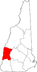
Map of New Hampshire highlighting Grafton County.svg
This is a locator map showing Grafton County in New Hampshire. For more information, see Commons:United States county locator maps.
This is a locator map showing Grafton County in New Hampshire. For more information, see Commons:United States county locator maps.
Map of New Hampshire highlighting Hillsborough County.svg
This is a locator map showing Hillsborough County in New Hampshire. For more information, see Commons:United States county locator maps.
This is a locator map showing Hillsborough County in New Hampshire. For more information, see Commons:United States county locator maps.
Map of New Hampshire highlighting Strafford County.svg
This is a locator map showing Strafford County in New Hampshire. For more information, see Commons:United States county locator maps.
This is a locator map showing Strafford County in New Hampshire. For more information, see Commons:United States county locator maps.


