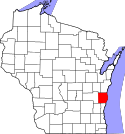
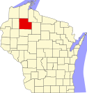
Lista hrabstw w stanie Wisconsin
Lista hrabstw w stanie Wisconsin obejmuje 72 jednostki administracyjne.
| Nazwa | kod FIPS[1] | Siedziba | Powierzchnia całkowita (km²)[2] | Populacja (2009)[1] | Data powstania[3] | Położenie na mapie |
|---|---|---|---|---|---|---|
| Adams | 55001 | Friendship | 1783,23 | 20 088 | 1848 | 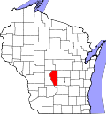 |
| Ashland | 55003 | Ashland | 5940,73 | 16 181 | 1848 | 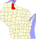 |
| Barron | 55005 | Barron | 2305,14 | 45 591 | 1859 | 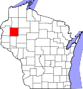 |
| Bayfield | 55007 | Washburn | 5287,54 | 14 789 | 1859 | 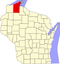 |
| Brown | 55009 | Green Bay | 1593,93 | 247 319 | 1818 | 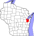 |
| Buffalo | 55011 | Alma | 1837,8 | 13,425 | 1853 | 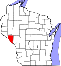 |
| Burnett | 55013 | Meenon | 2280,17 | 15 884 | 1856 | 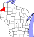 |
| Calumet | 55015 | Chilton | 1028,3 | 44 739 | 1836 |  |
| Chippewa | 55017 | Chippewa Falls | 2697 | 60 609 | 1845 |  |
| Clark | 55019 | Neillsville | 3157,4 | 33 426 | 1853 |  |
| Columbia | 55021 | Portage | 2060,85 | 55 170 | 1846 | 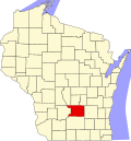 |
| Crawford | 55023 | Prairie du Chien | 1551,97 | 16 731 | 1836 |  |
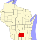
| Dane | 55025 | Madison | 3207,23 | 491 357 | 1836 | 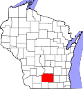 |
| Dodge | 55027 | Juneau | 2349,09 | 87 335 | 1836 | 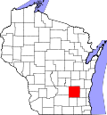 |
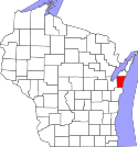
| Door | 55029 | Sturgeon Bay | 6137,83 | 27 815 | 1851 |  |
| Douglas | 55031 | Superior | 3832,95 | 44 274 | 1854 |  |
| Dunn | 55033 | Menomonie | 2237,52 | 42 968 | 1854 |  |
| Eau Claire | 55035 | Eau Claire | 1671,27 | 99 409 | 1856 |  |
| Florence | 55037 | Florence | 1288,42 | 4554 | 1881 |  |
| Fond du Lac | 55039 | Fond du Lac | 1983,41 | 100 070 | 1836 |  |
| Forest | 55041 | Crandon | 2710,16 | 9605 | 1885 |  |
| Grant | 55043 | Lancaster | 3064,76 | 48 965 | 1836 | 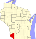 |
| Green | 55045 | Monroe | 1514 | 36 110 | 1836 |  |
| Green Lake | 55047 | Green Lake | 985,33 | 55047 | 1858 |  |
| Iowa | 55049 | Dodgeville | 1989,32 | 23 498 | 1829 |  |
| Iron | 55051 | Hurley | 2380,82 | 6078 | 1893 |  |
| Jackson | 55053 | Black River Falls | 2590,27 | 19 886 | 1853 |  |
| Jefferson | 55055 | Jefferson | 1509,32 | 80 833 | 1836 |  |
| Juneau | 55057 | Mauston | 2082,69 | 26 451 | 1856 |  |
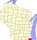
| Kenosha | 55059 | Kenosha | 1953,65 | 165 382 | 1850 | 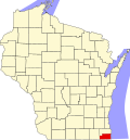 |
| Kewaunee | 55061 | Kewaunee | 2808,89 | 20 315 | 1852 |  |
| La Crosse | FIPS | La Crosse | 1242,99 | 113 679 | 1851 |  |
| Lafayette | 55065 | Darlington | 1643,5[ | 15 737 | 1846 |  |
| Langlade | 55067 | Antigo | 2299,6 | 20 008 | 1879 |  |
| Lincoln | 55069 | Merrill | 2349,25 | 29 404 | 1874 |  |
| Manitowoc | 55071 | Manitowoc | 3869,11 | 80 583 | 1836 | 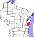 |
| Marathon | 55073 | Wausau | 4082,18 | 131 612 | 1850 | 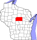 |
| Marinette | 55075 | Marinette | 4014,66 | 41 968 | 1879 | 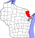 |
| Menominee | 55078 | Keshena | 945,32 | 4513 | 1961 |  |
| Milwaukee | 55079 | Milwaukee | 3081,31 | 959 521 | 1834 |  |
| Monroe | 55081 | Sparta | 2352,46 | 43 760 | 1854 | 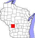 |
| Oconto | 55083 | Oconto | 2976 | 37 149 | 1851 |  |
| Oneida | 55085 | Rhinelander | 3200,91 | 35 930 | 1885 |  |
| Outagamie | 55087 | Appleton | 1668,99 | 177 155 | 1851 |  |
| Ozaukee | 55089 | Port Washington | 2890,94 | 86 311 | 1853 |  |
| Pepin | 55091 | Durand | 644,08 | 7293 | 1858 | 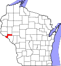 |
| Pierce | 55093 | Ellsworth | 1532,21 | 40 081 | 1853 | 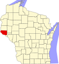 |
| Polk | 55095 | Balsam Lake | 2476,75 | 44 252 | 1853 | 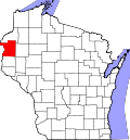 |
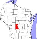
| Portage | 55097 | Stevens Point | 2130,94 | 69 176 | 1836 |  |
| Price | 55099 | Phillips | 3311,12 | 14 214 | 1879 | 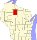 |
| Racine | 55101 | Racine | 2051,01 | 200 601 | 1836 |  |
| Richland | 55103 | Richland Center | 1526,49 | 17 848 | 1842 |  |
| Rock | 55105 | Janesville | 1880,85 | 160 155 | 1836 |  |
| Rusk | 55107 | Ladysmith | 2410,99 | 14 367 | 1901 |  |
| Sauk | 55111 | Baraboo | 2197,42 | 58 922 | 1840 |  |
| Sawyer | 55113 | Hayward | 3497,31 | 16 939 | 1883 |  |
| Shawano | 55115 | Shawano | 2355,15 | 41 166 | 1853 |  |
| Sheboygan | 55117 | Sheboygan | 3291,8 | 114 560 | 1836 |  |
| St. Croix | 55109 | Hudson | 1905,74 | 83 351 | 1840 | 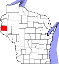 |
| Taylor | 55119 | Medford | 2549,82 | 19 222 | 1848 |  |
| Trempealeau | 55121 | Whitehall | 1921,72 | 27 754 | 1854 |  |
| Vernon | 55123 | Viroqua | 5476,5 | 29 324 | 1851 | 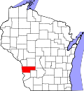 |
| Vilas | 55125 | Eagle River | 2636 | 21 033 | 1893 |  |
| Walworth | 55127 | Elkhorn | 1493,13 | 100 593 | 1836 |  |
| Washburn | 55129 | Shell Lake | 2209,42 | 16 666 | 1883 |  |
| Washington | 55131 | West Bend | 1128,95 | 130 681 | 1836 |  |
| Waukesha | 55133 | Waukesha | 1503,44 | 383 154 | 1846 |  |
| Waupaca | 55135 | Waupaca | 1982,2 | 51 665 | 1851 |  |
| Waushara | 55137 | Wautoma | 1650,83 | 24 606 | 1851 | 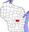 |
| Winnebago | 55139 | Oshkosh | 1498,83 | 163 370 | 1840 |  |
| Wood | 55141 | Wisconsin Rapids | 2096,49 | 73 932 | 1856 |  |
Przypisy
- ↑ a b US Census Bureau: Wisconsin (ang.). Quickfacts. [dostęp 2010-11-13].
- ↑ US Census Bureau: Wisconsin County. Population, Housing Units, Area, and Density: 2000 (ang.). [dostęp 2010-11-13].
- ↑ Wisconsin Local Community Information And Wisconsin Local Government (ang.). Wisconsin Online. [dostęp 2010-11-13].
Media użyte na tej stronie
Map of Wisconsin highlighting Burnett County.svg
This is a locator map showing Burnett County in Wisconsin. For more information, see Commons:United States county locator maps.
This is a locator map showing Burnett County in Wisconsin. For more information, see Commons:United States county locator maps.
Map of Wisconsin highlighting Rock County.svg
This is a locator map showing Rock County in Wisconsin. For more information, see Commons:United States county locator maps.
This is a locator map showing Rock County in Wisconsin. For more information, see Commons:United States county locator maps.
Map of Wisconsin highlighting Shawano County.svg
This is a locator map showing Shawano County in Wisconsin. For more information, see Commons:United States county locator maps.
This is a locator map showing Shawano County in Wisconsin. For more information, see Commons:United States county locator maps.
Map of Wisconsin highlighting Monroe County.svg
This is a locator map showing Monroe County in Wisconsin. For more information, see Commons:United States county locator maps.
This is a locator map showing Monroe County in Wisconsin. For more information, see Commons:United States county locator maps.
Map of Wisconsin highlighting Clark County.svg
This is a locator map showing Clark County in Wisconsin. For more information, see Commons:United States county locator maps.
This is a locator map showing Clark County in Wisconsin. For more information, see Commons:United States county locator maps.
Map of Wisconsin highlighting Barron County.svg
This is a locator map showing Barron County in Wisconsin. For more information, see Commons:United States county locator maps.
This is a locator map showing Barron County in Wisconsin. For more information, see Commons:United States county locator maps.
Map of Wisconsin highlighting Vilas County.svg
This is a locator map showing Vilas County in Wisconsin. For more information, see Commons:United States county locator maps.
This is a locator map showing Vilas County in Wisconsin. For more information, see Commons:United States county locator maps.
Map of Wisconsin highlighting Calumet County.svg
This is a locator map showing Calumet County in Wisconsin. For more information, see Commons:United States county locator maps.
This is a locator map showing Calumet County in Wisconsin. For more information, see Commons:United States county locator maps.
Map of Wisconsin highlighting Polk County.svg
This is a locator map showing Polk County in Wisconsin. For more information, see Commons:United States county locator maps.
This is a locator map showing Polk County in Wisconsin. For more information, see Commons:United States county locator maps.
Map of Wisconsin highlighting Crawford County.svg
This is a locator map showing Crawford County in Wisconsin. For more information, see Commons:United States county locator maps.
This is a locator map showing Crawford County in Wisconsin. For more information, see Commons:United States county locator maps.
Map of Wisconsin highlighting Kenosha County.svg
This is a locator map showing Kenosha County in Wisconsin. For more information, see Commons:United States county locator maps.
This is a locator map showing Kenosha County in Wisconsin. For more information, see Commons:United States county locator maps.
Map of Wisconsin highlighting Adams County.svg
This is a locator map showing Adams County in Wisconsin. For more information, see Commons:United States county locator maps.
This is a locator map showing Adams County in Wisconsin. For more information, see Commons:United States county locator maps.
Map of Wisconsin highlighting Waupaca County.svg
This is a locator map showing Waupaca County in Wisconsin. For more information, see Commons:United States county locator maps.
This is a locator map showing Waupaca County in Wisconsin. For more information, see Commons:United States county locator maps.
Map of Wisconsin highlighting Eau Claire County.svg
This is a locator map showing Eau Claire County in Wisconsin. For more information, see Commons:United States county locator maps.
This is a locator map showing Eau Claire County in Wisconsin. For more information, see Commons:United States county locator maps.
Map of Wisconsin highlighting Jackson County.svg
This is a locator map showing Jackson County in Wisconsin. For more information, see Commons:United States county locator maps.
This is a locator map showing Jackson County in Wisconsin. For more information, see Commons:United States county locator maps.
Map of Wisconsin highlighting Wood County.svg
This is a locator map showing Wood County in Wisconsin. For more information, see Commons:United States county locator maps.
This is a locator map showing Wood County in Wisconsin. For more information, see Commons:United States county locator maps.
Map of Wisconsin highlighting Columbia County.svg
This is a locator map showing Columbia County in Wisconsin. For more information, see Commons:United States county locator maps.
This is a locator map showing Columbia County in Wisconsin. For more information, see Commons:United States county locator maps.
Map of Wisconsin highlighting Langlade County.svg
This is a locator map showing Langlade County in Wisconsin. For more information, see Commons:United States county locator maps.
This is a locator map showing Langlade County in Wisconsin. For more information, see Commons:United States county locator maps.
Map of Wisconsin highlighting Juneau County.svg
This is a locator map showing Juneau County in Wisconsin. For more information, see Commons:United States county locator maps.
This is a locator map showing Juneau County in Wisconsin. For more information, see Commons:United States county locator maps.
Map of Wisconsin highlighting Lafayette County.svg
This is a locator map showing Lafayette County in Wisconsin. For more information, see Commons:United States county locator maps.
This is a locator map showing Lafayette County in Wisconsin. For more information, see Commons:United States county locator maps.
Map of Wisconsin highlighting Racine County.svg
This is a locator map showing Racine County in Wisconsin. For more information, see Commons:United States county locator maps.
This is a locator map showing Racine County in Wisconsin. For more information, see Commons:United States county locator maps.
Map of Wisconsin highlighting Dane County.svg
This is a locator map showing Dane County in Wisconsin. For more information, see Commons:United States county locator maps.
This is a locator map showing Dane County in Wisconsin. For more information, see Commons:United States county locator maps.
Map of Wisconsin highlighting Jefferson County.svg
This is a locator map showing Jefferson County in Wisconsin. For more information, see Commons:United States county locator maps.
This is a locator map showing Jefferson County in Wisconsin. For more information, see Commons:United States county locator maps.
Map of Wisconsin highlighting Outagamie County.svg
This is a locator map showing Outagamie County in Wisconsin. For more information, see Commons:United States county locator maps.
This is a locator map showing Outagamie County in Wisconsin. For more information, see Commons:United States county locator maps.
Map of Wisconsin highlighting Kewaunee County.svg
This is a locator map showing Kewaunee County in Wisconsin. For more information, see Commons:United States county locator maps.
This is a locator map showing Kewaunee County in Wisconsin. For more information, see Commons:United States county locator maps.
Map of Wisconsin highlighting Marinette County.svg
This is a locator map showing Marinette County in Wisconsin. For more information, see Commons:United States county locator maps.
This is a locator map showing Marinette County in Wisconsin. For more information, see Commons:United States county locator maps.
Map of Wisconsin highlighting Dunn County.svg
This is a locator map showing Dunn County in Wisconsin. For more information, see Commons:United States county locator maps.
This is a locator map showing Dunn County in Wisconsin. For more information, see Commons:United States county locator maps.
Map of Wisconsin highlighting Trempealeau County.svg
This is a locator map showing Trempealeau County in Wisconsin. For more information, see Commons:United States county locator maps.
This is a locator map showing Trempealeau County in Wisconsin. For more information, see Commons:United States county locator maps.
Map of Wisconsin highlighting Saint Croix County.svg
This is a locator map showing Saint Croix County in Wisconsin. For more information, see Commons:United States county locator maps.
This is a locator map showing Saint Croix County in Wisconsin. For more information, see Commons:United States county locator maps.
Map of Wisconsin highlighting Iowa County.svg
This is a locator map showing Iowa County in Wisconsin. For more information, see Commons:United States county locator maps.
This is a locator map showing Iowa County in Wisconsin. For more information, see Commons:United States county locator maps.
Map of Wisconsin highlighting Waushara County.svg
This is a locator map showing Waushara County in Wisconsin. For more information, see Commons:United States county locator maps.
This is a locator map showing Waushara County in Wisconsin. For more information, see Commons:United States county locator maps.
Map of Wisconsin highlighting Manitowoc County.svg
This is a locator map showing Manitowoc County in Wisconsin. For more information, see Commons:United States county locator maps.
This is a locator map showing Manitowoc County in Wisconsin. For more information, see Commons:United States county locator maps.
Map of Wisconsin highlighting Price County.svg
This is a locator map showing Price County in Wisconsin. For more information, see Commons:United States county locator maps.
This is a locator map showing Price County in Wisconsin. For more information, see Commons:United States county locator maps.
Map of Wisconsin highlighting Buffalo County.svg
This is a locator map showing Buffalo County in Wisconsin. For more information, see Commons:United States county locator maps.
This is a locator map showing Buffalo County in Wisconsin. For more information, see Commons:United States county locator maps.
Map of Wisconsin highlighting Menominee County.svg
This is a locator map showing Menominee County in Wisconsin. For more information, see Commons:United States county locator maps.
This is a locator map showing Menominee County in Wisconsin. For more information, see Commons:United States county locator maps.
Map of Wisconsin highlighting Oneida County.svg
This is a locator map showing Oneida County in Wisconsin. For more information, see Commons:United States county locator maps.
This is a locator map showing Oneida County in Wisconsin. For more information, see Commons:United States county locator maps.
Map of Wisconsin highlighting Green County.svg
This is a locator map showing Green County in Wisconsin. For more information, see Commons:United States county locator maps.
This is a locator map showing Green County in Wisconsin. For more information, see Commons:United States county locator maps.
Map of Wisconsin highlighting Florence County.svg
This is a locator map showing Florence County in Wisconsin. For more information, see Commons:United States county locator maps.
This is a locator map showing Florence County in Wisconsin. For more information, see Commons:United States county locator maps.
Map of Wisconsin highlighting Vernon County.svg
This is a locator map showing Vernon County in Wisconsin. For more information, see Commons:United States county locator maps.
This is a locator map showing Vernon County in Wisconsin. For more information, see Commons:United States county locator maps.
Map of Wisconsin highlighting Pepin County.svg
This is a locator map showing Pepin County in Wisconsin. For more information, see Commons:United States county locator maps.
This is a locator map showing Pepin County in Wisconsin. For more information, see Commons:United States county locator maps.
Map of Wisconsin highlighting Door County.svg
Locator map showing Door County (red) — in northeastern Wisconsin.
Locator map showing Door County (red) — in northeastern Wisconsin.
- Credits
- For more information, see Commons:United States county locator maps.
Map of Wisconsin highlighting Green Lake County.svg
This is a locator map showing Green Lake County in Wisconsin. For more information, see Commons:United States county locator maps.
This is a locator map showing Green Lake County in Wisconsin. For more information, see Commons:United States county locator maps.
Map of Wisconsin highlighting La Crosse County.svg
This is a locator map showing La Crosse County in Wisconsin. For more information, see Commons:United States county locator maps.
This is a locator map showing La Crosse County in Wisconsin. For more information, see Commons:United States county locator maps.
Map of Wisconsin highlighting Waukesha County.svg
This is a locator map showing Waukesha County in Wisconsin. For more information, see Commons:United States county locator maps.
This is a locator map showing Waukesha County in Wisconsin. For more information, see Commons:United States county locator maps.
Map of Wisconsin highlighting Sheboygan County.svg
This is a locator map showing Sheboygan County in Wisconsin. For more information, see Commons:United States county locator maps.
This is a locator map showing Sheboygan County in Wisconsin. For more information, see Commons:United States county locator maps.
Map of Wisconsin highlighting Washburn County.svg
This is a locator map showing Washburn County in Wisconsin. For more information, see Commons:United States county locator maps.
This is a locator map showing Washburn County in Wisconsin. For more information, see Commons:United States county locator maps.
Map of Wisconsin highlighting Richland County.svg
This is a locator map showing Richland County in Wisconsin. For more information, see Commons:United States county locator maps.
This is a locator map showing Richland County in Wisconsin. For more information, see Commons:United States county locator maps.
Map of Wisconsin highlighting Dodge County.svg
This is a locator map showing Dodge County in Wisconsin. For more information, see Commons:United States county locator maps.
This is a locator map showing Dodge County in Wisconsin. For more information, see Commons:United States county locator maps.
Map of Wisconsin highlighting Ozaukee County.svg
This is a locator map showing Ozaukee County in Wisconsin. For more information, see Commons:United States county locator maps.
This is a locator map showing Ozaukee County in Wisconsin. For more information, see Commons:United States county locator maps.
Map of Wisconsin highlighting Douglas County.svg
This is a locator map showing Douglas County in Wisconsin. For more information, see Commons:United States county locator maps.
This is a locator map showing Douglas County in Wisconsin. For more information, see Commons:United States county locator maps.
Map of Wisconsin highlighting Ashland County.svg
This is a locator map showing Ashland County in Wisconsin. For more information, see Commons:United States county locator maps.
This is a locator map showing Ashland County in Wisconsin. For more information, see Commons:United States county locator maps.
Map of Wisconsin highlighting Winnebago County.svg
This is a locator map showing Winnebago County in Wisconsin. For more information, see Commons:United States county locator maps.
This is a locator map showing Winnebago County in Wisconsin. For more information, see Commons:United States county locator maps.
Map of Wisconsin highlighting Chippewa County.svg
This is a locator map showing Chippewa County in Wisconsin. For more information, see Commons:United States county locator maps.
This is a locator map showing Chippewa County in Wisconsin. For more information, see Commons:United States county locator maps.
Map of Wisconsin highlighting Pierce County.svg
This is a locator map showing Pierce County in Wisconsin. For more information, see Commons:United States county locator maps.
This is a locator map showing Pierce County in Wisconsin. For more information, see Commons:United States county locator maps.
Map of Wisconsin highlighting Grant County.svg
This is a locator map showing Grant County in Wisconsin. For more information, see Commons:United States county locator maps.
This is a locator map showing Grant County in Wisconsin. For more information, see Commons:United States county locator maps.
Map of Wisconsin highlighting Rusk County.svg
This is a locator map showing Rusk County in Wisconsin. For more information, see Commons:United States county locator maps.
This is a locator map showing Rusk County in Wisconsin. For more information, see Commons:United States county locator maps.
Map of Wisconsin highlighting Portage County.svg
This is a locator map showing Portage County in Wisconsin. For more information, see Commons:United States county locator maps.
This is a locator map showing Portage County in Wisconsin. For more information, see Commons:United States county locator maps.
Map of Wisconsin highlighting Marathon County.svg
Locator map showing Marathon County — in Wisconsin.
Locator map showing Marathon County — in Wisconsin.
- For more information, see Commons:United States county locator maps.
Map of Wisconsin highlighting Lincoln County.svg
This is a locator map showing Lincoln County in Wisconsin. For more information, see Commons:United States county locator maps.
This is a locator map showing Lincoln County in Wisconsin. For more information, see Commons:United States county locator maps.
Map of Wisconsin highlighting Milwaukee County.svg
This is a locator map showing Milwaukee County in Wisconsin. For more information, see Commons:United States county locator maps.
This is a locator map showing Milwaukee County in Wisconsin. For more information, see Commons:United States county locator maps.
Map of Wisconsin highlighting Fond du Lac County.svg
This is a locator map showing Fond du Lac County in Wisconsin. For more information, see Commons:United States county locator maps.
This is a locator map showing Fond du Lac County in Wisconsin. For more information, see Commons:United States county locator maps.
Map of Wisconsin highlighting Iron County.svg
This is a locator map showing Iron County in Wisconsin. For more information, see Commons:United States county locator maps.
This is a locator map showing Iron County in Wisconsin. For more information, see Commons:United States county locator maps.
Map of Wisconsin highlighting Bayfield County.svg
This is a locator map showing Bayfield County in Wisconsin. For more information, see Commons:United States county locator maps.
This is a locator map showing Bayfield County in Wisconsin. For more information, see Commons:United States county locator maps.
Map of Wisconsin highlighting Washington County.svg
This is a locator map showing Washington County in Wisconsin. For more information, see Commons:United States county locator maps.
This is a locator map showing Washington County in Wisconsin. For more information, see Commons:United States county locator maps.
Map of Wisconsin highlighting Oconto County.svg
This is a locator map showing Oconto County in Wisconsin. For more information, see Commons:United States county locator maps.
This is a locator map showing Oconto County in Wisconsin. For more information, see Commons:United States county locator maps.
Map of Wisconsin highlighting Brown County.svg
This is a locator map showing Brown County in Wisconsin. For more information, see Commons:United States county locator maps.
This is a locator map showing Brown County in Wisconsin. For more information, see Commons:United States county locator maps.
Map of Wisconsin highlighting Sauk County.svg
This is a locator map showing Sauk County in Wisconsin. For more information, see Commons:United States county locator maps.
This is a locator map showing Sauk County in Wisconsin. For more information, see Commons:United States county locator maps.
Map of Wisconsin highlighting Walworth County.svg
This is a locator map showing Walworth County in Wisconsin. For more information, see Commons:United States county locator maps.
This is a locator map showing Walworth County in Wisconsin. For more information, see Commons:United States county locator maps.
Map of Wisconsin highlighting Sawyer County.svg
This is a locator map showing Sawyer County in Wisconsin. For more information, see Commons:United States county locator maps.
This is a locator map showing Sawyer County in Wisconsin. For more information, see Commons:United States county locator maps.
Map of Wisconsin highlighting Forest County.svg
This is a locator map showing Forest County in Wisconsin. For more information, see Commons:United States county locator maps.
This is a locator map showing Forest County in Wisconsin. For more information, see Commons:United States county locator maps.
Map of Wisconsin highlighting Taylor County.svg
This is a locator map showing Taylor County in Wisconsin. For more information, see Commons:United States county locator maps.
This is a locator map showing Taylor County in Wisconsin. For more information, see Commons:United States county locator maps.


