Lista parafii cywilnych w stanie Luizjana
Lista parafii cywilnych w stanie Luizjana obejmuje 64 jednostki administracyjne.
| Nazwa | kod FIPS[1] | Siedziba | Powierzchnia całkowita (km²)[1] | Populacja (2010)[2] | Data powstania | Położenie na mapie |
|---|---|---|---|---|---|---|
| Acadia | 22001 | Crowley | 1702.81 | 61773 | 1886 |  |
| Allen | 22003 | Oberlin | 1983.82 | 25764 | 1912 |  |
| Ascension | 22005 | Donaldsonville | 784.22 | 107194 | 1807 |  |
| Assumption | 22007 | Napoleonville | 944.13 | 23421 | 1807 |  |
| Avoyelles | 22009 | Marksville | 2242.28 | 42073 | 1807 | 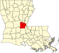 |
| Beauregard | 22011 | DeRidder | 3019.52 | 35654 | 1912 |  |
| Bienville | 22013 | Arcadia | 2129.16 | 14353 | 1848 |  |
| Bossier | 22015 | Benton | 2246.1 | 116979 | 1843 | 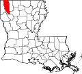 |
| Caddo | 22017 | Shreveport | 2426.37 | 254969 | 1838 |  |
| Calcasieu | 22019 | Lake Charles | 2834.17 | 192768 | 1840 | 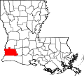 |
| Caldwell | 22021 | Columbia | 1400.49 | 10132 | 1838 |  |
| Cameron | 22023 | Cameron | 5015.97 | 6839 | 1870 |  |
| Catahoula | 22025 | Harrisonburg | 1915.1 | 10407 | 1808 |  |
| Claiborne | 22027 | Homer | 1987.61 | 17195 | 1828 |  |
| Concordia | 22029 | Vidalia | 1935.51 | 20822 | 1807 | 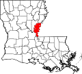 |
| DeSoto | 22031 | Mansfield | 2316.98 | 26656 | 1843 |  |
| East Baton Rouge | 22033 | Baton Rouge | 1217.91 | 440178 | 1812 |  |
| East Carroll | 22035 | Lake Providence | 1145.9 | 7759 | 1877 | 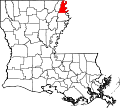 |
| East Feliciana | 22037 | Clinton | 1180.47 | 20263 | 1824 |  |
| Evangeline | 22039 | Ville Platte | 1760.23 | 33984 | 1910 |  |
| Franklin | 22041 | Winnsboro | 1645.78 | 20767 | 1843 |  |
| Grant | 22043 | Colfax | 1721.45 | 22309 | 1869 |  |
| Iberia | 22045 | New Iberia | 2669.07 | 73240 | 1868 |  |
| Iberville | 22047 | Plaquemine | 1690.9 | 33387 | 1805 |  |
| Jackson | 22049 | Jonesboro | 1502.92 | 16274 | 1845 |  |
| Jefferson | 22051 | Gretna | 1723.45 | 432552 | 1825 |  |
| Jefferson Davis | 22053 | Jennings | 1705.66 | 31594 | 1912 | 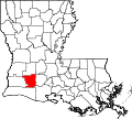 |
| Lafayette | 22055 | Lafayette | 697.25 | 221578 | 1823 |  |
| Lafourche | 22057 | Thibodaux | 3818.46 | 96588 | 1807 |  |
| La Salle | 22059 | Jena | 1715.6 | 14890 | 1908 |  |
| Lincoln | 22061 | Ruston | 1223.71 | 46735 | 1873 |  |
| Livingston | 22063 | Livingston | 1820.37 | 128040 | 1832 |  |
| Madison | 22065 | Tallulah | 1685.83 | 12093 | 1838 |  |
| Morehouse | 22067 | Bastrop | 2087.76 | 27979 | 1844 |  |
| Natchitoches | 22069 | Natchitoches | 3364.39 | 39566 | 1805 |  |
| Nowy Orlean | 22071 | Nowy Orlean | 907.05 | 343829 | 1807 |  |
| Ouachita | 22073 | Monroe | 1636.23 | 153720 | 1807 |  |
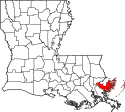
| Plaquemines | 22075 | Pointe à la Hache | 6649.04 | 22075 | 1807 |  |
| Pointe Coupee | 22077 | New Roads | 1529.94 | 22802 | 1807 | 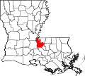 |
| Rapides | 22079 | Alexandria | 3526.69 | 131613 | 1807 |  |
| Red River | 22081 | Coushatta | 1042.07 | 9091 | 1871 |  |
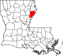
| Richland | 22083 | Rayville | 1462.1 | 20725 | 1868 |  |
| Sabine | 22085 | Many | 2620.09 | 24233 | 1843 |  |
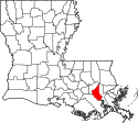
| St. Bernard | 22087 | Chalmette | 5589.41 | 35897 | 1807 | |
| St. Charles | 22089 | Hahnville | 1063.53 | 52880 | 1807 |  |
| St. Helena | 22091 | Greensburg | 1060.57 | 11203 | 1810 |  |
| St. James | 22093 | Convent | 668.11 | 22102 | 1807 |  |
| St. John the Baptist | 22095 | Edgard | 900.38 | 45824 | 1807 |  |
| St. Landry | 22097 | Opelousas | 2431.96 | 83384 | 1807 |  |
| St. Martin | 22099 | St. Martinville | 2114.71 | 52160 | 1807 | 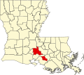 |
| St. Mary | 22101 | Franklin | 2899.31 | 54650 | 1811 |  |
| St. Tammany | 22103 | Covington | 2911.65 | 233737 | 1810 |  |
| Tangipahoa | 22105 | Amite City | 2132.27 | 121101 | 1869 |  |
| Tensas | 22107 | St. Joseph | 1660.68 | 5252 | 1843 |  |
| Terrebonne | 22109 | Houma | 5392.57 | 111590 | 1822 |  |
| Union | 22111 | Farmerville | 2344.99 | 22721 | 1839 |  |
| Vermilion | 22113 | Abbeville | 3993.96 | 57999 | 1844 | 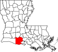 |
| Vernon | 22115 | Leesville | 3474.45 | 52334 | 1871 |  |
| Washington | 22117 | Franklinton | 1750.54 | 47171 | 1819 |  |
| Webster | 22119 | Minden | 1592.44 | 41207 | 1871 |  |
| West Baton Rouge | 22121 | Port Allen | 527.9 | 23788 | 1807 |  |
| West Carroll | 22123 | Oak Grove | 933.87 | 11604 | 1877 |  |
| West Feliciana | 22125 | St. Francisville | 1103.35 | 15625 | 1824 |  |
| Winn | 22127 | Winnfield | 2478.17 | 15313 | 1852 | 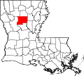 |
Przypisy
- ↑ a b Census 2000 U.S. Gazetteer Files: Counties (ang.). [dostęp 2014-04-26].
- ↑ QuickFacts from the US Census Bureau (ang.). [dostęp 2014-04-26].
Media użyte na tej stronie
Map of Louisiana highlighting Red River Parish.svg
This is a locator map showing Red River Parish in Louisiana. For more information, see Commons:United States county locator maps.
This is a locator map showing Red River Parish in Louisiana. For more information, see Commons:United States county locator maps.
Map of Louisiana highlighting Richland Parish.svg
This is a locator map showing Richland Parish in Louisiana. For more information, see Commons:United States county locator maps.
This is a locator map showing Richland Parish in Louisiana. For more information, see Commons:United States county locator maps.
Map of Louisiana highlighting Winn Parish.svg
This is a locator map showing Winn Parish in Louisiana. For more information, see Commons:United States county locator maps.
This is a locator map showing Winn Parish in Louisiana. For more information, see Commons:United States county locator maps.
Map of Louisiana highlighting Natchitoches Parish.svg
Locator map showing Natchitoches Parish in Louisiana.
Locator map showing Natchitoches Parish in Louisiana.
- For more information, see Commons:United States county locator maps.
Map of Louisiana highlighting West Feliciana Parish.svg
This is a locator map showing West Feliciana Parish in Louisiana. For more information, see Commons:United States county locator maps.
This is a locator map showing West Feliciana Parish in Louisiana. For more information, see Commons:United States county locator maps.
Map of Louisiana highlighting Union Parish.svg
This is a locator map showing Union Parish in Louisiana. For more information, see Commons:United States county locator maps.
This is a locator map showing Union Parish in Louisiana. For more information, see Commons:United States county locator maps.
Map of Louisiana highlighting East Baton Rouge Parish.svg
This is a locator map showing East Baton Rouge Parish in Louisiana. For more information, see Commons:United States county locator maps.
This is a locator map showing East Baton Rouge Parish in Louisiana. For more information, see Commons:United States county locator maps.
Map of Louisiana highlighting East Feliciana Parish.svg
This is a locator map showing East Feliciana Parish in Louisiana. For more information, see Commons:United States county locator maps.
This is a locator map showing East Feliciana Parish in Louisiana. For more information, see Commons:United States county locator maps.
Map of Louisiana highlighting Orleans Parish.svg
This is a locator map showing Orleans Parish in Louisiana. For more information, see Commons:United States county locator maps.
This is a locator map showing Orleans Parish in Louisiana. For more information, see Commons:United States county locator maps.
Map of Louisiana highlighting Ouachita Parish.svg
This is a locator map showing Ouachita Parish in Louisiana. For more information, see Commons:United States county locator maps.
This is a locator map showing Ouachita Parish in Louisiana. For more information, see Commons:United States county locator maps.
Map of Louisiana highlighting Concordia Parish.svg
This is a locator map showing Concordia Parish in Louisiana. For more information, see Commons:United States county locator maps.
This is a locator map showing Concordia Parish in Louisiana. For more information, see Commons:United States county locator maps.
Map of Louisiana highlighting Beauregard Parish.svg
This is a locator map showing Beauregard Parish in Louisiana. For more information, see Commons:United States county locator maps.
This is a locator map showing Beauregard Parish in Louisiana. For more information, see Commons:United States county locator maps.
Map of Louisiana highlighting Vernon Parish.svg
This is a locator map showing Vernon Parish in Louisiana. For more information, see Commons:United States county locator maps.
This is a locator map showing Vernon Parish in Louisiana. For more information, see Commons:United States county locator maps.
Map of Louisiana highlighting Lafayette Parish.svg
This is a locator map showing Lafayette Parish in Louisiana. For more information, see Commons:United States county locator maps.
This is a locator map showing Lafayette Parish in Louisiana. For more information, see Commons:United States county locator maps.
Map of Louisiana highlighting Saint John the Baptist Parish.svg
This is a locator map showing Saint John the Baptist Parish in Louisiana. For more information, see Commons:United States county locator maps.
This is a locator map showing Saint John the Baptist Parish in Louisiana. For more information, see Commons:United States county locator maps.
Map of Louisiana highlighting Saint Landry Parish.svg
This is a locator map showing Saint Landry Parish in Louisiana. For more information, see Commons:United States county locator maps.
This is a locator map showing Saint Landry Parish in Louisiana. For more information, see Commons:United States county locator maps.
Map of Louisiana highlighting Ascension Parish.svg
This is a locator map showing Ascension Parish in Louisiana. For more information, see Commons:United States county locator maps.
This is a locator map showing Ascension Parish in Louisiana. For more information, see Commons:United States county locator maps.
Map of Louisiana highlighting Rapides Parish.svg
This is a locator map showing Rapides Parish in Louisiana. For more information, see Commons:United States county locator maps.
This is a locator map showing Rapides Parish in Louisiana. For more information, see Commons:United States county locator maps.
Map of Louisiana highlighting Lincoln Parish.svg
This is a locator map showing Lincoln Parish in Louisiana. For more information, see Commons:United States county locator maps.
This is a locator map showing Lincoln Parish in Louisiana. For more information, see Commons:United States county locator maps.
Map of Louisiana highlighting Evangeline Parish.svg
This is a locator map showing Evangeline Parish in Louisiana. For more information, see Commons:United States county locator maps.
This is a locator map showing Evangeline Parish in Louisiana. For more information, see Commons:United States county locator maps.
Map of Louisiana highlighting Pointe Coupee Parish.svg
This is a locator map showing Pointe Coupee Parish in Louisiana. For more information, see Commons:United States county locator maps.
This is a locator map showing Pointe Coupee Parish in Louisiana. For more information, see Commons:United States county locator maps.
Map of Louisiana highlighting Bossier Parish.svg
This is a locator map showing Bossier Parish in Louisiana. For more information, see Commons:United States county locator maps.
This is a locator map showing Bossier Parish in Louisiana. For more information, see Commons:United States county locator maps.
Map of Louisiana highlighting Calcasieu Parish.svg
This is a locator map showing Calcasieu Parish in Louisiana. For more information, see Commons:United States county locator maps.
This is a locator map showing Calcasieu Parish in Louisiana. For more information, see Commons:United States county locator maps.
Map of Louisiana highlighting Caddo Parish.svg
This is a locator map showing Caddo Parish in Louisiana. For more information, see Commons:United States county locator maps.
This is a locator map showing Caddo Parish in Louisiana. For more information, see Commons:United States county locator maps.
Map of Louisiana highlighting Grant Parish.svg
This is a locator map showing Grant Parish in Louisiana. For more information, see Commons:United States county locator maps.
This is a locator map showing Grant Parish in Louisiana. For more information, see Commons:United States county locator maps.
Map of Louisiana highlighting Terrebonne Parish.svg
This is a locator map showing Terrebonne Parish in Louisiana. For more information, see Commons:United States county locator maps.
This is a locator map showing Terrebonne Parish in Louisiana. For more information, see Commons:United States county locator maps.
Map of Louisiana highlighting West Carroll Parish.svg
This is a locator map showing West Carroll Parish in Louisiana. For more information, see Commons:United States county locator maps.
This is a locator map showing West Carroll Parish in Louisiana. For more information, see Commons:United States county locator maps.
Map of Louisiana highlighting Claiborne Parish.svg
This is a locator map showing Claiborne Parish in Louisiana. For more information, see Commons:United States county locator maps.
This is a locator map showing Claiborne Parish in Louisiana. For more information, see Commons:United States county locator maps.
Map of Louisiana highlighting Saint Charles Parish.svg
This is a locator map showing Saint Charles Parish in Louisiana. For more information, see Commons:United States county locator maps.
This is a locator map showing Saint Charles Parish in Louisiana. For more information, see Commons:United States county locator maps.
Map of Louisiana highlighting Morehouse Parish.svg
This is a locator map showing Morehouse Parish in Louisiana. For more information, see Commons:United States county locator maps.
This is a locator map showing Morehouse Parish in Louisiana. For more information, see Commons:United States county locator maps.
Map of Louisiana highlighting Caldwell Parish.svg
This is a locator map showing Caldwell Parish in Louisiana. For more information, see Commons:United States county locator maps.
This is a locator map showing Caldwell Parish in Louisiana. For more information, see Commons:United States county locator maps.
Map of Louisiana highlighting Saint Tammany Parish.svg
This is a locator map showing Saint Tammany Parish in Louisiana. For more information, see Commons:United States county locator maps.
This is a locator map showing Saint Tammany Parish in Louisiana. For more information, see Commons:United States county locator maps.
Map of Louisiana highlighting Iberia Parish.svg
This is a locator map showing Iberia Parish in Louisiana. For more information, see Commons:United States county locator maps.
This is a locator map showing Iberia Parish in Louisiana. For more information, see Commons:United States county locator maps.
Map of Louisiana highlighting Jackson Parish.svg
This is a locator map showing Jackson Parish in Louisiana. For more information, see Commons:United States county locator maps.
This is a locator map showing Jackson Parish in Louisiana. For more information, see Commons:United States county locator maps.
Map of Louisiana highlighting Jefferson Davis Parish.svg
This is a locator map showing w:Baton Rouge in Louisiana. For more information, see Commons:United States county locator maps.
This is a locator map showing w:Baton Rouge in Louisiana. For more information, see Commons:United States county locator maps.
Map of Louisiana highlighting Avoyelles Parish.svg
This is a locator map showing Avoyelles Parish in Louisiana. For more information, see Commons:United States county locator maps.
This is a locator map showing Avoyelles Parish in Louisiana. For more information, see Commons:United States county locator maps.
Map of Louisiana highlighting Saint Bernard Parish.svg
This is a locator map showing St. Bernard Parish in Louisiana. For more information, see Commons:United States county locator maps.
This is a locator map showing St. Bernard Parish in Louisiana. For more information, see Commons:United States county locator maps.
Map of Louisiana highlighting Lafourche Parish.svg
This is a locator map showing Lafourche Parish in Louisiana. For more information, see Commons:United States county locator maps.
This is a locator map showing Lafourche Parish in Louisiana. For more information, see Commons:United States county locator maps.
Map of Louisiana highlighting Iberville Parish.svg
This is a locator map showing Iberville Parish in Louisiana. For more information, see Commons:United States county locator maps.
This is a locator map showing Iberville Parish in Louisiana. For more information, see Commons:United States county locator maps.
Map of Louisiana highlighting Bienville Parish.svg
This is a locator map showing Bienville Parish in Louisiana. For more information, see Commons:United States county locator maps.
This is a locator map showing Bienville Parish in Louisiana. For more information, see Commons:United States county locator maps.
Map of Louisiana highlighting Plaquemines Parish.svg
This is a locator map showing Plaquemines Parish in Louisiana. For more information, see Commons:United States county locator maps.
This is a locator map showing Plaquemines Parish in Louisiana. For more information, see Commons:United States county locator maps.
Map of Louisiana highlighting LaSalle Parish.svg
This is a locator map showing LaSalle Parish in Louisiana. For more information, see Commons:United States county locator maps.
This is a locator map showing LaSalle Parish in Louisiana. For more information, see Commons:United States county locator maps.
Map of Louisiana highlighting Saint Helena Parish.svg
This is a locator map showing Saint Helena Parish in Louisiana. For more information, see Commons:United States county locator maps.
This is a locator map showing Saint Helena Parish in Louisiana. For more information, see Commons:United States county locator maps.
Map of Louisiana highlighting Livingston Parish.svg
This is a locator map showing Livingston Parish in Louisiana. For more information, see Commons:United States county locator maps.
This is a locator map showing Livingston Parish in Louisiana. For more information, see Commons:United States county locator maps.
Map of Louisiana highlighting East Carroll Parish.svg
This is a locator map showing East Carroll Parish in Louisiana. For more information, see Commons:United States county locator maps.
This is a locator map showing East Carroll Parish in Louisiana. For more information, see Commons:United States county locator maps.
Map of Louisiana highlighting Acadia Parish.svg
This is a locator map showing Acadia Parish in Louisiana. For more information, see Commons:United States county locator maps.
This is a locator map showing Acadia Parish in Louisiana. For more information, see Commons:United States county locator maps.
Map of Louisiana highlighting Washington Parish.svg
This is a locator map showing Washington Parish in Louisiana. For more information, see Commons:United States county locator maps.
This is a locator map showing Washington Parish in Louisiana. For more information, see Commons:United States county locator maps.
Map of Louisiana highlighting Saint Martin Parish.svg
This is a locator map showing Saint Martin Parish in Louisiana. For more information, see Commons:United States county locator maps.
This is a locator map showing Saint Martin Parish in Louisiana. For more information, see Commons:United States county locator maps.
Map of Louisiana highlighting Vermilion Parish.svg
This is a locator map showing Vermilion Parish in Louisiana. For more information, see Commons:United States county locator maps.
This is a locator map showing Vermilion Parish in Louisiana. For more information, see Commons:United States county locator maps.
Map of Louisiana highlighting Saint Mary Parish.svg
This is a locator map showing Saint Mary Parish in Louisiana. For more information, see Commons:United States county locator maps.
This is a locator map showing Saint Mary Parish in Louisiana. For more information, see Commons:United States county locator maps.
Map of Louisiana highlighting Franklin Parish.svg
This is a locator map showing Franklin Parish in Louisiana. For more information, see Commons:United States county locator maps.
This is a locator map showing Franklin Parish in Louisiana. For more information, see Commons:United States county locator maps.
Map of Louisiana highlighting Cameron Parish.svg
This is a locator map showing Cameron Parish in Louisiana. For more information, see Commons:United States county locator maps.
This is a locator map showing Cameron Parish in Louisiana. For more information, see Commons:United States county locator maps.
Map of Louisiana highlighting Madison Parish.svg
This is a locator map showing Madison Parish in Louisiana. For more information, see Commons:United States county locator maps.
This is a locator map showing Madison Parish in Louisiana. For more information, see Commons:United States county locator maps.
Map of Louisiana highlighting Jefferson Parish.svg
This is a locator map showing Jefferson Parish in Louisiana. For more information, see Commons:United States county locator maps.
This is a locator map showing Jefferson Parish in Louisiana. For more information, see Commons:United States county locator maps.
Map of Louisiana highlighting Assumption Parish.svg
This is a locator map showing Assumption Parish in Louisiana. For more information, see Commons:United States county locator maps.
This is a locator map showing Assumption Parish in Louisiana. For more information, see Commons:United States county locator maps.
Map of Louisiana highlighting West Baton Rouge Parish.svg
This is a locator map showing West Baton Rouge Parish in Louisiana. For more information, see Commons:United States county locator maps.
This is a locator map showing West Baton Rouge Parish in Louisiana. For more information, see Commons:United States county locator maps.
Map of Louisiana highlighting Saint James Parish.svg
Locator map showing Saint James Parish in Louisiana.
Locator map showing Saint James Parish in Louisiana.
- For more information, see Commons:United States county locator maps.
Map of Louisiana highlighting Catahoula Parish.svg
This is a locator map showing Catahoula Parish in Louisiana. For more information, see Commons:United States county locator maps.
This is a locator map showing Catahoula Parish in Louisiana. For more information, see Commons:United States county locator maps.
Map of Louisiana highlighting Tangipahoa Parish.svg
This is a locator map showing Tangipahoa Parish in Louisiana. For more information, see Commons:United States county locator maps.
This is a locator map showing Tangipahoa Parish in Louisiana. For more information, see Commons:United States county locator maps.
Map of Louisiana highlighting Tensas Parish.svg
This is a locator map showing Tensas Parish in Louisiana.
This is a locator map showing Tensas Parish in Louisiana.
Map of Louisiana highlighting Sabine Parish.svg
This is a locator map showing Sabine Parish in Louisiana. For more information, see Commons:United States county locator maps.
This is a locator map showing Sabine Parish in Louisiana. For more information, see Commons:United States county locator maps.
Map of Louisiana highlighting Allen Parish.svg
This is a locator map showing Allen Parish in Louisiana. For more information, see Commons:United States county locator maps.
This is a locator map showing Allen Parish in Louisiana. For more information, see Commons:United States county locator maps.
Map of Louisiana highlighting Webster Parish.svg
This is a locator map showing Webster Parish in Louisiana. For more information, see Commons:United States county locator maps.
This is a locator map showing Webster Parish in Louisiana. For more information, see Commons:United States county locator maps.


