Lista wysp świata według powierzchni

Artykuł zawiera listę wysp świata uszeregowanych według malejącej powierzchni. Wymienione są wszystkie pojedyncze wyspy o powierzchni powyżej 2500 km² oraz część mniejszych; pole powierzchni archipelagów jako całości nie jest brane pod uwagę.
W źródłach istnieją poważne rozbieżności, co do powierzchni poszczególnych wysp. Poniższe dane pochodzą z listy Programu Środowiskowego Organizacji Narodów Zjednoczonych[1], chyba że przypis wskazuje inne źródło. Pole powierzchni wysp podlega zmianom w czasie, w związku z procesami erozji, sedymentacji, wulkanizmu i wahaniami poziomu otaczających je zbiorników wodnych. Przykładowo wyspa Tupinambarana w Brazylii, z powierzchnią 11 850 km2 była 66. co do wielkości wyspą świata, ale obecnie nurt otaczającej rzeki podzielił ją na cztery mniejsze wyspy.
Niektóre wyspy Antarktyki są pokryte w całości przez lodowce i trudno jest dokładnie podać ich rzeczywistą powierzchnię.
Powyżej 250 000 km²
| Lp. | Nazwa wyspy | Ilustracja | Powierzchnia (km²) | Kraj |
|---|---|---|---|---|
| 1 | Grenlandia |  | 2 130 800[2] | |
| 2 | Nowa Gwinea |  | 785 753 | |
| 3 | Borneo |  | 748 168 | |
| 4 | Madagaskar |  | 587 713 | |
| 5 | Ziemia Baffina |  | 507 451[3] | |
| 6 | Sumatra |  | 443 066 |
Powyżej 25 000 km²
Powyżej 10 000 km²
Powyżej 5000 km²
Powyżej 2500 km²
Powyżej 1000 km²
Powyżej 95 km²
Przypisy
- ↑ Islands by Land Area. Program Środowiskowy Organizacji Narodów Zjednoczonych, 1998-02-18. [dostęp 2012-10-29]. (ang.).
- ↑ a b c d e f g h i j k l m n o p q r s t u v w x y z Josh Calder: WorldIslandInfo. [dostęp 2012-10-31].
- ↑ a b c d e f g h i j k l m n o p q r s t u v w x y z aa ab ac ad ae af ag ah ai aj ak al am The Atlas of Canada – Sea Islands. Natural Resources Canada, 2009-08-12. [dostęp 2012-10-29]. (ang.).
- ↑ Luiza Magalli Pinto Henriques, David C. Oren: The Avifauna of Marajó, Caviana and Mexiana Islands, Amazon River Estuary, Brazil (12.2.1996), s. 2
- ↑ Почвоведение, Scripta Technica, Incorporated, 1982, s. 14 [dostęp 2020-07-28] (ang.).
- ↑ Natuna Besar Islands, www.indonesia-tourism.com [dostęp 2020-07-28].
- ↑ a b General Information of Andaman & Nicobar Islands. Andaman and Nicobar Administration, 2011. [dostęp 2012-11-03]. (ang.).
- ↑ Sharad Singh Negi, Biosphere Reserves in India: Landuse, Biodiversity and Conservation, Indus Publishing, 1996, s. 129, ISBN 978-81-7387-043-9 [dostęp 2020-07-28] (ang.).
Media użyte na tej stronie
Autor: JoannaSerah, Licencja: CC BY-SA 3.0
Scale comparison of Greenland (the largest island) and Australia (the smallest continent) using the Mercator projection.
bendera Indonesia
Satellite image of Great Britain and Northern Ireland in April 2002.
Flag of New Zealand. Specification: http://www.mch.govt.nz/nzflag/description.html , quoting New Zealand Gazette, 27 June 1902.
The flag of the Dominican Republic has a centered white cross that extends to the edges. This emblem is similar to the flag design and shows a bible, a cross of gold and 6 Dominican flags. There are branches of olive and palm around the shield and above on the ribbon is the motto "Dios,Patria!, Libertad" ("God, Country, Freedom") and to amiable freedom. The blue is said to stand for liberty, red for the fire and blood of the independence struggle and the white cross symbolized that God has not forgotten his people. "Republica Dominicana". The Dominican flag was designed by Juan Pablo Duarte, father of the national Independence of Dominican Republic. The first dominican flag was sewn by a young lady named Concepción Bona, who lived across the street of El Baluarte, monument where the patriots gathered to fight for the independence, the night of February 27th, 1844. Concepción Bona was helped by her first cousin María de Jesús Pina.
The national and official state flag of Haiti; arms obtained from http://www.webchantier.com/. The civil flag can be found at here.
Łatwo można dodać ramkę naokoło tej grafiki
Flag of Jamaica. “The sunshine, the land is green, and the people are strong and bold” is the symbolism of the colours of the flag. GOLD represents the natural wealth and beauty of sunlight; GREEN represents hope and agricultural resources; BLACK represents the strength and creativity of the people. The original symbolism, however, was "Hardships there are, but the land is green, and the sun shineth", where BLACK represented the hardships being faced.
The flag of Navassa Island is simply the United States flag. It does not have a "local" flag or "unofficial" flag; it is an uninhabited island. The version with a profile view was based on Flags of the World and as a fictional design has no status warranting a place on any Wiki. It was made up by a random person with no connection to the island, it has never flown on the island, and it has never received any sort of recognition or validation by any authority. The person quoted on that page has no authority to bestow a flag, "unofficial" or otherwise, on the island.
Made by author of Xramp, first uploaded by Denelson83 as Flag of Ecuador.svg, modifications by Husunqu.
Autor: Pedro A. Gracia Fajardo, escudo de Manual de Imagen Institucional de la Administración General del Estado, Licencja: CC0
Flaga Hiszpanii
The Flag of India. The colours are saffron, white and green. The navy blue wheel in the center of the flag has a diameter approximately the width of the white band and is called Ashoka's Dharma Chakra, with 24 spokes (after Ashoka, the Great). Each spoke depicts one hour of the day, portraying the prevalence of righteousness all 24 hours of it.
Flag of Portugal, created by Columbano Bordalo Pinheiro (1857-1929), officially adopted by Portuguese government in June 30th 1911 (in use since about November 1910). Color shades matching the RGB values officially reccomended here. (PMS values should be used for direct ink or textile; CMYK for 4-color offset printing on paper; this is an image for screen display, RGB should be used.)
Flaga Finlandii
The national flag of Kingdom of Thailand since September 2017; there are total of 3 colours:
- Red represents the blood spilt to protect Thailand’s independence and often more simply described as representing the nation.
- White represents the religion of Buddhism, the predominant religion of the nation
- Blue represents the monarchy of the nation, which is recognised as the centre of Thai hearts.
The flag of Curaçao is a blue field with a horizontal yellow stripe slightly below the midline and two white, five-pointed stars in the canton. The geometry and colors are according to the description at Flags of the World.
Łatwo można dodać ramkę naokoło tej grafiki
Flag of São Tomé and Príncipe
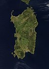
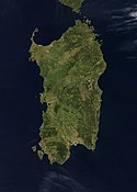
Credit Jeff Schmaltz, MODIS Rapid Response Team, NASA/GSFC The island of Sardinia sits between the Mediterranean Sea to the south and west and the Tyrrhenian Sea to the east. To its immediate north is the island of Corsica, which is a part of France. To the east of Sardinia is the middle of the Italian peninsula (not shown). Sardinia glows here with the green blush of spring.
Sardinia has had a tumultuous history. Starting in ancient times, the island was occupied by Phoenicians, Carthaginians, and Romans; thereafter it was controlled by Vandals, Byzantines, and a long string of rulers of Italian city-states. In the late 15th century, Sardinia came under the control of Spain, then in the early 18th century was passed to the Austrians. It briefly fell to Spanish occupation in 1717, but by 1720 was given over again to the control of Italian rule. This true-color Aqua MODIS image was acquired on April 27, 2003.Autor:
- Antarctic_Treaty_flag.svg: Alakasam.
- derivative work: B1mbo (talk)
Flag of the Antarctic Treaty
Satellite image of Amund Ringnes Island
Unimak Island, Alaska, United States - September 1992
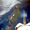
Seen in this southwest-looking, low-oblique photograph is Unimak Island, Alaska, the largest island in the Aleutian chain. The major volcano on the island (snow-capped peak at the center of the photograph), Shishaldin, rises approximately 9400 feet (2860 meters) and has been active during the last 175 years, with several eruptions occurring recently. The volcano is known locally as "Smoking Moses." At the southwestern end of the island is the snow-capped Pogromni Volcano. The blue lake situated in a large volcanic caldera, which can be seen midway between the Pogromni and Shishaldin volcanoes, is the result of a now extinct volcano that collapsed.
Satellitenfoto der Kodiak-Insel
Satellite image of Madagascar in September 2003. Slightly cropped, original taken from NASA's Visible Earth: [1]. Original description:
- The world's fourth largest island, Madagascar, is featured in this Moderate Resolution Imaging Spectroradiometer (MODIS) image taken by the Terra satellite on September 10, 2003. Several active fires, marked with red dots, burn in the central highlands, which are primarily covered with rice fields. The fires are probably controlled burns to clear farmland. The narrow strip of green along the east coast of the island is a rain forest. The west coast is lined with baobabs, a desert tree with a fat trunk, and thorny forest.
Wyspa Komsomolec
Wyspa Devon w Arktyce Kanadyjskiej, zdjęcie satelitarne NASA (MISR)
Wyspa Thurstona
Autor: Sadalmelik, Licencja: CC BY-SA 3.0
Topographic map of Buton and other nearby Islands in Indonesia. Created with GMT from SRTM data.
LIMA Satellite image of Berkner Island, Antarctica
LIMA Natural Color (Bands 3, 2, 1) -66 Percent brightness
+66 Percent contrastColor infrared view of Rinjani Volcano, Lombok Island, Indonesia
Fernandina Island; Galapagos Islands, Ecuador Fall/Winter 1996
The Galapagos Islands comprise a volcanic archipelago with 21 major islands located approximately 600 miles (965 kilometers) west of Ecuador. Named for their endemic large turtles, these islands, although isolated from much of the world, are known internationally for their beauty and unique flora and fauna. Theirs is a fragile environment that the government of Ecuador is trying to protect. Isabela, the seahorse-shaped and largest island, is about 82 miles (132 kilometers) long. Wolf Volcano, the northernmost and tallest (5600 feet - 1707 meters), is situated almost exactly on the equator. Fernandina, the roughly oval-shaped island west of Isabela, is the youngest of the volcanic islands and is still geologically active, with a most recent eruption occurring in 1995. Notice that calderas have formed in the shield volcanoes that formed the islands. The variety of colors on the islands indicate different ages of lava flows and also illustrate the impact that the elevations of the volcanic cones have on rainfall patterns from one side of the islands to the other. Note the lack of “color” on the northwest slopes or sides of the volcanoes, indicating the “rain-shadow effect.”
Axel Heiberg Island, Canadian Arctic Archipelago. NASA Blue Pearl data
Autor: Rotsee, Licencja: CC BY-SA 3.0
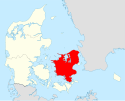
Själland, Zealand, Sjælland Denmark
Azores flag, from the xrmap flag collection 2.7.
The nine stars represent the nine islands which are: São Miguel, São Jorge, Terceira, Santa Maria, Graciosa, Faial, Pico, Flores, and Corvo.
The bird represent the goshawk which the word Azores derived from.
The shield represents the lesser arm of Portugal, of which the Azores is an autonomous region.Part of the Canadian Arctic Archipelago, Bylot Island is a 11,000-square-kilometer (4,200-square-mile) island within Canada’s Sirmilik National Park. In wintertime, snow and ice blanket the island in white, but in summertime, Bylot’s glaciers contrast with its earth-toned land cover. The Moderate Resolution Imaging Spectroradiometer (MODIS) on NASA’s Terra satellite observed Bylot Island on March 9, 2012 (top), and July 22, 2012 (bottom)
Aqua MODIS satellite image of Kotelnyy and Faddeyevsky Island, New Siberian Islands, Russia, connected by sandy Bunge Land
Hainan island, China. Satellite view.
Image of Puerto Rico taken by NASA during STS-34
Mission: STS034 Roll: 76 Frame: 88 Mission ID on the Film or image: STS34
Center Point Latitude: 18.0 Center Point Longitude: -66.5 (Negative numbers indicate south for latitude and west for longitude)
Satellite image of the island of Euboea (Greece)
Satellite image of Japan in May 2003.
- The islands of Japan are shown clearly off the coast of North and South Korea, China, and Russia in this true-color image. Running down through the islands are a string of mountains that make up part of the Pacific “Ring of Fire.†The Ring of Fire is a zone of frequent earthquakes and volcanic eruptions that stretches in a series of arcs from New Zealand, through Indonesia, up through the Philippines, Japan, the Kuril Islands and Kamchatka Peninsula (Russia), across the Pacific Ocean via the Aleutian Islands, and down the coast of the Americas. Seventy-five percent of the world’s volcanoes are in this ring, making it the most volcanically-active region on the planet. Also shown in this image are a number of fires, which are marked with red dots. A few fires were detected in Japan, China, and North Korea, but the majority were detected in Russia’s Primorskiy-Kray region. This true-color Aqua MODIS image was acquired on May 1, 2003.
Autor: derivative work: Angelus, Licencja: CC BY-SA 3.0
Topographic map of Guadlcanal island and the Nggela Islands (mexaco) — of the Solomon Islands archipelago, in the Solomon Islands (nation).
The flag of Aruba
Map showing location of Bokan mountain on Prince of Wales Island, Alaska; inset shows location of island in Alaska.
This image provides a nearly cloud-free view of the South Island of New Zealand, from the Moderate Resolution Imaging Spectroradiometer (MODIS) on NASA’s Aqua satellite.
From Earth Observatory website:
Colors ranging from deep brown to stark white give New Zealand’s South Island its intense beauty. The snow-capped Southern Alps run down the northern shore of the island. The highest peak in the range (and in New Zealand) is Aoraki/Mount Cook at 3,754 meters (12,316 ft). The mountains are rising as the Pacific Plate, the section of the Earth’s crust that holds the Pacific Ocean, including parts of New Zealand’s South Island, sinks beneath the Australia Plate, which holds the rest of New Zealand. The collision between the two plates pushes the mountains up and fosters volcanoes on the country’s North Island. Not only do the mountains mark the line between two tectonic plates, they also create different climate regions, which are visible in the image.
The shoreline west of the mountains receives more rain than any other place in the South Island. The rain-drenched shoreline is deep green, covered by temperature rain forests. To the south, the shore turns dark brown where rocky mountain terrain extends to the Pacific Ocean. Fingers of water cut into the western shore where glaciers cut deep fjords over time.
The landscape on the east side of the mountains is dramatically different. Hidden in the rain shadow of the Southern Alps, the region receives less rain than its neighbor and is correspondingly tan instead of green. The dry landscape is punctuated by alpine glacier lakes that hang like sapphire and aquamarine pendants from the mountain chain. Rivers also drain melting snow from the south side of the mountains into the Pacific Ocean. Over eons, the rivers have deposited finely ground rock from the mountains onto the landscape below, building nutrient-rich alluvial plains. Sediment washing into the ocean colors the water green blue. Spots of bright green accentuate the plains, an indication that these regions are cultivated. The large image reveals the grid of green made by fields of crops across the plains.
The Moderate Resolution Imaging Spectroradiometer (MODIS) on NASA’s Aqua satellite captured this photo-like image of the South Island on December 7, 2007, as spring began to give way to summer in this southern location. Places where the sensor detected fire are marked with red circles. The large image has a resolution of 250 meters per pixel, the highest resolution image available. The MODIS Rapid Response System provides the image in additional resolutions.
NASA image courtesy Jeff Schmaltz, MODIS Rapid Response Team at NASA GSFCAutor: Lencer, Licencja: CC BY-SA 3.0
Map of Barat Daya Islands and also the Leti Islands, Sermata Islands and Babar Islands
These true-color images of Indonesia were acquired by the Moderate Resolution Imaging Spectroradiometer in mid-May 2002. Fire season was not fully underway in the region, and skies over the large island of Borneo, with Malaysia at its northwest coast, are cloud-covered, but not hazy with air pollution. The horizontally situated island of java appears to be experiencing some haze at its western end, and a few scattered fires (red dots) were detected. These images were acquired on May 17 and 19, 2002.
Bathurst Island in the Canadian arctic. ASA blue pearl data.
Autor: Sadalmelik, Licencja: CC BY-SA 3.0
Relief (hypsometric) map of Sulawesi. Created with GMT from publicly released SRTM data. For locator version, see Image:Sulawesi_Locator_Topography.png
Sachalin w styczniu
This image is adapted from [1] NASA Visible Earth image VancouverIsland.A2003154.1930.250m.jpg and has been brightened and sharpened for better visibility, as well as trimmed to focus on Vancouver Island only. Boundaries shown are those of officially named mountain ranges on Vancouver Island, but here given without naming/numbering for other editors to work with if desired.
Yos Sudarso Island, Papua, Indonesia (formerly Frederik Hendrik Island)
Prince Patrick Island, Canada
Espiritu Santo as seen by the crew of STS068 aboard the Space Shuttle Endeavour on October 3rd, 1994. Unique photo number is STS068-215-75.
Cape Breton Island
Autor: Milenioscuro, Licencja: CC BY-SA 4.0
Locator map of XYZ province in the Philippines (see filename) Extracted from File:Ph_administrative_map_blank.svg
Satellite image of Tierra del Fuego. Very cloudy and snowy because this picture was taken during the southern hemisphere's autumn.
Autor: Klaus M. (Mikmaq), de-wiki, cropped and translated by Qyd, Licencja: CC BY-SA 3.0
Map of Prince Edward Island
Somerset Island in the Canadian arctic.
Satellite image of Jamaica in November 2001.
Insula Falkland de Vest 3D. Imagine realizata cu date SRTM furnizate liber de NASA.
Sattelite image of Majorca
The Lesser Sunda Islands, Indonesia Forming the southern arc of central Indonesia, the Lesser Sunda Islands link the island of Java (west) to the island of Timor (east). The islands stretch 1,200 kilometers west to east, and traverse the waters of the Timor, Sawu, Banda, and Flores Seas, as well as the Indian Ocean. Dotted across the islands are a number of fires, which are marked in bright red. Two tiny islands in this chain, Komodo and Rinca, are famous for being the home of dragons —of the non-mythical variety. Komodo Dragons are four-legged monitor lizards that are extremely fierce. They can weigh up to 130 kg (287 lbs) and grow to be over 3 meters (about 10 feet) in length. Komodo Dragons are a protected species, with only about 5700 of them living on these two and other smaller local islands. Komodo, Rinca, and Padar Islands (as well as numerous smaller islands) are part of Komodo National Park, which was established in 1980, and which was declared a World Heritage Site in 1991. Komodo Island is located just to the west of Flores Island, which is the long thin island dotted with numerous fires in the upper center of the image. This true-color Terra MODIS image was acquired on August 30, 2003.
Autor:
- Ph_locator_palawan_bataraza.png: Mike Gonzalez (TheCoffee)
- derivative work: JL 09 (talk) 14:22, 30 December 2009 (UTC)
Blank Map of Palawan
Autor: Oona Räisänen, Licencja: CC BY-SA 3.0
Topographic map of Buru.
Autor: See File history below for details., Licencja: CC0
The Flag of Dominica.
Satellite image of Cuba in November 2001.
Terra MODIS satellite image of snow-covered Newfoundland, Canada
Terra MODIS satellite image of Stefansson Island, Canada.
Mozaika zdjęć Wyspy Ellesmere'a z satelity Terra
Autor: Lencer, Licencja: CC BY-SA 3.0
Map of Seram Island and also Ambon Island and Lease Islands
Aqua MODIS satellite image of the New Siberian Islands, Russia
Autor: Sadalmelik, Licencja: CC BY-SA 3.0
Topographic map of Sumbawa, Indonesia. Created with GMT from SRTM data.
Terra MODIS satellite image of Disko Island (Qeqertarsuaq) off the west coast of Greenland
Autor: Sadalmelik, Licencja: CC BY-SA 3.0
Topographic map of Sumatra. Created with GMT from publicly released SRTM data. For locator vesion, see Image:Sumatra Locator Topography.png
Siple Island
Bolshevik island, Russia, Landsat-7 near natural image, 30 m resolution
Grass fires in Lafonia on East Falkland in the Falkland Islands
Satelitarne zdjęcie wyspy Hawaii
Map of Admiralty Island National Monument in Tongass National Forest, Alaska
Satellite picture of New Guinea
West of British Columbia, Canada, and south of the Yukon Territory, the southeastern coastline of Alaska trails off into the islands of the Alexander Archipelago. The area is rugged and contains many long, U-shaped, glaciated valleys, many of which terminate at tidewater. The Alexander Archipelago is home to Glacier Bay National Park. The large bay that has two forks on its northern end is Glacier Bay itself. The eastern fork is Muir inlet, into which runs the Muir glacier, named for the famous Scottish-born naturalist John Muir. Glacier Bay opens up into the Icy Strait. The large, solid white area to the west is Brady Icefield, which terminates at the southern end in Brady's Glacier.
A true-colour satellite view of Tasmania, including Flinder's Island, taken in the spring of 2005.
Description from NASA's Visible Earth website: http://visibleearth.nasa.gov/view.php?id=74906
Tasmania was emerald green with the flush of late spring when the Moderate Resolution Imaging Spectroradiometer (MODIS) on NASA’s Terra satellite captured this image on November 16, 2005. The western half of the island is covered with dense forest, which is darker green than grasslands in the east. Sitting below 40 degrees South, the island is the only part of Australia able to support a temperate rainforest. Above the northeast corner of Tasmania are Flinders Island (top), Cape Barren Island (center), and Clarke Island (closest to Tasmania). Tasmania is thought to have been a part of mainland Australia until the end of the last ice age 10,000 years ago when sea levels rose and made Tasmania into an island.Autor: Magalhães, Licencja: CC-BY-SA-3.0
Locator map of Cebu Island, Philippines
It is easy to see from this true-colour image why Ireland is called the Emerald Isle. Intense green vegetation, primarily grassland, covers most of the country except for the exposed rock on mountaintops. Ireland owes its greenness to moderate temperatures and moist air. The Atlantic Ocean, particularly the warm currents in the North Atlantic Drift, gives the country a more temperate climate than most others at the same latitude.
Autor: Modified by Dr. Blofeld, Licencja: CC BY 3.0
Relief map showing Murder Cove, Alaska
Cornwallis Island
The western and central parts of Crete appear surrounded by quicksilver in this astronaut photograph taken from the International Space Station. This phenomenon is known as sunglint, caused by light reflecting off of the sea surface directly toward the observer. The point of maximum reflectance is visible as a bright white region to the north-west of the island. Surface currents causing variations in the degree of reflectance are visible near the south-western shoreline of Crete and the smaller island of Gavdos (image lower left).
Autor: Magalhães, Licencja: CC-BY-SA-3.0
Map of the Philippine island Panay
Spaatz Island and DeAtley Island (much smaller, to the right)
Wyspa Carneya
Part of the Russian Federation, Wrangel Island rests above the Arctic Circle between the Chukchi and East Siberian Seas, northeast of Siberia. Skies were clear over the island, giving the Moderate Resolution Imaging Spectroradiometer (MODIS) on NASA’s Aqua satellite a chance to capture this image.
Autor: Sadalmelik, Licencja: CC BY-SA 3.0
Topographic map of Madura, Indonesia. Created with GMT from SRTM data.
Terra MODIS satellite image of Coats Island, Canada.
Autor:
Flag of Autonomous Region of Madeira, Portugal
Wyspa Kołgujew z satelity Terra
Autor: European Space Agency, Licencja: CC BY-SA 3.0 igo
The island of South Georgia as seen from The Copernicus Sentinel-2 mission. This southern Atlantic island is linked with the South Sandwich Islands to form a British Overseas Territory.
Mozaika zdjęć Wyspy Baffina z satelity Aqua
Satellite image of Hokkaido, Japan in May 2001. Taken from NASA's Visible Earth http://visibleearth.nasa.gov/view_rec.php?id=2060. This MODIS true-color image shows Hokkaido, Japan, at the top, and the northern tip of the island off Honshu at the bottom.
The flag of Guam, courtesy an e-mail from the author of xrmap. Modifications by Denelson83.
Autor: Sadalmelik, Licencja: CC BY-SA 3.0
Topography of Halmahera, Indonesia. Created with GMT from SRTM data.
Wyspa Adelajdy - zdjęcie satelitarne
Santa Isabel, wyspa w archipelagu Wysp Salomona, widoczna z Międzynarodowej Stacji Kosmicznej
Autor: User Magalhães on nl.wikipedia, Licencja: CC-BY-SA-3.0
De lokatie van het eiland nl:Negros in de nl:Filipijnen. kaartje bewerkt door Magalhães. Originele kaartje van seav.
Autor: Sadalmelik, Licencja: CC BY-SA 3.0
Topographic map of Nias, Indonesia. Created with GMT from SRTM data.
Autor: Sadalmelik, Licencja: CC BY-SA 3.0
Topographic map of Mentawai Islands, Indonesia. Created with GMT from SRTM data.
Topography of Java. Created with GMT from publicly released SRTM data. For locator version, see Image:Java Locator Topography.png
Terra MODIS satellite image of Mackenzie King Island, Canada. Brock Island is on the left.
Terra MODIS satellite image of Nunivak Island (Alaska) in the Bering Sea
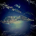
A view of the Caribbean island of Hispaniola from the International Space Station. This island is comprised of Haiti (in the center left of the image) and the Dominican Republic and is part of the Greater Antilles island chain which lies along the geological border of the North America Plate and the Caribbean Plate. A major fault line in the region, Enriquillo-Plantain Garden Fault, runs along the longer peninsula, in the foreground, and just south of Port-au-Prince. Part of a docked Russian spacecraft can be seen in the foreground. The epicenter of the disastrous 2010 earthquake occurred near this fault. This image was taken by the Expedition 20 crew on the International Space Station on Sept. 28, 2009 using a 25 mm lens setting.
NASA Landsat satellite global mosaic image of Long Island, New York
Source link: [1]
(Image was color corrected.)Prince Charles Island, Canada
This satellite image of New Zealand's North Island has been cropped from an image of both of New Zealand's main islands. "This stunning true-color image provides a rare, cloud-free look at the island nation of New Zealand, including most of its North and South Islands. This scene was acquired by the Moderate Resolution Imaging Spectroradiometer (MODIS), flying aboard NASA’s Terra satellite, on October 23, 2002. New Zealand is situated in the South Pacific Ocean, roughly 2,000 km (1,250 miles) southeast of Australia. Wellington, the capital of New Zealand, is located on the southern tip of the North Island, looking across Cook Strait toward South Island."
Satellite image of Trinidad and Tobago.
Autor: Sadalmelik, Licencja: CC BY-SA 3.0
Topographic maps of Bangka. Created with GMT from SRTM data
Terra MODIS satellite image of Edgeøya (bottom) and Barentsøya (top), Svalbard
Landsat image of the northern end of Bananal Island, Brazil
Autor: JL 09, Licencja: CC BY-SA 3.0
Mindanao Island (mainland Mindanao, Mindanao proper) in bright red. Associated islands in the Mindanao group of islands (Mindanao island group) are in maroon.
Autor: Sadalmelik, Licencja: CC BY-SA 3.0
Topographic map of Flores, Indonesia. Created with GMT from SRTM data.
Satellite image of Ellef Ringnes Island
Terra MODIS satellite image of Nordaustlandet, Svalbard
Autor: User:Guenny (Christian Günther) made this map of the Japanese Inland Sea (Setonaikai,瀬戸内海) for the German Wikipedia. de:Seto-Inlandsee. It's showing the Japanese islands surrounding the sea with the major straits and channels. Guenny is willing to do translations to other languages if needed, as well as corrections and enhancements., Licencja: CC-BY-SA-3.0
The Range of the Seto Inland Sea by the Territorial Sea Law (領海及び接続水域に関する法律) is 19,700 km2 (solid lines). Reference: Seto_Inland_Sea01.png . The Range of the Seto Inland Sea according to the Setouchi Law and the Setouchi Law Enforcement Order is 21,827 km2 (solid lines and dashed lines). Reference: Seto_Inland_Sea02.png.
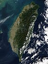
Satellite photo of Taiwan. Description by NASA: "The island of Taiwan sits off of the coast of southern China between the East China Sea, the South China Sea, southwestern Japan's Nansei-shoto Islands, and the Pacific Ocean. The island is mostly mountainous in the east, but gradually transitions to gently sloping plains in the west. At the northern tip of the island is Taiwan's capital city, Taipei, which appears as a large grayish patch surrounded by dark green. In this image, most of Taiwan's eastern coast is dotted with low clouds, with low and high clouds off the coast in the Pacific Ocean. MODIS also detected three fires, which are marked in red. This true-color Terra MODIS was acquired December 15, 2002."
Much of the left side of this NASA image with north to the upper left is covered by volcanic products from Tore (volcano) in the Emperor Range on NW Bougainville Island. The Tore massif lies to the left of the light-colored area at the center of the image, Mount Balbi volcano. The dark-colored caldera lake of Billy Mitchell (volcano) is at the right, above an ash plume originating from Bagana volcano. Papua New Guinea
Topographic map of New Ireland in Papua New Guinea. Created with GMT from publicly released SRTM data.
Banks-Insel und Victoria-Insel, Kanada
Roosevelt Island and coast of Ross Ice Shelf, Antarctica. Darkened and cropped from a wider view of the ice shelf, a true-color image from NASA’s Moderate Resolution Imaging Spectroradiometer (MODIS) taken on November 11 and 12, 2001.
Three volcanoes in Papua New Guinea’s West New Britain province spewed ash on June 21, 2005. The Moderate Resolution Imaging Spectroradiometer (MODIS), flying on NASA’s Aqua satellite captured this image of Langila, Ulawun, and Rabaul the same day. At the time MODIS captured this image, Langila showed the biggest plume of volcanic ash, followed by Ulawun. Both volcanoes are enlarged below the main image. In all cases, winds pushed the ash clouds to the northwest, over the ocean.
Autor: Createaccount, Licencja: CC BY-SA 3.0
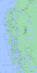
Hoste island, Gordon Island, Beagle Channel
Flag of the en:French Southern and Antarctic Lands, official since 23 February 2007
Wyspa Rewolucji Październikowej


