Litomierzyce
 Stary Ratusz (obecnie muzeum) i kościół Wszystkich Świętych | |||||
| |||||
| Państwo | |||||
|---|---|---|---|---|---|
| Kraj | |||||
| Powiat | |||||
| Burmistrz | Ladislav Chlupáč | ||||
| Powierzchnia | 17,99 km² | ||||
| Wysokość | 136 m n.p.m. | ||||
| Populacja (2006) • liczba ludności |
| ||||
| Kod pocztowy | 412 01 | ||||
| Tablice rejestracyjne | U | ||||
| Podział miasta | 4 części | ||||
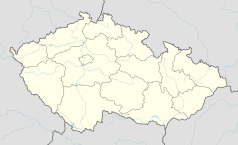
Położenie na mapie Czech (c) Karte: NordNordWest, Lizenz: Creative Commons by-sa-3.0 de | |||||
| Strona internetowa | |||||
| Portal | |||||
Litomierzyce (cz. Litoměřice, niem. Leitmeritz) – miasto w Czechach, w kraju usteckim, siedziba powiatu Litomierzyce. Leży na Średniogórzu Czeskim, u zbiegu Łaby i Ohrzy. Według danych z 31 grudnia 2003 powierzchnia miasta wynosiła 1799 ha, a liczba jego mieszkańców 24 489 osób.
Demografia
Liczba mieszkańców do 1950
| rok | mieszkańcy | Niemcy | Czesi |
|---|---|---|---|
| 1787 | 2830 | – | – |
| 1854 | 6068 | – | – |
| 1880 | 10 854 | 9263 | 1417 |
| 1890 | 11 342 | 10 004 | ? |
| 1900 | 13 075 | 11 532 | 1329 |
| 1910 | 15 421 | 13 165 | 2034 |
| 1921 | 16 988 | 11 015 | 5066 |
| 1930 | 18 498 | 10 878 | 6485 |
| 1939 | 17 259 | – | – |
| 1947 | 14 402 | – | – |
| 1950 | 14 035 | – | – |
Źródło: Wikipedia de [1][niewiarygodne źródło?]
Liczba mieszkańców od 1970
| Rok | 1970 | 1980 | 1991 | 2001 | 2003 |
|---|---|---|---|---|---|
| Liczba ludności | 19 595 | 22 869 | 25 719 | 24 879 | 24 489 |
Źródło: Czeski Urząd Statystyczny
Współpraca
Galeria
Linki zewnętrzne
Media użyte na tej stronie
Autor: Afil, Licencja: CC BY-SA 3.0
Location map of Usti nad Labem Czech Republic
(c) Karte: NordNordWest, Lizenz: Creative Commons by-sa-3.0 de
Location map of the Czech Republic
Flag of Ústí nad Labem Region
Autor: de:User:Kläuser (selbst fotografiert), Licencja: CC-BY-SA-3.0
Annunciation church and Jesuite college by O. Broggio in Litoměřice, Czech Republic.
Usti nad Labem Region CoA
A view of main square of Litoměřice from House “Goblet”, Czech Republic. W half of the square with brewery (originally a medieval castle) beyond its NW corner. On a slope in the background village of Miřejovice, the horizon is framed with hills of the České středohoří: left Bídnice (361 m), middle Plešivec (509 m), right Hradiště (545 m).
Cathedral of St. Stephen with belfry in Litoměřice, Czech Republic. A view from The Chalice House in the southwest direction. Hazmburk Castle is visible on the left horizon, less than 14 km away.
Litomšřice (town in northwest Bohemia, Czech Republic) as seen from the Radobýl Hill. In background on the left side hills of České středohoří Mountains, on the right edge the Labe (Elbe) River


