Livermore (Kalifornia)
| ||||
| ||||
 | ||||
| Państwo | ||||
| Stan | ||||
| Hrabstwo | Alameda | |||
| Data założenia | 1835 | |||
| Prawa miejskie | 1876 | |||
| Kod statystyczny | FIPS: 06-41992 GNIS ID: 0277542 | |||
| Zarządzający | John Marchand | |||
| Powierzchnia | 65,204 km² | |||
| Wysokość | 150 m n.p.m. | |||
| Populacja (2010) • liczba ludności • gęstość | 80 968 1241,9 os./km² | |||
| Nr kierunkowy | 925 | |||
| Kod pocztowy | 94550-94551 | |||
| Strefa czasowa | UTC-08:00 UTC-07:00 | |||
| Strona internetowa | ||||
| Portal | ||||
Livermore – miasto w Stanach Zjednoczonych, w stanie Kalifornia, w hrabstwie Alameda.
Liczy ok. 82 tys. mieszkańców (2005). Stanowi ośrodek badań nuklearnych i techniki laserowej. Miasto jest również centrum usługowym. Dominuje w nim produkcja białych win wytrawnych[1].
Na cześć miasta nazwano pierwiastek chemiczny - Liwermor.
Żarówka z Livermore
Jedną z atrakcji Livermore jest żarówka o mocy 4 watów znajdująca się w siedzibie straży pożarnej, która świeci tam niemal nieprzerwanie od 1901 r. (kilkakrotnie ją przenoszono).
Żarówka nazywana Centennial Light została wyprodukowana pod koniec XIX wieku przez firmę Shelby Electric, nieistniejącą od 1914 roku. Jej długi okres eksploatacji został zauważony w 1972 r. przez reportera Mike'a Dunstana. Z biegiem lat stawała się coraz bardziej znana – oglądali ją amerykańscy prezydenci, wyprawiono jej oficjalne setne urodziny.
Miasta partnerskie
 Quetzaltenango, Gwatemala
 Snieżynsk, Rosja
 Yotsukaidō, Japonia
Przypisy
- ↑ Livermore, [w:] Encyklopedia PWN [online] [dostęp 2008-05-12].
Media użyte na tej stronie
Autor: NordNordWest, Licencja: CC BY 3.0
Location map of California, USA
Autor: Uwe Dedering, Licencja: CC BY-SA 3.0
Location map of the USA (without Hawaii and Alaska).
EquiDistantConicProjection:
Central parallel:
* N: 37.0° N
Central meridian:
* E: 96.0° W
Standard parallels:
* 1: 32.0° N
* 2: 42.0° N
Made with Natural Earth. Free vector and raster map data @ naturalearthdata.com.
Formulas for x and y:
x = 50.0 + 124.03149777329222 * ((1.9694462586094064-({{{2}}}* pi / 180))
      * sin(0.6010514667026994 * ({{{3}}} + 96) * pi / 180))
y = 50.0 + 1.6155950752393982 * 124.03149777329222 * 0.02613325650382181
      - 1.6155950752393982  * 124.03149777329222 *
     (1.3236744353715044  - (1.9694462586094064-({{{2}}}* pi / 180))
      * cos(0.6010514667026994 * ({{{3}}} + 96) * pi / 180))
The flag of Navassa Island is simply the United States flag. It does not have a "local" flag or "unofficial" flag; it is an uninhabited island. The version with a profile view was based on Flags of the World and as a fictional design has no status warranting a place on any Wiki. It was made up by a random person with no connection to the island, it has never flown on the island, and it has never received any sort of recognition or validation by any authority. The person quoted on that page has no authority to bestow a flag, "unofficial" or otherwise, on the island.
Flag of California. This version is designed to accurately depict the standard print of the bear as well as adhere to the official flag code regarding the size, position and proportion of the bear, the colors of the flag, and the position and size of the star.
Autor: Daniel Schwen, Licencja: CC BY-SA 4.0
Former fire station in Livermore, CA
Autor: Arkyan, Licencja: CC-BY-SA-3.0
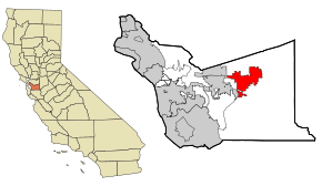
This map shows the incorporated and unincorporated areas in Alameda County, California, highlighting Livermore in red. It was created with a custom script with US Census Bureau data and modified with Inkscape.


