Llangollen
 Widok na murowane domy | |
| Państwo | |
|---|---|
| Księstwo | |
| Hrabstwo | |
| Populacja (2001) • liczba ludności |
|
| Nr kierunkowy | 01978 |
| Kod pocztowy | LL20 |
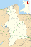
Położenie na mapie Denbighshire Contains Ordnance Survey data © Crown copyright and database right, CC BY-SA 3.0 | |
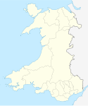
Położenie na mapie Wielkiej Brytanii (c) Karte: NordNordWest, Lizenz: Creative Commons by-sa-3.0 de | |
| Strona internetowa | |
| Portal | |
Llangollen (wymowa [ɬaŋˈɡoɬɛn]) – miasteczko w walijskim hrabstwie Denbighshire, położone nad rzeką Dee.
Przypisy
- ↑ Office for National Statistics : Census 2001 : Parish Headcounts : Denbighshire Retrieved 2009-12-14
Media użyte na tej stronie
(c) Karte: NordNordWest, Lizenz: Creative Commons by-sa-3.0 de
Location map of the United Kingdom
Autor: NordNordWest, Licencja: CC BY-SA 3.0
Location map of Wales, United Kingdom
Contains Ordnance Survey data © Crown copyright and database right, CC BY-SA 3.0
Blank map of Denbighshire, UK with the following information shown:
- Administrative borders
- Coastline, lakes and rivers
- Roads and railways
- Urban areas
Equirectangular map projection on WGS 84 datum, with N/S stretched 165%
Geographic limits:
- West: 3.65W
- East: 3.05W
- North: 53.40N
- South: 52.85N
Autor: Manfred Heyde, Licencja: CC BY-SA 3.0
Village of Llangollen in North Wales/UK, view over the town


