Loch Gowna
(c) Oliver Dixon, CC BY-SA 2.0 Widok od strony jeziora Gowna | |
| Państwo | |
|---|---|
| Prowincja | Ulster |
| Hrabstwo | Cavan |
| Populacja (2011) • liczba ludności | 229[1] |
| Tablice rejestracyjne | CN |
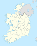
Loch Gowna – wieś w hrabstwie Cavan w Irlandii położona na północno-wschodnim brzegu jeziora Gowna. Do 1950 roku wieś posiadała nazwę Scrabby, zmienioną w wyniku plebiscytu[2].
Przypisy
- ↑ Census 2011 Preliminary Report. [zarchiwizowane z tego adresu].
- ↑ Cavan County Council Minutes (ang.). Cavan County Council.
Media użyte na tej stronie
(c) Oliver Dixon, CC BY-SA 2.0
North-west corner of Lough Gowna Lough Gowna is one of the largest loughs in the Irish lakeland, and is divided between Counties Longford and Cavan. The lough which extends to 728 hectares in area is of extremely convoluted outline, consisting as it does of drowned drumlin country. The River Erne enters and leaves the eastern tip of the Lough. The waters of the lough offer prime coarse angling.


