Londrina
| Ten artykuł od 2015-08 wymaga zweryfikowania podanych informacji. |
| |||||
 | |||||
| Państwo | |||||
| Stan | |||||
| Data założenia | 1929[1] | ||||
| Burmistrz | Marcelo Belinati | ||||
| Powierzchnia | 1650,809 km² | ||||
| Wysokość | 576 m n.p.m. | ||||
| Populacja (2009) • liczba ludności • gęstość | 510 707 309,36 os./km² | ||||
| Nr kierunkowy | 43 | ||||
| Kod pocztowy | 86000-000 | ||||
| Strona internetowa | |||||
Londrina – miasto w południowej Brazylii, w północnej części stanu Parana. Około 447 tys. mieszkańców.
Miasto jest siedzibą klubu piłkarskiego Londrina EC.
Siedziba Regionu Metropolitalnego Londrina (RML), drugiej co do wielkości aglomeracji miejskiej w stanie, której ludność szacowano w 2020 na 575 377 mieszkańców[2].
W mieście rozwinął się przemysł spożywczy oraz drzewny[1].
Współpraca
Przypisy
- ↑ a b Londrina, [w:] Encyklopedia PWN [online] [dostęp 2021-07-21].
- ↑ {{{tytuł}}}, cidades.ibge.gov.br [dostęp 2020-10-21].tytuł
Media użyte na tej stronie
Flag of Paraná, Brazil
Brasão de Armas do Município de Londrina no Estado do Paraná, Brasil./ Coat of Arms of Paraná's city Londrina, Brazil
Autor:
- Parana_MesoMicroMunicip.svg: Raphael Lorenzeto de Abreu
- derivative work: Milenioscuro (talk)
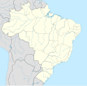
Location map of Paraná state.
Equirectangular projection, N/S stretching 110 %. Geographic limits of the map:
- N: 22.35° S
- S: 26.78° S
- W: 54.79° W
- E: 47.90° W
The flag of Navassa Island is simply the United States flag. It does not have a "local" flag or "unofficial" flag; it is an uninhabited island. The version with a profile view was based on Flags of the World and as a fictional design has no status warranting a place on any Wiki. It was made up by a random person with no connection to the island, it has never flown on the island, and it has never received any sort of recognition or validation by any authority. The person quoted on that page has no authority to bestow a flag, "unofficial" or otherwise, on the island.
Autor: Allice Hunter, Licencja: CC BY-SA 4.0
Montage of Londrina, Paraná, Brazil. From left to right and top to bottom: Igapó Lake, Museum of Londrina; Cathedral of Londrina; Greenhouse of the Botanic Garden of Londrina; Tomi Nakagawa Square


