Los Cabos
(c) Stan Shebs, CC BY-SA 3.0 | |||||
| |||||
| Państwo | |||||
|---|---|---|---|---|---|
| Powierzchnia | 3750,93 km² | ||||
| Populacja (2015) • liczba ludności • gęstość | 330 312 88,1 os./km² | ||||
| Nr kierunkowy | 624 | ||||
| Kod pocztowy | 23400–23597 | ||||
| Strona internetowa | |||||
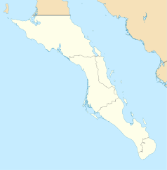
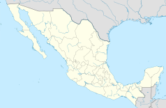
Los Cabos – gmina w Meksyku, położone na Półwyspie Kalifornijskim w stanie Kalifornia Dolna Południowa. Zajmuje powierzchnię 3750,93 km². Populacja gminy w roku 2015 wnosiła 330 312 mieszkańców[1]. Siedzibą gminy jest San José del Cabo.
Największe miasta gminy (ponad 10 tysięcy mieszkańców) to[2]:
- San José del Cabo - 93 069
- Cabo San Lucas - 81 111
- Colonia del Sol - 64 055
- Las Palmas - 15 419
- Las Veredas - 13 973
W czerwcu 2012 odbył się tam szczyt G20[3].
Przypisy
- ↑ Carlos Mendoza Davis i in.: LOS CABOS Información Estratégica (hiszp.). setuesbcs.gob.mx, 2020. s. 6. [dostęp 2022-02-04].
- ↑ Carlos Mendoza Davis i in.: LOS CABOS Información Estratégica (hiszp.). setuesbcs.gob.mx, 2020. s. 8. [dostęp 2022-02-04].
- ↑ G20: Polska powinna zastąpić Argentynę. forsal.pl, 2012-04-17. [dostęp 2012-05-03]. [zarchiwizowane z tego adresu (2012-06-23)].
Media użyte na tej stronie
Autor:
- Baja_California_Sur_Location_Map.svg: Addicted04
- derivative work: Spischot (talk)
Own work as from the map of municipalities of INEGI and costs taken from OpenStreetMap.org (under Creative Commons Attribution-Share Alike 2.0 Generic Licence). Limits of map:
- West : 115.50' W
- Est : 109.00º W
- North : 28.50° N
- South : 22.50° N
This is a shield image.
Coat of arms of Baja California Sur. Shades on the coat of arms are as follows:
- PANTONE 534 C
- PANTONE 485 C
- PANTONE YELLOW C
- PANTONE 429 C


