Los Silos
 | |||||
| Państwo | |||||
|---|---|---|---|---|---|
| Wspólnota autonomiczna | |||||
| Prowincja | |||||
| Alkad | Santiago Martin Perez | ||||
| Powierzchnia | 24,23[1] km² | ||||
| Populacja (2011) • liczba ludności • gęstość |
| ||||
| Kod pocztowy | 38470 | ||||
| Tablice rejestracyjne | TF | ||||
| Strona internetowa | |||||
| Portal | |||||
Los Silos – gmina w Hiszpanii, w prowincji Santa Cruz de Tenerife, we wspólnocie autonomicznej Wysp Kanaryjskich, o powierzchni 24,23[1] km². W 2011 roku gmina liczyła 5119[1] mieszkańców.
Przypisy
- ↑ a b c d Ministerio de Hacienda y Administraciones Públicas: Datos del registro de Entidades Locales. [dostęp 2013-06-16]. (hiszp.).
Media użyte na tej stronie
Autor: Pedro A. Gracia Fajardo, escudo de Manual de Imagen Institucional de la Administración General del Estado, Licencja: CC0
Flaga Hiszpanii
Autor: NordNordWest, Licencja: CC BY-SA 3.0
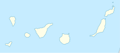
Location map of the Canary Islands, Spain
main square in Los silos town, Tenerife, Canary Islanda, Spain
Flag of Los Silos, in Santa Cruz de Tenerife (Spain)
Autor: HansenBCN, Licencja: CC-BY-SA-3.0
Santa Cruz de Tenerife province flag
Autor: Tentotwo, Licencja: CC BY-SA 3.0
Relief location map of Atlantic_Ocean.
- Projection: Lambert azimuthal equal-area projection.
- Area of interest:
- N: 70.0° N
- S: -70.0° N
- W: -95.0° E
- E: 25.0° E
- Projection center:
- NS: 0.0° N
- WE: -35.0° E
- GMT projection: -JA-35.0/0.0/180/19.998266666666666c
- GMT region: -R-147.58842045747764/-48.58942183011819/77.58842045747762/48.589421830118205r
- Land, shoreline and borders: 1:110m Natural Earth Datasets
Escudo de Los Silos, en Santa Cruz de Tenerife (España)


