Lost City (meteoryt)
| ||
| Sposób odkrycia | Spadły | |
| Państwo | ||
| Stan | ||
| Miejsce znalezienia | Lost City | |
| Data znalezienia | 3 stycznia 1970 | |
| Typ | meteoryt kamienny, chondryt | |
| Klasa | oliwinowo-bronzytowy | |
| Grupa | H5 | |
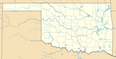
Lost City – meteoryt kamienny należący do chondrytów oliwinowo-bronzytowych grupy H5, spadły 3 stycznia 1970 roku w okolicach miasta Lost City w stanie Oklahoma w USA. Przelot meteorytu Lost City był pierwszym zarejestrowanym przez kamery Preriowej Sieci Bolidowej USA przelotem bolidu w Stanach Zjednoczonych. Na miejscu spadku znaleziono cztery fragmenty meteorytu o łącznej masie 17 kg. Największy okaz ważył 9,8 kg.
Bibliografia
- Tajemnice kamieni z nieba, Marek Żbik, Warszawa 1987, str.103,104.
Media użyte na tej stronie
Autor: Uwe Dedering, Licencja: CC BY-SA 3.0
Location map of the USA (without Hawaii and Alaska).
EquiDistantConicProjection:
Central parallel:
* N: 37.0° N
Central meridian:
* E: 96.0° W
Standard parallels:
* 1: 32.0° N
* 2: 42.0° N
Made with Natural Earth. Free vector and raster map data @ naturalearthdata.com.
Formulas for x and y:
x = 50.0 + 124.03149777329222 * ((1.9694462586094064-({{{2}}}* pi / 180))
      * sin(0.6010514667026994 * ({{{3}}} + 96) * pi / 180))
y = 50.0 + 1.6155950752393982 * 124.03149777329222 * 0.02613325650382181
      - 1.6155950752393982  * 124.03149777329222 *
     (1.3236744353715044  - (1.9694462586094064-({{{2}}}* pi / 180))
      * cos(0.6010514667026994 * ({{{3}}} + 96) * pi / 180))
The flag of Navassa Island is simply the United States flag. It does not have a "local" flag or "unofficial" flag; it is an uninhabited island. The version with a profile view was based on Flags of the World and as a fictional design has no status warranting a place on any Wiki. It was made up by a random person with no connection to the island, it has never flown on the island, and it has never received any sort of recognition or validation by any authority. The person quoted on that page has no authority to bestow a flag, "unofficial" or otherwise, on the island.
Autor: Alexrk, Licencja: CC BY 3.0
Ta mapa została stworzona za pomocą GeoTools.
Shiny orange button/marker widget.


