Lublin (Wisconsin)
| ||
| Państwo | ||
|---|---|---|
| Stan | ||
| Hrabstwo | Taylor | |
| Powierzchnia | 3,99 km² | |
| Wysokość | 392 m n.p.m. | |
| Populacja (2011) • liczba ludności • gęstość | 118 29,6 os./km² | |
| Strona internetowa | ||
| Portal | ||
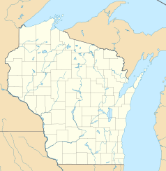
Lublin – wioska w hrabstwie Taylor w stanie Wisconsin, w Stanach Zjednoczonych Ameryki.
Położenie
Lublin jest położony u źródeł rzeki Eau Claire. będącej dopływem rzeki Chippewa, uchodzącej do Missisipi.
Wioska zajmuje powierzchnię 3,9 km² (1,5 mi²).
Historia
Nazwa wsi pochodzi od Lublina we wschodniej Polsce[1], nadanej jej przez chicagowskiego agenta nieruchomości Marvina Durskiego[2], którego rodzina pochodziła z ze wspomnianego polskiego miasta.
Demografia
Według spisu z 2011 roku wioska liczy 118 osób żyjących w 59 gospodarstwach domowych. Osoby te stanowią 32 rodziny.
Religia
We wsi działają trzy świątynie parafialne[3]:
- cerkiew Zaśnięcia Matki Bożej w Lublinie (Holy Assumption Orthodox Church in Lublin)[4] – parafia[5] diecezji Środkowego Zachodu OCA (dekanat Minneapolis); założona w 1908 r, przez greckokatolickich austro-węgierskich Rusinów z Karpat i z Galicji, którzy pod wpływem niechętnej postawy hierarchów łacińskich wobec obrzędowości bizantyjskiej przeszli na prawosławie[6];
- kościół Wniebowzięcia Najświętszej Maryi Panny w Lublinie (St Mary's Polish National Catholic Church in Lublin)[7] – parafia diecezji zachodniej PNKK (seniorat północno-zachodni[8]);
- kościół św. Stanisława w Lublinie[9] (St. Stanislaus Church in Lublin) – rzymskokatolicka parafia diecezji Superior.
Urodzeni w Lublinie
- Joseph Sweda(ang.) (1926–2015) – amerykański farmer i polityk, członek zgromadzenia stanowego Wisconsin (Wisconsin State Assembly) z ramienia Partii Demokratycznej (1963–1974)
Przypisy
- ↑ Kevin Carr: Centennial Celebration Puts Quiet Taylor County Village on the Map (ang.). www.wsaw.com, 2015-07-26. [dostęp 2019-02-15].
- ↑ Jennifer Herman: Wisconsin Encyclopedia. Hamburg (Minnesota): 2008, s. 383. ISBN 978-1-8785926-1-3.
- ↑ Churches and Community Organizations (ang.). Villageoflublin.com. [dostęp 2019-02-15].
- ↑ Holy Assumption, Orthodox Church in America, Lublin, Wisconsin (ang.). Holyassumptionwi.org, 2015-07-26. [dostęp 2019-02-15].
- ↑ Diocese of the Midwest – Parish Directory (ang.). Domoca.org. [dostęp 2019-02-15].
- ↑ Annmarie Adams, Sally McMurry: Exploring Everyday Landscapes. Knoxville: 1997, s. 202. ISBN 0-87049-983-1.
- ↑ Parish Directory – Polish National Catholic Church (ang.). www.pncc.org. [dostęp 2019-02-15].
- ↑ Our parishes (ang.). Westerndiocesepncc.org. [dostęp 2019-02-15].
- ↑ St. Stanislaus – Diocese of Superior –Superior, WI (ang.). Catholicdos.org. [dostęp 2019-02-15].
Linki zewnętrzne
- Village of Lublin – Living the Good Life in Lublin, WI (ang.). Villageoflublin.com. [dostęp 2019-02-15].
Media użyte na tej stronie
Autor: Alexrk2, Licencja: CC BY 3.0
Ta mapa została stworzona za pomocą GeoTools.
Autor: Uwe Dedering, Licencja: CC BY-SA 3.0
Location map of the USA (without Hawaii and Alaska).
EquiDistantConicProjection:
Central parallel:
* N: 37.0° N
Central meridian:
* E: 96.0° W
Standard parallels:
* 1: 32.0° N
* 2: 42.0° N
Made with Natural Earth. Free vector and raster map data @ naturalearthdata.com.
Formulas for x and y:
x = 50.0 + 124.03149777329222 * ((1.9694462586094064-({{{2}}}* pi / 180))
      * sin(0.6010514667026994 * ({{{3}}} + 96) * pi / 180))
y = 50.0 + 1.6155950752393982 * 124.03149777329222 * 0.02613325650382181
      - 1.6155950752393982  * 124.03149777329222 *
     (1.3236744353715044  - (1.9694462586094064-({{{2}}}* pi / 180))
      * cos(0.6010514667026994 * ({{{3}}} + 96) * pi / 180))
The flag of Navassa Island is simply the United States flag. It does not have a "local" flag or "unofficial" flag; it is an uninhabited island. The version with a profile view was based on Flags of the World and as a fictional design has no status warranting a place on any Wiki. It was made up by a random person with no connection to the island, it has never flown on the island, and it has never received any sort of recognition or validation by any authority. The person quoted on that page has no authority to bestow a flag, "unofficial" or otherwise, on the island.


