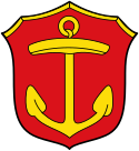
Ludwigshafen am Rhein
| |||||
 | |||||
| Państwo | |||||
|---|---|---|---|---|---|
| Kraj związkowy | |||||
| Zarządzający | Jutta Steinruck | ||||
| Powierzchnia | 77,68 km² | ||||
| Populacja (31.12.2013) • liczba ludności • gęstość | 161 518 2 103 os./km² | ||||
| Nr kierunkowy | 0621 | ||||
| Kod pocztowy | 67059–67071 | ||||
| Tablice rejestracyjne | LU | ||||
| Strona internetowa | |||||
| Portal | |||||
Ludwigshafen am Rhein – miasto na prawach powiatu w Niemczech, w kraju związkowym Nadrenia-Palatynat, siedziba powiatu Rhein-Pfalz, drugie po Moguncji pod względem liczby ludności miasto kraju związkowego.
Ludwigshafen am Rhein wywodzi się z dawnego Szańca Reńskiego (Mannheimer Rheinschanze) i leży na lewym brzegu Renu naprzeciwko badeńskiego miasta Mannheim. Jest znane głównie dzięki fabryce BASF, która ma tu swoją siedzibę.
Najbliżej położonymi miastami są: Mannheim, Heidelberg (ok. 25 km na południowy zachód), Karlsruhe (ok. 50 km na południe) i Moguncja (ok. 60 km na północ).
Ludwigshafen jest jednym z pięciu głównych centrów Nadrenii-Palatynatu, wraz z Mannheim tworzy tzw. centrum podwójne (konurbację). Miasto należy do Regionu Rhein-Neckar.
W roku 1925 populacja miasta przekroczyła 100 tys. mieszkańców – Ludwigshafen stało się w ciągu niecałego wieku od powstania (1853) dużym miastem.
3 kwietnia 1930 urodził się w tym mieście kanclerz Helmut Kohl.
Transport
W mieście znajdują się następujące stacje kolejowe: Ludwigshafen (Rhein) Hauptbahnhof, Ludwigshafen (Rhein) Mitte i Ludwigshafen-Mundenheim.
Sport
- TSG Friesenheim – klub piłki ręcznej mężczyzn
Współpraca
Miejscowości partnerskie[1]:
 Antwerpia, Belgia
 Dessau-Roßlau, Saksonia-Anhalt
 Gaziantep, Turcja
 London Borough of Havering, Wielka Brytania
 Lorient, Francja
 Pasadena, Stany Zjednoczone
 Sumgait, Azerbejdżan
Galeria
Zobacz też
- Oficjalny portal miasta
- Eksplozja w Oppau
Przypisy
Media użyte na tej stronie
Autor: NordNordWest, Licencja: CC BY-SA 3.0
Location map of Germany (Wp article: en:Germany)
Redirect arrow, to be used in redirected articles in Wikipedias written from left to right. Without text.
The flag of Navassa Island is simply the United States flag. It does not have a "local" flag or "unofficial" flag; it is an uninhabited island. The version with a profile view was based on Flags of the World and as a fictional design has no status warranting a place on any Wiki. It was made up by a random person with no connection to the island, it has never flown on the island, and it has never received any sort of recognition or validation by any authority. The person quoted on that page has no authority to bestow a flag, "unofficial" or otherwise, on the island.
Hissflagge der kreisfreien Stadt Ludwigshafen am Rhein, Rheinland-Pfalz
- Horizontal rot-gelb-rot im Verhältnis 1:3:1 gestreift mit dem Stadtwappen im gelben Mittelstreifen.
Autor: Ikar.us, Licencja: CC BY 3.0 de
südlicher Teil der BASF-anlagen, von Norden gesehen
Civil and state flag of the state Rhineland-Palatinate
Helmut Kohl, former chancellor of the Federal Republic of Germany
Autor: Hanhil based on work by TUBS, Licencja: CC BY-SA 3.0
Location map Rhineland-Palatinate, showing position of Rhineland-Palatinate within Germany. Geographic limits of the map:
Autor: Dominik Lott (Dolo280), Licencja: CC BY-SA 2.5
Blick auf Ludwigshafen am Rhein (Stadt) aus einem Segelflugzeug
Autor: Immanuel Giel, Licencja: CC-BY-SA-3.0
Rathaus-Center, Ludwigshafen am Rhein, Rheinland-Pfalz (Germany)


