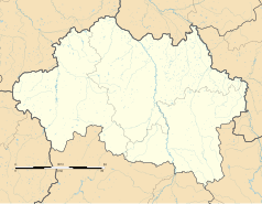
Lusigny
| gmina | |
 | |
| Państwo | |
|---|---|
| Region | |
| Departament | |
| Okręg | |
| Kanton | Chevagnes |
| Kod INSEE | 03156 |
| Mer | André Jardin (2001-2026) |
| Powierzchnia | 44,55 km² |
| Wysokość | 224-273 m n.p.m. |
| Populacja (2018) • liczba ludności |
|
| • gęstość | 39,5 os./km² |
| Kod pocztowy | 03230 |
| Strefa czasowa | UTC + 1 |
| Strona internetowa | |
| Portal | |
Lusigny – miejscowość i gmina we Francji, w regionie Owernia-Rodan-Alpy, w departamencie Allier. Według danych na rok 2018 gminę zamieszkiwało 1575 osób[1], a gęstość zaludnienia wynosiła 35 osób/km².
Demografia
Ludność według grup wiekowych[2]:
| Wiek | 2007 | % | 2012 | % | 2017 | % |
|---|---|---|---|---|---|---|
| 0 - 14 lat | 297 | 18,8 | 387 | 22,6 | 363 | 21,4 |
| 15 - 29 lat | 218 | 13,9 | 179 | 10,4 | 178 | 10,5 |
| 30 - 44 lat | 354 | 22,5 | 403 | 23,6 | 354 | 20,8 |
| 45 - 59 lat | 377 | 24 | 339 | 19,8 | 335 | 19,7 |
| 60 - 74 lat | 202 | 12,8 | 266 | 15,5 | 325 | 19,2 |
| 75 lat i więcej | 126 | 8 | 138 | 8,1 | 143 | 8,4 |
Ludność historyczna:
| Rok | 1982 | 1990 | 1999 | 2007 | 2012 | 2017 | 2018 |
|---|---|---|---|---|---|---|---|
| Populacja | 1541 | 1575 | 1428 | 1575 | 1712 | 1698 | 1575 |
| Średnia gęstość (mieszk. / Km²) | 34,6 | 35,4 | 32,1 | 35,4 | 38,4 | 38,1 | 39,5 |
Zobacz też
- Gminy w departamencie Allier
Przypisy
- ↑ Populations légales 2018 − Ces données sont disponibles sur toutes les communes de France hors Mayotte | Insee, www.insee.fr [dostęp 2021-04-16].
- ↑ Dossier complet − Commune de Lusigny (03156) | Insee, www.insee.fr [dostęp 2021-04-16].
Bibliografia
Media użyte na tej stronie
Autor: Flappiefh, Licencja: CC BY-SA 4.0
Blank administrative map of the department of Allier, France, for geo-location purpose.
Autor: Superbenjamin, Licencja: CC BY-SA 4.0
Blank administrative map of France for geo-location purpose, with regions and departements distinguished. Approximate scale : 1:3,000,000
Autor: Flappiefh, Licencja: CC BY-SA 4.0
Carte administrative vierge de la région Auvergne-Rhône-Alpes, France, destinée à la géolocalisation.
Autor: jean-louis Zimmermann, Licencja: CC BY 2.0
Aerial view of Lusigny, Allier, France.


