Mäntyharju
 | |||
| |||
| Państwo | |||
|---|---|---|---|
| Region | |||
| Powierzchnia | 1210,99 km² | ||
| Populacja (31.12.2021) • liczba ludności |
| ||
| Kod pocztowy | 52701 | ||
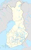
Położenie na mapie Finlandii (c) Karte: NordNordWest, Lizenz: Creative Commons by-sa-3.0 de | |||
| Strona internetowa | |||
| Portal | |||
Mäntyharju – gmina w Finlandii, położona w południowo-wschodniej części kraju, należąca do regionu Etelä-Savo.
Przypisy
- ↑ Väestö 31.12. muuttujina Alue, Ikä, Sukupuoli, Vuosi ja Tiedot, Tilastokeskus [dostęp 2022-10-18] [zarchiwizowane z adresu 2022-10-18] (fiń.).
Media użyte na tej stronie
Finland adm location map.svg
(c) Karte: NordNordWest, Lizenz: Creative Commons by-sa-3.0 de
Location map of Finland
(c) Karte: NordNordWest, Lizenz: Creative Commons by-sa-3.0 de
Location map of Finland
Flag of Finland.svg
Flaga Finlandii
Flaga Finlandii
Etelä-Savo.vaakuna.svg
Coat of arms of Southern Savonia
Coat of arms of Southern Savonia
Mäntyharju.vaakuna.svg
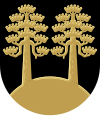
On black field two pine tree growing from arched base; all gold.
On black field two pine tree growing from arched base; all gold.


