Maciejówka (szczyt)
| Ten artykuł od 2022-07 wymaga zweryfikowania podanych informacji. |
| Państwo | |
|---|---|
| Pasmo | |
| Wysokość | 469 m n.p.m. |
Maciejówka – zalesiony szczyt o wysokości 469 m n.p.m., na Pogórzu Przemyskim.
Zobacz też
Media użyte na tej stronie
U+25B2.svg
Black up-pointing triangle ▲, U+25B2 from Unicode-Block Geometric Shapes (25A0–25FF)
Black up-pointing triangle ▲, U+25B2 from Unicode-Block Geometric Shapes (25A0–25FF)
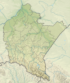
Subcarpathian Voivodeship Relief location map.svg
Autor: SANtosito, Licencja: CC BY-SA 4.0
Relief ocation map of Podkarpackie Voivodeship. Geographic limits of the map:
Autor: SANtosito, Licencja: CC BY-SA 4.0
Relief ocation map of Podkarpackie Voivodeship. Geographic limits of the map:
- N: 50.9 N
- S: 48.95 N
- W: 21.03 E
- E: 23.66 E


