Madison (rzeka)
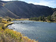
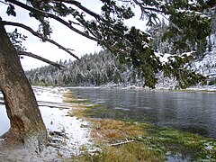
 Madison River w Parku Narodowym Yellowstone | |
| Kontynent | |
|---|---|
| Państwo | |
| Rzeka | |
| Długość | 295 km |
| Średni przepływ | |
| Źródło | |
| Miejsce | z połączenia rzek Firehole, Gibbon |
| Współrzędne | |
| Ujście | |
| Recypient | tworzy Missouri |
| Miejsce | 45.9274281 -111.5080238 |
| Wysokość | 1232 m n.p.m.[2] |
| Współrzędne | |
| Mapa | |
 Rzeki w stanie Montana | |
Madison – rzeka przepływająca przez stany Wyoming i Montana w Stanach Zjednoczonych. Jej długość wynosi 294,5 km[2]. Rzeka bierze początek w hrabstwie Park w Wyoming, w północno-zachodnim narożniku w Parku Yellowstone[3]. Bierze początek z połączenia rzek Firehole i Gibbon[3]. Łącząc się z rzekami Jefferson i Gallatin w Missouri Headwaters State Park, w pobliżu miasta Three Forks w stanie Montana tworzy oficjalny początek rzeki Missouri[2][4].
Zobacz też
Przypisy
- ↑ USGS 06114700 Judith River nr mouth, nr Winifred MT. National Water Information System: Web Interface. [dostęp 2018-08-08]. (ang.).
- ↑ a b c Feature Detail Report for: Madison River. Geographic Names Information System (GNIS). [dostęp 2018-08-08]. (ang.).
- ↑ a b Madison River, [w:] Encyclopædia Britannica [online] [dostęp 2018-08-08] (ang.).
- ↑ Three Forks Area, Mouth of Madison River. TopoView. [dostęp 2018-08-08]. (ang.).
Media użyte na tej stronie
Autor: Uwe Dedering, Licencja: CC BY-SA 3.0
Relief location map of the USA (without Hawaii and Alaska).
EquiDistantConicProjection : Central parallel :
* N: 37.0° N
Central meridian :
* E: 96.0° W
Standard parallels:
* 1: 32.0° N
* 2: 42.0° N
Made with Natural Earth. Free vector and raster map data @ naturalearthdata.com.
Formulas for x and y:
x = 50.0 + 124.03149777329222 * ((1.9694462586094064-({{{2}}}* pi / 180))
      * sin(0.6010514667026994 * ({{{3}}} + 96) * pi / 180))
y = 50.0 + 1.6155950752393982 * 124.03149777329222 * 0.02613325650382181
      - 1.6155950752393982  * 124.03149777329222 *
     (1.3236744353715044  - (1.9694462586094064-({{{2}}}* pi / 180))
      * cos(0.6010514667026994 * ({{{3}}} + 96) * pi / 180))
The flag of Navassa Island is simply the United States flag. It does not have a "local" flag or "unofficial" flag; it is an uninhabited island. The version with a profile view was based on Flags of the World and as a fictional design has no status warranting a place on any Wiki. It was made up by a random person with no connection to the island, it has never flown on the island, and it has never received any sort of recognition or validation by any authority. The person quoted on that page has no authority to bestow a flag, "unofficial" or otherwise, on the island.
Madison River along the West Entrance Road; Jim Peaco; June 17, 2014; Catalog #20430d;
Original #IMG_4021Madison River Below Seven Mile Bridge In October
Autor: Oryginalnym przesyłającym był Americasroof z angielskiej Wikipedii, Licencja: CC BY-SA 2.5
Rivers in en:Montana generated by en:National Atlas, a United States government agency and then annotated by poster in March 2007.
Lower Madison River in Beartrap Canyon


