Maidstone (borough)
| ||
| Borough of | ||
| Państwo | ||
|---|---|---|
| Kraj | ||
| Hrabstwo | Kent | |
| Siedziba | Maidstone | |
| Powierzchnia | 393.3 km² | |
| Populacja (2011) • liczba ludności | 155 143[1] | |
| • gęstość | 395 os./km² | |
| Położenie na mapie hrabstwa Kent Contains Ordnance Survey data © Crown copyright and database right, CC BY-SA 3.0 | ||
| Strona internetowa | ||
| Portal | ||

Borough of Maidstone - dystrykt w Anglii, w środkowej części hrabstwa Kent. Centrum administracyjne dystryktu znajduje się w Maidstone.
Dystrykt ma powierzchnię 393.3 km2, od północy graniczy z dystryktami Swale i Medway, od zachodu z dystryktem Tonbridge and Malling, od południa z dystryktem Tunbridge Wells, zaś od wschodu z dystryktem Ashford w hrabstwie Kent. Zamieszkuje go 155 143 osób.
Na terenie dystryktu znajdują się zamki Leeds i Allington, ruiny normańskiego zamku z XII wieku[2], a także pochodzący z XIV wieku dawny Pałac Arcybiskupi. Ponadto w Maidstone mieści się jeden z kampusów University for the Creative Arts[3].
Podział administracyjny
Dystrykt obejmuje miasto Maidstone oraz 41 civil parish:
Dystrykt dzieli się na 19 okręgów wyborczych[4]:
|
Demografia
W 2011 roku dystrykt Maidstone miał 155 143 mieszkańców. Zgodnie ze spisem powszechnym z 2011 roku dystrykt zamieszkiwało 1526 osób urodzonych w Polsce[5].
Podział mieszkańców według grup etnicznych na podstawie spisu powszechnego z 2011 roku[6]:
|
|
Podział mieszkańców według wyznania na podstawie spisu powszechnego z 2011 roku[7]:
- Chrześcijaństwo - 62,9%
- Islam – 1,1%
- Hinduizm – 1,0%
- Judaizm – 0,1%
- Buddyzm – 0,6%
- Sikhizm – 0,1%
- Pozostałe religie – 0,4%
- Bez religii – 26,7%
- Nie podana religia – 7,1%
Transport i komunikacja
Na terenie dystryktu znajdują się następujące stacje kolejowe:
- Bearsted
- Beltring
- East Farleigh
- Harrietsham
- Headcorn
- Hollingbourne
- Lenham
- Maidstone Barracks
- Maidstone East
- Maidstone West
- Marden
- Staplehurst
- Yalding
Przez dystrykt przechodzą autostrady M2 i M20 a także droga A20 łącząca Dover z centrum Londynu.
Między miejscowościami Wormshill a Bredgar w dystrykcie Swale na trasie o długości 600 metrów kursuje kolej wąskotorowa Bredgar & Wormshill Light Railway[8].
Inne miejscowości
Allington, Barming Heath, Bearsted, Bedmonton, Benover, Bexon, Bicknor, Boughton Green, Boughton Malherbe, Boughton Monchelsea, Boxley, Broomfield, Caring, Chainhurst, Chart Sutton, Collier Street, Coxheath, Detling, East Barming, East Farleigh, Frinsted, Grove Green, Harrietsham, Hawkenbury, Headcorn, Hollingbourne, Horden, Hunton, Kingswood, Kit's Coty, Langley, Leeds, Lenham, Linton, Loose, Marden, Marley, Nettlestead Green, Nettlestead, New Hythe, Otham, Otterden, Penenden Heath, Platts Heath, Sandway, Shepway, Stockbury, Sutton Valence, Thurnham, Tovil, Ulcombe, West Farleigh, Wormshill, Yalding.
Przypisy
- ↑ „ons.gov.uk – 2011 Census: KS102EW Age structure, local authorities in England and Wales”
- ↑ „english-heritage.org.uk - Official website”
- ↑ „ucreative.ac.uk - Official website”
- ↑ „maidstone.gov.uk – Election results by wards”
- ↑ „ons.gov.uk – 2011 Census: KS204EW Country of birth, local authorities in England and Wales”
- ↑ „ons.gov.uk – 2011 Census: KS201EW Ethnic group, local authorities in England and Wales”
- ↑ „ons.gov.uk – 2011 Census: KS209EW Religion, local authorities in England and Wales”
- ↑ „bwlr.co.uk - Official website”. [dostęp 2013-04-28]. [zarchiwizowane z tego adresu (2013-05-11)].
Media użyte na tej stronie
Flag of England. Saint George's cross (a red cross on a white background), used as the Flag of England, the Italian city of Genoa and various other places.
Autor: Diliff, Licencja: CC BY-SA 3.0
A wide angle view of Leeds Castle in Kent, England. Taken by myself with a Canon 5D and 70-200mm f/2.8L at ~85mm, ISO 200 and f/8.0.
Autor: Clem Rutter, Rochester Kent, Licencja: CC-BY-SA-3.0
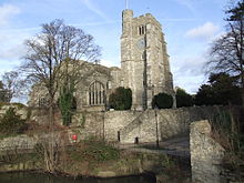
The Horse Way and All Saints' parish church, Maidstone, Kent, seen from the southwest from the River Medway
(c) Stephen Nunney, CC BY-SA 2.0
Archbishop's Palace across the Medway
Contains Ordnance Survey data © Crown copyright and database right, CC BY-SA 3.0
Equirectangular map projection on WGS 84 datum, with N/S stretched 160%
(c) Penny Mayes, CC BY-SA 2.0
Locomotive Bronhilde approaches Stony Shaw, Bredgar & Wormshill Light Railway


