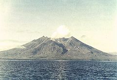
Makian (wyspa)
 | |
| Kontynent | |
|---|---|
| Państwo | |
| Akwen | |
| Archipelag | |
| Powierzchnia | 84,36 km² |
| Populacja (2010) • liczba ludności |
|
| 0°20′00″N 127°22′00″E/0,333333 127,366667 | |
Makian, także Makeang[1] lub Kie Besi[2] (indonez. Pulau Makian) – wyspa w Indonezji na Morzu Moluckim w archipelagu Moluków na zachód od Halmahery i na południe od Tidore; powierzchnia 84,36 km², 12 394 mieszkańców (2010)[3].
Ludność Makian posługuje się dwoma niespokrewnionymi ze sobą językami: makian zachodnim (moi) i makian wschodnim (taba)[4][5].
Historia
Od XVII do początku XX w. wyspa znajdowała się pod kontrolą Sułtanatu Ternate. Dziś należy do Indonezji[6].
Przypisy
- ↑ Faris Bobero: Orang Halmahera: Sebuah Catatan dari Lapangan (Faris Bobero). Handi Andrian, 2021, s. 59. [dostęp 2022-01-27]. (indonez.).
- ↑ William Hutton, Jonathan Eagle: Earth’s Catastrophic Past and Future: A Scientific Analysis of Information Channeled by Edgar Cayce. Boca Raton, Fla.: Universal Publishers, 2004, s. 49. ISBN 978-1-58112-517-7. OCLC 58788836. [dostęp 2022-01-27]. (ang.).
- ↑ Biro Pusat Statistik, Dżakarta, 2011.
- ↑ John Bowden: Taba. W: K. Alexander Adelaar, Nikolaus P. Himmelmann: The Austronesian languages of Asia and Madagascar. London: Routledge, 2005, s. 769–792. DOI: 10.4324/9780203821121. ISBN 0-7007-1286-0. OCLC 53814161. (ang.).
- ↑ John Bowden: Taba (Makian Dalam): Description of an Austronesian language from Eastern Indonesia. Department of Linguistics and Applied Linguistics, The University of Melbourne, 1997, s. 2. OCLC 222104670. (ang.).
- ↑ Clemens L. Voorhoeve: The West Makian language, North Moluccas, Indonesia: a fieldwork report. W: Clemens L. Voorhoeve (red.): The Makian languages and their neighbours. Canberra: Department of Linguistics, Research School of Pacific Studies, Australian National University, 1982, s. 1–74 (5–6), seria: Pacific Linguistics D-46; Materials in languages of Indonesia 12. DOI: 10.15144/PL-D46.1. ISBN 0-85883-277-1. OCLC 12421689. [dostęp 2022-10-21]. (ang.).
Linki zewnętrzne
- Makian: North Maluku’s Most Dangerous Volcano. East-Indonesia.info. [dostęp 2022-09-30]. (ang.).
Media użyte na tej stronie
bendera Indonesia
Autor: Uwe Dedering, Licencja: CC BY-SA 3.0
Location map of Indonesia.
Equirectangular projection. Strechted by 100.0%. Geographic limits of the map:
- N: 6.5° N
- W: 94.5° E
- E: 141.5° E
- S: -11.5° N
Makian volcano forms a 10-km-wide island near the southern end of a chain of volcanic islands off the western coast of Halmahera. The northern of two prominent valleys that extend from the summit is prominent in this photo. The large 1.5-km-wide summit crater containing a small lake on the NE side gives the 1357-m-high peak a flat-topped profile. Violent eruptions from Makian volcano, also known as Kie Besi, have devastated villages on the island.


