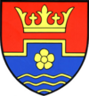
Mannersdorf am Leithagebirge
| |||
| |||
| Państwo | |||
| Kraj związkowy | |||
| Powiat | Bruck na der Leitha | ||
| Powierzchnia | 29,91 km² | ||
| Wysokość | 212 m n.p.m. | ||
| Populacja (1 stycznia 2014) • liczba ludności | 3 887 | ||
| • gęstość | 130 os./km² | ||
| Numer kierunkowy | 02168 | ||
| Kod pocztowy | 2452 | ||
| Tablice rejestracyjne | BL | ||
| Strona internetowa | |||
Mannersdorf am Leithagebirge − miasto w Austrii, w kraju związkowym Dolna Austria, w powiecie Bruck na der Leitha. Według Austriackiego Urzędu Statystycznego liczyło 3 887 mieszkańców (1 stycznia 2014)[1].
Zobacz też
- Mannersdorf
Przypisy
Media użyte na tej stronie
Autor: Rosso Robot, Licencja: CC BY-SA 3.0
Location map of Lower Austria
Equirectangular projection. Geographic limits of the map:
- N: 49.02796° N
- S: 47.38301° N
- W: 14.44565° E
- E: 17.07430° E
Autor: Lencer, Licencja: CC BY-SA 3.0
Location map of Austria
Equirectangular projection, N/S stretching 150 %. Geographic limits of the map:
- N: 49.2° N
- S: 46.3° N
- W: 9.4° E
- E: 17.2° E
Autor: Joadl, Licencja: CC BY-SA 3.0
Cava near the village Mannersdorf am Leithagebirge / Lower Austria / Austria / EU. In the foreground is the quarry in the middle of the chimney of the kiln Baxa is visible in the background, the level of the village "Mannersdorf".
Herb Mannersdorf am Leithagebirge, Dolna Austria


