Manor Ground
| ||
 | ||
| Manor Ground | ||
| Państwo | ||
| Kraj | ||
| Adres | Plumstead, Londyn | |
| Data otwarcia | 1888 | |
| Data zamknięcia | 1913 | |
| Właściciel | Royal/Woolwich Arsenal | |
| Klub | Royal/Woolwich Arsenal (1888–1890, 1893–1913) | |
| Pojemność stadionu | Nieznana | |
Położenie na mapie gminy Greenwich Contains Ordnance Survey data © Crown copyright and database right, CC BY-SA 3.0 | ||
Położenie na mapie Wielkiej Brytanii (c) Karte: NordNordWest, Lizenz: Creative Commons by-sa-3.0 de | ||
Położenie na mapie Wielkiego Londynu Contains Ordnance Survey data © Crown copyright and database right, CC BY-SA 3.0 | ||
Manor Ground – nieistniejący stadion piłkarski w Plumstead w południowo-wschodnim Londynie, który w latach 1888–1890 i 1893–1913 był stadionem domowym klubu początkowo znanego jako Royal Arsenal, zaś w 1891 przemianowanego na Woolwich Arsenal. Po opuszczeniu Manor Ground klub przeniósł się w inną część Londynu, na Arsenal Stadium w Highbury i wkrótce zmienił swą nazwę na Arsenal Football Club.
Przypisy
- Soar, Phil & Tyler, Martin: The Official Illustrated History of Arsenal. Hamlyn, 2005. ISBN 0-600-61344-5.
- Spurling, Jon: Rebels For The Cause: The Alternative History of Arsenal Football Club. Mainstream, 2004. ISBN 0-575-40015-3.
Linki zewnętrzne
Media użyte na tej stronie
(c) Karte: NordNordWest, Lizenz: Creative Commons by-sa-3.0 de
Location map of the United Kingdom
Contains Ordnance Survey data © Crown copyright and database right, CC BY-SA 3.0
Map of Greater London, UK with the following information shown:
- Administrative borders
- Coastline, lakes and rivers
- Roads and railways
- Urban areas
The data includes both primary routes and railway lines.
Equirectangular map projection on WGS 84 datum, with N/S stretched 160%
Geographic limits:
- West: 0.57W
- East: 0.37E
- North: 51.72N
- South: 51.25N
Flag of England. Saint George's cross (a red cross on a white background), used as the Flag of England, the Italian city of Genoa and various other places.
Autor:
- Gfi-set01-stadium.png: gfi
- derivative work: Frédéric (talk)
icone pour terrain de sport
Autor:
- derivative work: הגמל התימני (talk)
- Arsenal_Stadium_interior_Clock_End.jpg: Qwghlm
- Insideemirates1.jpg: [1]
- Barcelona_vs_Arsenal_Teams_line_up.jpg: Freddyballo
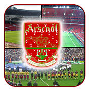
The Clock End of the Arsenal Stadium, Highbury, London.Inside the Emirates Stadium.Arsenal F.C. and FC Barcelona line up before the 2006 UEFA Champions League Final. Photo taken from en.wikipedia.
All up togetherContains Ordnance Survey data © Crown copyright and database right, CC BY-SA 3.0
Blank map of the London Borough of Greenwich, showing electoral wards.
Equirectangular map projection on WGS 84 datum, with N/S stretched 160%
Geographic limits:
- West: 0.03W
- East: 0.13E
- North: 51.52N
- South: 51.42N
Woolwich Arsenal vs. Everton, Manor Ground


