Manor House
| ||
 Główne wejście | ||
| Państwo | ||
| Data otwarcia | 1932 | |
| Poprzednia stacja | Turnpike Lane | |
| Następna stacja | Finsbury Park | |
Położenie na mapie gminy Hackney  Contains Ordnance Survey data © Crown copyright and database right, CC BY-SA 3.0 | ||
Położenie na mapie Wielkiej Brytanii  (c) Karte: NordNordWest, Lizenz: Creative Commons by-sa-3.0 de | ||
Położenie na mapie Anglii  | ||
Położenie na mapie Wielkiego Londynu  Contains Ordnance Survey data © Crown copyright and database right, CC BY-SA 3.0 | ||
| Portal | ||
Manor House – stacja metra londyńskiego na linii Piccadilly, położona w północnej części miasta. Leży dokładnie na granicy dwóch gmin Wielkiego Londynu: London Borough of Haringey oraz London Borough of Hackney, dla tej ostatniej jest jedyną stacją metra na terenie gminy. Została otwarta w 1932 roku[1], jej głównym projektantem był modernistyczny architekt Charles Holden. W 2009 roku skorzystało z niej ok. 8,83 mln pasażerów[2]. Jest stacją graniczną między drugą i trzecią strefą biletową[3].
Galeria

Logo stacji
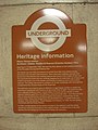
Tabliczka z historią stacji [czytelna po powiększeniu zdjęcia]
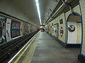
Jeden z peronów

Jedno z wejść
Przypisy
- ↑ CULG - Piccadilly Line. [dostęp 2011-03-15].
- ↑ Statystyki Transport for London [dostęp 2011-03-15]
- ↑ Schemat sieci metra w Londynie [dostęp 2011-03-15]
| Linia główna |
|
|---|---|
| Odgałęzienie Uxbridge |
|
| Odgałęzienie Heathrow |
|
![]()
| Metro | |
|---|---|
| National Express East Anglia |
|
| First Capital Connect |
|
| London Overground |

Media użyte na tej stronie
(c) Karte: NordNordWest, Lizenz: Creative Commons by-sa-3.0 de
Location map of the United Kingdom
Contains Ordnance Survey data © Crown copyright and database right, CC BY-SA 3.0
Map of Greater London, UK with the following information shown:
- Administrative borders
- Coastline, lakes and rivers
- Roads and railways
- Urban areas
The data includes both primary routes and railway lines.
Equirectangular map projection on WGS 84 datum, with N/S stretched 160%
Geographic limits:
- West: 0.57W
- East: 0.37E
- North: 51.72N
- South: 51.25N

Contains Ordnance Survey data © Crown copyright and database right, CC BY-SA 3.0
Blank map of the London Borough of Hackney, showing electoral wards.
Equirectangular map projection on WGS 84 datum, with N/S stretched 160%
Geographic limits:
- West: 0.11W
- East: 0.01W
- North: 51.58N
- South: 51.515N


Autor: Sunil060902, Licencja: CC BY-SA 3.0
Manor house tube station main entrance, to the northwest of the A105 Green Lanes/A503 Seven Sisters Road junction. However the ticket office is below ground

Autor: Image:LondonHaringey.png by Morwen, Image:BlankMap-LondonBoroughs.svg by Richtom80, Licencja: CC BY 2.5
Ta ^specifik^ z W3C grafika wektorowa została stworzona za pomocą Inkscape.


Autor: Sunil060902, Licencja: CC BY-SA 3.0
One of several subway entrances to Manor House tube station, in this case to the southeast of the A105 Green Lanes/A503 Seven Sisters Road junction.
