Mansfield (Waszyngton)
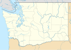
 Położenie Mansfield | |
| Państwo | |
|---|---|
| Stan | |
| Hrabstwo | |
| Powierzchnia | 0,8 km² |
| Wysokość | 692 m n.p.m. |
| Populacja (2000) • liczba ludności • gęstość |
|
| Nr kierunkowy | 509 |
| Kod pocztowy | 98830 |
| Strona internetowa | |
| Portal | |
Mansfield – miasto w Stanach Zjednoczonych, w stanie Waszyngton, w hrabstwie Douglas.
Demografia
Według spisu z 2000 roku miasto zamieszkiwało 319 osób, 148 gospodarstw domowych i 95 rodzin mieszkających w mieście. Gęstość zaludnienia wynosiła 1,026 osób na kilometr kwadratowy (397,3/km ²). Średni dochód dla gospodarstwa domowego w mieście wyniósł 28.750 dolarów, a średni dochód dla rodziny wynosi 42.500 dolarów. Dla mężczyzn 38.125 dolarów i 21.667 dolarów dla kobiet. Dochód na jednego mieszkańca dla miasta wyniósł 17.368 dolarów. 17,1% populacji żyło poniżej granicy ubóstwa, w tym 19,7% osób poniżej 18 roku życia i 6,3% osób powyżej 65 roku życia[2].
Przypisy
- ↑ factfinder.census.gov – United States Census Bureau.
- ↑ American FactFinder, factfinder.census.gov [dostęp 2017-11-25] [zarchiwizowane z adresu 2015-01-08].
Media użyte na tej stronie
Autor: Alexrk2, Licencja: CC BY 3.0
Ta mapa została stworzona za pomocą GeoTools.
Autor: Uwe Dedering, Licencja: CC BY-SA 3.0
Location map of the USA (without Hawaii and Alaska).
EquiDistantConicProjection:
Central parallel:
* N: 37.0° N
Central meridian:
* E: 96.0° W
Standard parallels:
* 1: 32.0° N
* 2: 42.0° N
Made with Natural Earth. Free vector and raster map data @ naturalearthdata.com.
Formulas for x and y:
x = 50.0 + 124.03149777329222 * ((1.9694462586094064-({{{2}}}* pi / 180))
      * sin(0.6010514667026994 * ({{{3}}} + 96) * pi / 180))
y = 50.0 + 1.6155950752393982 * 124.03149777329222 * 0.02613325650382181
      - 1.6155950752393982  * 124.03149777329222 *
     (1.3236744353715044  - (1.9694462586094064-({{{2}}}* pi / 180))
      * cos(0.6010514667026994 * ({{{3}}} + 96) * pi / 180))
The flag of Navassa Island is simply the United States flag. It does not have a "local" flag or "unofficial" flag; it is an uninhabited island. The version with a profile view was based on Flags of the World and as a fictional design has no status warranting a place on any Wiki. It was made up by a random person with no connection to the island, it has never flown on the island, and it has never received any sort of recognition or validation by any authority. The person quoted on that page has no authority to bestow a flag, "unofficial" or otherwise, on the island.
Photo of Mansfield, Washington. Taken November 2006 by uploader. All rights released. Williamborg 07:09, 12 November 2006 (UTC)
Autor: Alexrk2, Licencja: CC BY 3.0
Ta mapa została stworzona za pomocą GeoTools.
Autor: Arkyan, Licencja: CC-BY-SA-3.0
This map shows the incorporated and unincorporated areas in Douglas County, Washington, highlighting Mansfield in red. It was created with a custom script with US Census Bureau data and modified with Inkscape.


