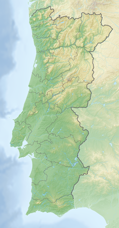
Marão
| Państwo | |
|---|---|
| Wysokość | 1415 m n.p.m. |
| Wybitność | 689 m |
Marão – góra na Półwyspie Iberyjskim w północnej Portugalii, najwyższy szczyt masywu Serra do Marão. Wznosi się na wysokość 1415 m n.p.m.[1]
Przypisy
Media użyte na tej stronie
Flag of Portugal.svg
Flag of Portugal, created by Columbano Bordalo Pinheiro (1857-1929), officially adopted by Portuguese government in June 30th 1911 (in use since about November 1910). Color shades matching the RGB values officially reccomended here. (PMS values should be used for direct ink or textile; CMYK for 4-color offset printing on paper; this is an image for screen display, RGB should be used.)
Flag of Portugal, created by Columbano Bordalo Pinheiro (1857-1929), officially adopted by Portuguese government in June 30th 1911 (in use since about November 1910). Color shades matching the RGB values officially reccomended here. (PMS values should be used for direct ink or textile; CMYK for 4-color offset printing on paper; this is an image for screen display, RGB should be used.)
U+25B2.svg
Black up-pointing triangle ▲, U+25B2 from Unicode-Block Geometric Shapes (25A0–25FF)
Black up-pointing triangle ▲, U+25B2 from Unicode-Block Geometric Shapes (25A0–25FF)


