Mar Argentino
| ||
 Zdjęcie satelitarne | ||
| Kontynent | Ameryka Południowa | |
| Państwa | Argentyna, Urugwaj, Chile | |
| Terytoria | Falklandy | |
| Powierzchnia | 1 000 000 km² | |
| Zasolenie | 35‰ | |
| Typ morza | otwarte | |
| Części morza | Bahía Blanca, San Jorge, San Matías, Bahía Grande, Nuevo, Cieśnina Falklandzka | |
| Wyspy | Falklandy, Ziemia Ognista, Wyspa Stanów | |
Mar Argentino (pol. Morze Argentyńskie) – morze otwarte na szelfie kontynentalnym w Ameryce Południowej. Stanowi część południowego Oceanu Atlantyckiego. Leży pomiędzy wybrzeżem Argentyny a otwartym oceanem[1].
Geografia

Morze rozciąga się od estuarium La Platy ma północy do Morza Scotia na południu. Największe archipelagi wysp na Mar Argentino to Falklandy i Ziemia Ognista[1]. Ma powierzchnię około 1 000 000 km². Jego średnie zasolenie wynosi 35‰. Największe zatoki będące częścią Mar Argentino to Bahía Blanca, San Jorge, San Matías, Bahía Grande i Nuevo[2].
Przyroda
W wodach Mar Argentino i na jego wybrzeżach występują liczne populacje m.in. krabów, pingwinów, wielorybów i słoni morskich[2].
Ochrona przyrody
Na wybrzeżu Mar Argentino znajdują się parki narodowe Campos del Tuyú (w prowincji Buenos Aires) i Monte León (w prowincji Santa Cruz)[3] oraz wiele parków prowincjonalnych[1]. Ponadto Półwysep Valdés wpisany jest na listę światowego dziedzictwa UNESCO jako obiekt najcenniejszy przyrodniczy (X kryterium)[4].
Przypisy
- ↑ a b c Ecorregión Mar Argentino (hiszp.). fvsa.org.ar. [dostęp 2019-01-13].
- ↑ a b Mar Argentino (hiszp.). redargentina.com. [dostęp 2019-01-13].
- ↑ Historia (hiszp.). argentina.gob.ar. [dostęp 2020-06-12].
- ↑ Península Valdés (ang. • fr.). whc.unesco.org. [dostęp 2019-01-13].
Media użyte na tej stronie
Many different species of phytoplankton colour the ocean’s surface. Very common in the South Atlantic bloom, coccolithophores are probably responsible for the milky blue colour in this image. Sunlight reflecting off the surface of the water is turning the water’s surface silver in the lower left corner. Many environmental factors come together to make the South Atlantic ideal for this large annual bloom of millions of micro-organisms. First, the chilly Malvinas Current, a north-flowing branch of the Antarctic Circumpolar Current, flows north along the edge of the South American continental shelf. The current brings cool, nutrient rich waters north. Water also rises to the surface along the edge of the continental shelf, bringing additional iron to sunlit waters. Finally, the Rio de la Plata deposits nitrogen and iron-laden sediment into the ocean just north of the area shown in the image. Though this image covers hundreds of kilometres, it shows only a portion of the entire bloom.
Autor: Gonce, Licencja: CC BY 3.0
el farallon en inmediaciones del faro san jorge, comodoro rivadavia
Autor:
- Argentina_location_map.svg: NordNordWest
- derivative work: Виктор В (talk)
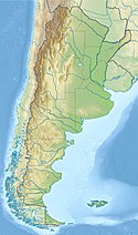
Location map of Argentina


